Privolzhsky, Mari El Republic

Last updated
Privolzhsky
Приволжский(Russian)
Приволжский (Meadow Mari)
-   Urban-type settlement [1]   -
Map of Russia - Mari El Republic (2008-03).svg
Location of the Mari El Republic in Russia
Location map of Mari El 2.svg
Red pog.svg
Privolzhsky
Location of Privolzhsky in the Mari El Republic
Coordinates: 55°58′N48°25′E / 55.967°N 48.417°E / 55.967; 48.417 Coordinates: 55°58′N48°25′E / 55.967°N 48.417°E / 55.967; 48.417
Administrative status  (as of October 2014)
Country Russia
Federal subject Mari El Republic [1]
Administrative district Volzhsky District [1]
Urban-type settlement Privolzhsky Urban-Type Settlement [1]
Administrative center of Privolzhsky Urban-Type Settlement [1]
Municipal status  (as of August 2014)
Municipal district Volzhsky Municipal District [2]
Urban settlement Privolzhsky Urban Settlement [2]
Administrative center of Privolzhsky Urban Settlement [2]
Statistics
Population (2010 Census) 4,159 inhabitants [3]
Time zone MSK (UTC+03:00) [4]
Founded1980[ citation needed ]
Postal code(s) [5] 425030
Privolzhsky population
2010 Census 4,159 [3]
2002 Census 4,161 [6]
1989 Census 3,795 [7]

Privolzhsky (Russian : Приво́лжский; Meadow Mari : Приволжский) is an urban locality (an urban-type settlement) in Volzhsky District of the Mari El Republic, Russia. As of the 2010 Census, its population was 4,159. [3]

Russian language East Slavic language

Russian is an East Slavic language, which is official in the Russian Federation, Belarus, Kazakhstan and Kyrgyzstan, as well as being widely used throughout Eastern Europe, the Baltic states, the Caucasus and Central Asia. It was the de facto language of the Soviet Union until its dissolution on 25 December 1991. Although nearly three decades have passed since the breakup of the Soviet Union, Russian is used in official capacity or in public life in all the post-Soviet nation-states, as well as in Israel and Mongolia.

Meadow Mari or Eastern Mari is a standardised dialect of the Mari language used by about half a million people mostly in the European part of the Russian Federation. Meadow Mari, Hill Mari, and Russian are official languages in the Mariy El Autonomous Republic of the Russian Federation.

The classification system of the types of inhabited localities in Russia, the former Soviet Union, and some other post-Soviet states has certain peculiarities compared with the classification systems in other countries.

Contents

History

It was founded in 1980.[ citation needed ]

Administrative and municipal status

Within the framework of administrative divisions, the urban-type settlement of Privolzhsky, together with two rural localities, is incorporated within Volzhsky District as Privolzhsky Urban-Type Settlement [8] (an administrative division of the district). [1] As a municipal division, Privolzhsky Urban-Type Settlement is incorporated within Volzhsky Municipal District as Privolzhsky Urban Settlement. [2]

Volzhsky District, Mari El Republic District in Mari El Republic, Russia

Volzhsky District is an administrative and municipal district (raion), one of the fourteen in the Mari El Republic, Russia. It is located in the south of the republic. The area of the district is 942.7 square kilometers (364.0 sq mi). Its administrative center is the town of Volzhsk. As of the 2010 Census, the total population of the district was 23,940.

Related Research Articles

Sovetsky, Mari El Republic Urban-type settlement in Mari El, Russia

Sovetsky is an urban locality and the administrative center of Sovetsky District of the Mari El Republic, Russia. As of the 2010 Census, its population was 10,664.

Kilemarsky District District in Mari El Republic, Russia

Kilemarsky District is an administrative and municipal district (raion), one of the fourteen in the Mari El Republic, Russia. It is located in the west of the republic. The area of the district is 3,255 square kilometers (1,257 sq mi). Its administrative center is the urban locality of Kilemary. As of the 2010 Census, the total population of the district was 13,604, with the population of Kilemary accounting for 29.9% of that number.

Kuzhenersky District District in Mari El Republic, Russia

Kuzhenersky District is an administrative and municipal district (raion), one of the fourteen in the Mari El Republic, Russia. It is located in the east of the republic. The area of the district is 852 square kilometers (329 sq mi). Its administrative center is the urban locality of Kuzhener. As of the 2010 Census, the total population of the district was 14,556, with the population of Kuzhener accounting for 37.0% of that number.

Mari-Tureksky District District in Mari El Republic, Russia

Mari-Tureksky District is an administrative and municipal district (raion), one of the fourteen in the Mari El Republic, Russia. It is located in the east of the republic. The area of the district is 1,500 square kilometers (580 sq mi). Its administrative center is the urban locality of Mari-Turek. As of the 2010 Census, the total population of the district was 23,155, with the population of Mari-Turek accounting for 22.3% of that number.

Medvedevsky District District in Mari El Republic, Russia

Medvedevsky District is an administrative and municipal district (raion), one of the fourteen in the Mari El Republic, Russia. It is located in the central and northern parts of the republic. The area of the district is 2,800 square kilometers (1,100 sq mi). Its administrative center is the urban locality of Medvedevo. As of the 2010 Census, the total population of the district was 67,703, with the population of Medvedevo accounting for 24.9% of that number.

Morkinsky District District in Mari El Republic, Russia

Morkinsky District is an administrative and municipal district (raion), one of the fourteen in the Mari El Republic, Russia. It is located in the southeast of the republic. The area of the district is 2,272 square kilometers (877 sq mi). Its administrative center is the urban locality of Morki. As of the 2010 Census, the total population of the district was 32,403, with the population of Morki accounting for 30.6% of that number.

Novotoryalsky District District in Mari El Republic, Russia

Novotoryalsky District is an administrative and municipal district (raion), one of the fourteen in the Mari El Republic, Russia. It is located in the northeast of the republic. The area of the district is 920 square kilometers (360 sq mi). Its administrative center is the urban locality of Novy Toryal. As of the 2010 Census, the total population of the district was 17,124, with the population of Novy Toryal accounting for 38.7% of that number.

Orshansky District District in Mari El Republic, Russia

Orshansky District is an administrative and municipal district (raion), one of the fourteen in the Mari El Republic, Russia. It is located in the north of the republic. The area of the district is 897 square kilometers (346 sq mi). Its administrative center is the urban locality of Orshanka. As of the 2010 Census, the total population of the district was 15,139, with the population of Orshanka accounting for 43.5% of that number.

Paranginsky District District in Mari El Republic, Russia

Paranginsky District is an administrative and municipal district (raion), one of the fourteen in the Mari El Republic, Russia. It is located in the east of the republic. The area of the district is 800 square kilometers (310 sq mi). Its administrative center is the urban locality of Paranga. As of the 2010 Census, the total population of the district was 16,307, with the population of Paranga accounting for 36.7% of that number.

Sernursky District District in Mari El Republic, Russia

Sernursky District is an administrative and municipal district (raion), one of the fourteen in the Mari El Republic, Russia. It is located in the northeast of the republic. The area of the district is 1,032 square kilometers (398 sq mi). Its administrative center is the urban locality of Sernur. As of the 2010 Census, the total population of the district was 25,672, with the population of Sernur accounting for 33.8% of that number.

Sovetsky District, Mari El Republic District in Mari El Republic, Russia

Sovetsky District is an administrative and municipal district (raion), one of the fourteen in the Mari El Republic, Russia. It is located in the center of the republic. The area of the district is 1,421 square kilometers (549 sq mi). Its administrative center is the urban locality of Sovetsky. As of the 2010 Census, the total population of the district was 31,081, with the population of the administrative center accounting for 34.3% of that number.

Yurinsky District District in Mari El Republic, Russia

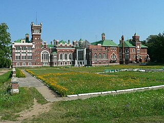
Yurinsky District is an administrative and municipal district (raion), one of the fourteen in the Mari El Republic, Russia. It is located in the west of the republic. The area of the district is 2,040 square kilometers (790 sq mi). Its administrative center is the urban locality of Yurino. As of the 2010 Census, the total population of the district was 8,758, with the population of Yurino accounting for 39.6% of that number.

Mari-Turek Urban-type settlement in Mari El, Russia

Mari-Turek is an urban locality and the administrative center of Mari-Tureksky District of the Mari El Republic, Russia. As of the 2010 Census, its population was 5,164.

Krasnooktyabrsky, Mari El Republic Urban-type settlement in Mari El, Russia

Krasnooktyabrsky is an urban locality in Medvedevsky District of the Mari El Republic, Russia. As of the 2010 Census, its population was 4,559.

Paranga, Russia Urban-type settlement in Mari El, Russia

Paranga is an urban locality and the administrative center of Paranginsky District of the Mari El Republic, Russia. As of the 2010 Census, its population was 5,985.

Sernur Urban-type settlement in Mari El, Russia

Sernur is an urban locality and the administrative center of Sernursky District of the Mari El Republic, Russia. As of the 2010 Census, its population was 8,686.

Krasnogorsky, Mari El Republic Urban-type settlement in Mari El, Russia

Krasnogorsky is an urban locality in Zvenigovsky District of the Mari El Republic, Russia. As of the 2010 Census, its population was 6,699.

Suslonger Urban-type settlement in Mari El, Russia

Suslonger is an urban locality in Zvenigovsky District of the Mari El Republic, Russia. As of the 2010 Census, its population was 3,161.

References

Notes

  1. 1 2 3 4 5 6 Law #22-Z
  2. 1 2 3 4 Law #62-Z
  3. 1 2 3 Russian Federal State Statistics Service (2011). "Всероссийская перепись населения 2010 года. Том 1" [2010 All-Russian Population Census, vol. 1]. Всероссийская перепись населения 2010 года (2010 All-Russia Population Census) (in Russian). Federal State Statistics Service . Retrieved June 29, 2012.
  4. Правительство Российской Федерации. Федеральный закон №107-ФЗ от 3 июня 2011 г. «Об исчислении времени», в ред. Федерального закона №271-ФЗ от 03 июля 2016 г. «О внесении изменений в Федеральный закон "Об исчислении времени"». Вступил в силу по истечении шестидесяти дней после дня официального опубликования (6 августа 2011 г.). Опубликован: "Российская газета", №120, 6 июня 2011 г. (Government of the Russian Federation. Federal Law #107-FZ of June 31, 2011 On Calculating Time , as amended by the Federal Law #271-FZ of July 03, 2016 On Amending Federal Law "On Calculating Time". Effective as of after sixty days following the day of the official publication.).
  5. Почта России. Информационно-вычислительный центр ОАСУ РПО. (Russian Post). Поиск объектов почтовой связи (Postal Objects Search) (in Russian)
  6. Russian Federal State Statistics Service (May 21, 2004). "Численность населения России, субъектов Российской Федерации в составе федеральных округов, районов, городских поселений, сельских населённых пунктов – районных центров и сельских населённых пунктов с населением 3 тысячи и более человек" [Population of Russia, Its Federal Districts, Federal Subjects, Districts, Urban Localities, Rural Localities—Administrative Centers, and Rural Localities with Population of Over 3,000](XLS). Всероссийская перепись населения 2002 года [All-Russia Population Census of 2002] (in Russian). Retrieved August 9, 2014.
  7. Demoscope Weekly (1989). "Всесоюзная перепись населения 1989 г. Численность наличного населения союзных и автономных республик, автономных областей и округов, краёв, областей, районов, городских поселений и сёл-райцентров" [All Union Population Census of 1989: Present Population of Union and Autonomous Republics, Autonomous Oblasts and Okrugs, Krais, Oblasts, Districts, Urban Settlements, and Villages Serving as District Administrative Centers]. Всесоюзная перепись населения 1989 года [All-Union Population Census of 1989] (in Russian). Институт демографии Национального исследовательского университета: Высшая школа экономики [Institute of Demography at the National Research University: Higher School of Economics]. Retrieved August 9, 2014.
  8. Resolution #9

Sources

The State Assembly of Mari El is the legislature of that republic. It succeeded the Supreme Council and comprises 52 deputies elected for a period of five years. Twenty-six of them are elected from single-member constituencies from an equal number of voters, while twenty-six are elected on basis of one deputy from each district and republican city.