
Kirkkonummi is a municipality in Finland, located in the southern coast of the country. Kirkkonummi is situated in the western part of the Uusimaa region. The population of Kirkkonummi is approximately 41,000. It is the 28th most populous municipality in Finland. Kirkkonummi is part of the Helsinki Metropolitan Area, which has approximately 1.6 million inhabitants.
Sipoo is a municipality of Finland. It is part of the Helsinki metropolitan area. The municipality has a population of 22,840 (31 August 2024) and covers an area of 698.60 square kilometres (269.73 sq mi) of which 358.97 km2 (138.60 sq mi) is water. The population density is 67.24 inhabitants per square kilometre (174.2/sq mi). The administrative center of the municipality is Nikkilä, which is located 34 kilometres (21 mi) northeast of the center of Helsinki. Another significant urban area is Söderkulla, located in the southern part of the municipality.

Alavieska is a municipality of Finland. It is located in the province of Oulu and is part of the Northern Ostrobothnia region. The municipality has a population of 2,440 and covers an area of 253.02 square kilometres (97.69 sq mi) of which 1.66 km2 (0.64 sq mi) is water. The population density is 9.7 inhabitants per square kilometre (25/sq mi).
Asikkala is a municipality of Finland. Its seat is in Vääksy, at the shores of the Lake Päijänne. It is located in the province of Southern Finland and is part of the Päijänne Tavastia region. Asikkala's neighboring municipalities are Hämeenlinna, Heinola, Hollola, Lahti, Padasjoki and Sysmä.
Askola is a municipality of Finland. It is located in the Uusimaa region. The municipality has a population of 4,679 and covers an area of 218.03 square kilometres (84.18 sq mi) of which 5.61 km2 (2.17 sq mi) is water. The population density is 22.03 inhabitants per square kilometre (57.1/sq mi). Monninkylä is the largest village of the municipality in terms of population. Neighbouring municipalities are Myrskylä, Mäntsälä, Pornainen, Porvoo and Pukkila.

Aura is a municipality of Finland. The name derives from the river Aura and the plough reminiscent shape of the municipality. The municipality was established in 1917 from parts of Lieto and Pöytyä.

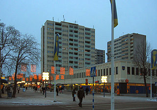
Kouvola is a city in Finland and the administrative capital of Kymenlaakso. It is located in the southeastern interior of the country. The population of Kouvola is approximately 79,000. It is the 11th most populous municipality in Finland, and the 17th most populous urban area in the country.
Hausjärvi is a municipality of Finland. Its seat is in Oitti.

Ingå is a municipality in Finland, located in the southern coast of the country. Ingå is situated in the western part of the Uusimaa region. The population of Ingå is approximately 5,000, while the sub-region has a population of approximately 40,000. It is the 161st most populous municipality in Finland.
Kerava is a town in Finland, located in the southern interior of the country. Kerava is situated in the centre of the Uusimaa region. The population of Kerava is approximately 38,000. It is the 30th most populous municipality in Finland. Kerava is part of the Helsinki Metropolitan Area, which has approximately 1.6 million inhabitants.

Keuruu is a town and municipality of Finland. It is located in the province of Western Finland and is part of the Central Finland region. The municipality has a population of 9,145 and covers an area of 1,430.57 square kilometres (552.35 sq mi) of which 172.4 km2 (66.6 sq mi) is water. The population density is 7.27 inhabitants per square kilometre (18.8/sq mi). The town center and Haapamäki village are both the most populated places in Keuruu.
Merikarvia is a municipality in Finland. It is located in the Satakunta region. The neighboring municipalities are Isojoki, Kristinestad, Pomarkku, Pori and Siikainen.

Korsholm is a municipality in Finland, located on the west coast of the country. Korsholm is situated in Ostrobothnia, along the Gulf of Bothnia. The population of Korsholm is approximately 20,000, while the sub-region has a population of approximately 111,000. It is the 55th most populous municipality in Finland.

Myrskylä is a municipality in Finland, located in the southern interior of the country. Myrskylä is situated in the eastern part of the Uusimaa region, and it is the smallest municipality in the region in relation to its population. The population of Myrskylä is approximately 2,000, while the sub-region has a population of approximately 60,000. It is the 272nd most populous municipality in Finland.

Nummi-Pusula is a former municipality of Finland. Its seat was in Nummi. Nummi-Pusula was formed in 1981 from the former municipalities Nummi and Pusula. With Karjalohja, it was merged with the town of Lohja on 1 January 2013.

Närpes is a town in Finland, located on the west coast of the country. Närpes is situated in Ostrobothnia, along the Gulf of Bothnia. The population of Närpes is approximately 10,000, while the sub-region has a population of approximately 17,000. It is the 101st most populous municipality in Finland.

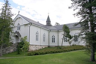
Paimio is a town and municipality of Finland.

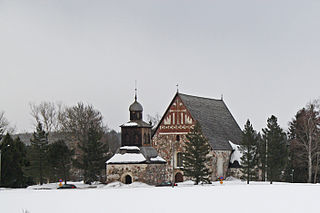
Ruotsinpyhtää is a former municipality of Finland. Ruotsinpyhtää, Pernå and Liljendal were consolidated to Loviisa on January 1, 2010.

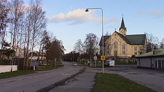
Toivakka is a municipality of Finland. It is located in the Central Finland region, near Jyväskylä. The municipality has a population of 2,352 (31 August 2024) and covers an area of 413.94 square kilometres (159.82 sq mi) of which 52.44 km2 (20.25 sq mi) is water. The population density is 6.51 inhabitants per square kilometre (16.9/sq mi). The municipality is unilingually Finnish.

Kimitoön is a municipality and island of Finland. It was created on 1 January 2009, when the municipalities of Dragsfjärd, Kimito and Västanfjärd were consolidated into a single municipality.


