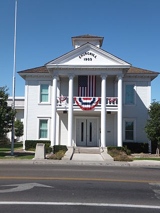
Churchill County is a county in the western U.S. state of Nevada. As of the 2020 census, the population was 25,516. Its county seat is Fallon. Named for Mexican–American War hero brevet Brigadier General Sylvester Churchill, the county was formed in 1861. Churchill County comprises the Fallon, NV Micropolitan Statistical Area. It is in northwestern Nevada. Churchill County is noteworthy in that it owns and operates the local telephone carrier, Churchill County Communications.

The Black Rock Desert is a semi-arid region of lava beds and playa, or alkali flats, situated in the Black Rock Desert–High Rock Canyon Emigrant Trails National Conservation Area, a silt playa 100 miles (160 km) north of Reno, Nevada that encompasses more than 300,000 acres (120,000 ha) of land and contains more than 120 miles (200 km) of historic trails. It is in the northern Nevada section of the Great Basin with a lakebed that is a dry remnant of Pleistocene Lake Lahontan.

The Pah Rah Range is a mountain range located in western Nevada in Washoe County just to the northeast of Reno. It is a hook shaped range with the main eastern portion oriented northwest–southeast, approximately 20 miles (32 km) long. The northwest flowing Cottonwood Creek in Warm Springs Valley is bounded on three sides by the range. To the south and east the Truckee River forms the boundary and Pyramid Lake is at the northeast. Spanish Springs Valley north of Reno forms the southwest margin. To the north, the narrow Mullen Pass separates the Pah Rah Range from the Virginia Mountains.
The Churchill Mountains are a mountain range group of the Transantarctic Mountains System, located in the Ross Dependency region of Antarctica. They border on the western side of the Ross Ice Shelf, between Byrd Glacier and Nimrod Glacier.
Vya is a small ghost town located in Washoe County, in northwestern Nevada, United States. It is about 10 miles (16 km) east of the California state line, north of Forty Nine Canyon. Not much remains of the small town, which essentially died in the 1920s. Just two wooden buildings can still be seen—the Vya Post Office and Library. The Vya Post Office was in operation from September 1910 until October 1941. The settlement was named for Vya Wimer, the first European heritage baby born in the valley.
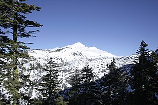
Pyramid Peak is a mountain in the California's Sierra Nevada in the Crystal Range to the west of Lake Tahoe. It is the highest point in the Desolation Wilderness. With an elevation gain of almost 4,100 feet (1,250 m), the Rocky Canyon route is the mountain's most popular approach although it is very arduous. To the east, at the base of the peak, lies Pyramid Lake.
Contact is an unincorporated community in Elko County, Nevada, United States. It is located on a mineral-rich granite intrusion and there are many mines nearby.

San Jacinto is a ghost town in along Salmon Falls Creek in northern Elko County, Nevada, United States. It is part of the Elko Micropolitan Statistical Area.
Cobre is a ghost town in Elko County, Nevada, United States.
Arthur is an unincorporated community in Nevada, United States. There are only two small houses at Arthur currently.
Buchanan, originally named Mouth of Bear, is an unincorporated community located in Lawrence County, Kentucky, United States at the mouth of Bear Creek where it joins the Big Sandy River, five miles downstream from the mouth of Blaine Creek.
Rowland is a ghost town in northern Elko County, Nevada, United States.
Wickahoney is a ghost town in Owyhee County, Idaho, United States. The town is located in a remote part of southern Owyhee County. It once had its own post office, which doubled as a stagecoach stop on the route from Mountain Home, Idaho to Mountain City, Nevada; the now-abandoned Wickahoney Post Office and Stage Station is listed on the National Register of Historic Places.

Mazuma, Nevada was a small mining town in Pershing County, Nevada where eight people were killed in a flash flood on July 11, 1912.
Huntington is a ghost town in Elko County, Nevada, United States.
Deep Hole is a ghost town in Washoe County, Nevada. Founded by Ladue Vary in 1856, Deep Hole is located southwest of the Granite Range in the Black Rock Desert at the north end of the Smoke Creek Desert.

Jungo is a ghost town located on Humboldt County Route 55, between Winnemucca, Nevada and Sulphur, Nevada. At one time, Jungo boasted a hotel, store, filling station and blacksmith's shop, though no buildings remain.
Wahmonie was a mining town in Nevada. It was established as a gold mining camp in February 1928 and had a population of 500 by March. Peak population was reached that summer, with between 1000 and 1500 residents. Gold was not found in sufficient quantity to sustain the place, and the site was quickly abandoned. The post office was in operation from April 1928 until April 1929. Wahmonie was the last large mining rush in Nevada. The location was also known as Horn Silver Mine.
Pyramid City is a ghost town located south of Sutcliffe, Nevada. This location was also sometimes known as Pyramid and should not be confused with Pyramid, Nevada, located north of Sutcliffe. Pyramid City consisted of two mining camps, Upper Pyramid and Lower Pyramid, also known as Pyramid City.

