Qausuittuq National Park

Last updated

Qausuittuq National Park
Peary caribou - looking west towards Evan's Bay.jpg
Caribou in Qausuittuq National Park
Canada relief map 2.svg
Red pog.svg
Location of Qausuittuq National Park in Canada
Canada Nunavut location map-lambert proj3.svg
Red pog.svg
Qausuittuq National Park (Nunavut)
Location Nunavut
Canada
Nearest city Resolute
Coordinates 76°00′N100°00′W / 76.000°N 100.000°W / 76.000; -100.000 (Qausuittuq National Park) Coordinates: 76°00′N100°00′W / 76.000°N 100.000°W / 76.000; -100.000 (Qausuittuq National Park)
Areagreater than 11,000 km2 (4,200 sq mi)
EstablishedSeptember 1, 2015
Governing body Parks Canada

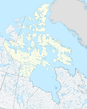
Qausuittuq National Park (pronounced Qow-soo-ee-tooq, from Inuktitut meaning place where the sun does not rise) is a national park located on northwest Bathurst Island in Nunavut. [1] [2] It was established on September 1, 2015, becoming Canada's 45th national park. [3]

Contents

This area was chosen to represent the Western High Arctic natural region, one of 39 such regions identified by Parks Canada. This region encompasses most of the high Arctic Archipelago (the Queen Elizabeth Islands and the Grinnell Peninsula on Devon Island, but not Ellesmere Island or Axel Heiberg Island). The park also protects important Peary caribou habitat. It is north of the existing Polar Bear Pass National Wildlife Area.

History

Archaeological studies in the Bathurst Island area indicate occasional human use over the past 4500 years by prehistoric as well as historic Dorset and Thule Inuit. Human presence fluctuated with changes in climate, ice cover and the corresponding availability of wildlife for subsistence. Human use was primarily in the southern and eastern part of Bathurst Island, rather than within the proposed park area itself. [4]

The area was explored by British naval expeditions during the mid-nineteenth century, primarily those associated with the search for the lost Franklin expedition. Several cairns remain on the north coast. [4] Exploration of the area continued sporadically, including scientific and commercial studies beginning during the 1960s.

The community of Resolute, located on Cornwallis Island to the southeast of the park, was established in 1953. Inuit from the community use the land and waters of the Bathurst Island area to hunt and fish.

A park feasibility study was initiated in 1994. The work included a Mineral and Energy Resources Assessment. This report was released in 1999 and the overall park feasibility study was concluded in 2000. The lands on northern Bathurst Island were first withdrawn for the purpose of establishing a national park in 1996. In 2009 Parks Canada entered into negotiations with the communities most closely connected to the proposed park with respect to establishing an Inuit Impact and Benefit Agreement (IIBA) for the establishment of the park.

In 2015, the federal government introduced a bill to create the park, which received approval on June 24. The law specified that it would come into force on either the day of approval or on September 1, 2015—whichever came latest. With approval given in June, the park was legally created on September 1.

The proposed name of the park was "Tuktusiuqvialuk National Park". [5] The Qausuittuq name was selected through a contest in the local area.

Qausuittuq National Park was open to the public and received its first visitors in 2016. [6]

Geology and climate

The park geology is composed primarily of sedimentary rocks such as limestone, sandstone and dolomite. The area was glaciated in the past as evidenced by landforms such as eskers, moraines and beach terraces. The area is generally rolling hills. [7]

Bathurst Island has a cold dry climate. The cool central Arctic climate pushes almost unimpeded into the low-lying islands of the northwest and north-central sector of the Queen Elizabeth islands; reaching to Bathurst Island. [8] Mean temperatures range from -35 °C in January to 5 °C in July. Annual precipitation is less than 130 mm. [7]

Flora and fauna

Peary caribou Peary caribou.png
Peary caribou

The severe climate limits soil and nutrient development, which in turn limits vegetation. This region has low vascular plant diversity and is dominated by herbaceous species. [8] Plants include purple saxifrage, dwarf willow, sedges, grasses, lichens and mosses. [7]

Terrestrial wildlife species adapted to this environment include Peary caribou, muskoxen, wolves, Arctic foxes and bird species such as snowy owls, snow geese, king eiders, jaegers as well as various gulls and shorebirds. Marine species in the area include ringed seals, bearded seals, polar bears, walruses, bowhead whales, beluga whales and narwhals. [7]

See also

Related Research Articles

<span class="mw-page-title-main">Baffin Island</span> Largest Arctic island in Nunavut, Canada

Baffin Island, in the Canadian territory of Nunavut, is the largest island in Canada and the fifth-largest island in the world. Its area is 507,451 km2 (195,928 sq mi), slightly larger than Spain; its population was 13,039 as of the 2021 Canadian census; and it is located at 68°N70°W. It also contains the city of Iqaluit, the capital of Nunavut.

<span class="mw-page-title-main">Victoria Island</span> Island in Arctic Canada

Victoria Island is a large island in the Arctic Archipelago that straddles the boundary between Nunavut and the Northwest Territories of Canada. It is the eighth-largest island in the world, and at 217,291 km2 (83,897 sq mi) in area, it is Canada's second-largest island. It is nearly double the size of Newfoundland (111,390 km2 [43,010 sq mi]), and is slightly larger than the island of Great Britain (209,331 km2 [80,823 sq mi]) but smaller than Honshu (225,800 km2 [87,200 sq mi]). The western third of the island lies in the Inuvik Region of the Northwest Territories; the remainder is part of Nunavut's Kitikmeot Region. The population of 2,168 is divided among 2 settlements, the larger of which is in Nunavut and the other of which is in the Northwest Territories.

<span class="mw-page-title-main">Banks Island</span> Inhabited island in the Northwest Territories, Canada

Banks Island is one of the larger members of the Arctic Archipelago. Situated in the Inuvik Region, and part of the Inuvialuit Settlement Region, of the Northwest Territories, it is separated from Victoria Island to its east by the Prince of Wales Strait and from the mainland by Amundsen Gulf to its south. The Beaufort Sea lies to its west, and to its northeast M'Clure Strait separates the island from Prince Patrick Island and Melville Island.

<span class="mw-page-title-main">Pond Inlet</span> Place in Nunavut, Canada

Pond Inlet is a small, predominantly Inuit community in the Qikiqtaaluk Region of Nunavut, Canada, located on northern Baffin Island. To the Inuit the name of the place "is and always has been Mittimatalik." The Scottish explorer Sir John Ross had named an arm of the sea that separates Bylot Island from Baffin Island as Pond's Bay, and the hamlet now shares that name. On 29 August 1921, the Hudson's Bay Company opened its trading post near the Inuit camp and named it Pond Inlet, marking the expansion of its trading empire into the High Arctic.

<span class="mw-page-title-main">Quttinirpaaq National Park</span> National park in Nunavut, Canada

Quttinirpaaq National Park is located on the northeastern corner of Ellesmere Island in the Qikiqtaaluk Region of Nunavut, Canada. It is the second most northerly park on Earth after Northeast Greenland National Park. In Inuktitut, Quttinirpaaq means "top of the world". It was established as Ellesmere Island National Park Reserve in 1988, and the name was changed to Quttinirpaaq in 1999, when Nunavut was created, and became a national park in 2000. The reserve covers 37,775 km2 (14,585 sq mi), making it the second largest park in Canada, after Wood Buffalo National Park.

<span class="mw-page-title-main">Bathurst Island (Nunavut)</span> Uninhabited member of the Queen Elizabeth Islands, Nunavut, Canada

Bathurst Island is one of the Queen Elizabeth Islands in Nunavut, Canada. It is a member of the Arctic Archipelago. The area of the island is estimated at 16,042 km2 (6,194 sq mi), 115 to 117 mi long and from 63 mi (101 km) to 72 mi (116 km) to 92.9 mi (149.5 km) wide, making it the 54th largest island in the world and Canada's 13th largest island. It is uninhabited.

The Indigenous peoples in Northern Canada consist of the First Nations, Métis, and Inuit located in Canada's three territories: Northwest Territories, Nunavut, and Yukon.

<span class="mw-page-title-main">Aulavik National Park</span> National park in Northwest Territories, Canada

Aulavik National Park ; from the Inuvialuktun for "place where people travel") is a national park located on Banks Island in the Northwest Territories of Canada. It is known for its access to the Thomsen River, one of the most northerly navigable rivers in North America. The park is a fly-in park, and protects approximately 12,274 square kilometres (4,739 sq mi) of Arctic Lowlands at the northern end of the island. The most practical way to visit the park is to charter a plane, and currently the park has four landing sites. Aulavik is considered a polar desert and often experiences high winds. Precipitation for the park is approximately 300 mm (12 in) per year. In the southern regions of the park a sparsely vegetated upland plateau reaches a height of 450 m (1,480 ft) above sea level.

<span class="mw-page-title-main">Tuktut Nogait National Park</span> National park in Northwest Territories, Canada

Tuktut Nogait National Park is a national park located in the Northwest Territories of Canada that was established in 1998. Meaning "young caribou" in Inuvialuktun, the park is home to the calving grounds of the Bluenose-West caribou herd.

<span class="mw-page-title-main">Whale Cove, Nunavut</span> Place in Nunavut, Canada

Whale Cove, is a hamlet located 74 km (46 mi) south southwest of Rankin Inlet, 145 km (90 mi) northeast of Arviat, in the Kivalliq Region, Nunavut, Canada, on the western shore of Hudson Bay.

<span class="mw-page-title-main">Bathurst Inlet, Nunavut</span> Abandoned settlement in Nunavut, Canada

Bathurst Inlet,, is a small Inuit community located in Bathurst Inlet in the Kitikmeot Region of Nunavut, Canada.

<span class="mw-page-title-main">Peary caribou</span> Subspecies of deer

The Peary caribou is a subspecies of caribou found in the High Arctic islands of Nunavut and the Northwest Territories in Canada. They are the smallest of the North American caribou, with the females weighing an average of 60 kg (130 lb) and the males 110 kg (240 lb). In length the females average 1.4 m and the males 1.7 m.

<span class="mw-page-title-main">Barren-ground caribou</span> Subspecies of deer

The barren-ground caribou is a subspecies of the reindeer that is found in the Canadian territories of Nunavut and the Northwest Territories, in northern Alaska and in south-western, Greenland. It includes the Porcupine caribou of Yukon and Alaska. The barren-ground caribou is a medium-sized caribou, smaller and lighter-colored than the boreal woodland caribou, with the females weighing around 90 kg (200 lb) and the males around 150 kg (330 lb). However, on some of the smaller islands, the average weight may be less. The large migratory herds of barren-ground caribou take their names from the traditional calving grounds, such as the Ahiak herd, the Baffin Island herds, the Bathurst herd, the Beverly herd, the Bluenose East herd, the Bluenose West herd, the Porcupine herd and the Qamanirjuaq herd.

<span class="mw-page-title-main">Arctic Cordillera</span> Terrestrial ecozone in northern Canada

The Arctic Cordillera is a terrestrial ecozone in northern Canada characterized by a vast, deeply dissected chain of mountain ranges extending along the northeastern flank of the Canadian Arctic Archipelago from Ellesmere Island to the northeasternmost part of the Labrador Peninsula in northern Labrador and northern Quebec, Canada. It spans most of the eastern coast of Nunavut with high glaciated peaks rising through ice fields and some of Canada's largest ice caps, including the Penny Ice Cap on Baffin Island. It is bounded to the east by Baffin Bay, Davis Strait and the Labrador Sea while its northern portion is bounded by the Arctic Ocean.

<span class="mw-page-title-main">Polar Bear Pass</span>

Polar Bear Pass, is a 262,400 hectare wetland and mountain pass on Bathurst Island within the Qikiqtaaluk Region, Nunavut, Canada. The pass is on federal Crown land.

<span class="mw-page-title-main">Polar Bear Pass National Wildlife Area</span>

Polar Bear Pass National Wildlife Area is a National Wildlife Area on Bathurst Island within Qikiqtaaluk, Nunavut, Canada. It is on federal Crown land, and is administered by the Canadian Wildlife Service, a division of Environment Canada, with respect to the Canada Wildlife Act's National Wildlife Area Regulations. Land use is also subject to the Nunavut Land Claims Agreement. To the north and west is Qausuittuq National Park.

<span class="mw-page-title-main">Nirjutiqavvik National Wildlife Area</span> National Wildlife Area site in Nunavut, Canada

Nirjutiqavvik National Wildlife Area is a National Wildlife Area on Coburg Island within the Qikiqtaaluk Region, Nunavut, Canada. It is located in Baffin Bay's Lady Ann Strait between Ellesmere Island, to the north, and Devon Island to the south. The NWA includes Coburg Island and its surrounding marine area.

Seymour Island is an uninhabited island in the Qikiqtaaluk Region of northern Canada's territory of Nunavut. A member of the Berkeley Islands group, it is located approximately 30 mi (48 km) north of northern Bathurst Island. Between Seymour Island and Bathurst Island lies Helena Island. Penny Strait lies about 90 km (56 mi) to the east where open water polynyas occur.

<span class="mw-page-title-main">Dolphin-Union caribou</span> Migratory population of caribou

Dolphin and Union Caribou, Dolphin and Union caribou herd, Dolphin-Union, locally known as Island Caribou, are a migratory population of barren-ground caribou, Rangifer tarandus groenlandicus, that occupy Victoria Island in the Canadian Arctic Archipelago and the nearby mainland. They are endemic to Canada. They migrate across the Dolphin and Union Strait from their summer grazing on Victoria Island to their winter grazing area on the Nunavut-Northwest Territories mainland in Canada. It is unusual for North American caribou to seasonally cross sea ice and the only other caribou to do so are the Peary caribou who are smaller in size and population. They were listed as Endangered by Committee on the Status of Endangered Wildlife in Canada (COSEWIC) since November 2017.

Caribou herds in Canada are discrete populations of seven subspecies that are represented in Canada. Caribou can be found from the High Arctic region south to the boreal forest and Rocky Mountains and from the east to the west coasts.

References

  1. "National Park System Plan, 3rd Edition". Parks Canada. Archived from the original on August 7, 2014. Retrieved August 15, 2014.
  2. "Qausuittuq National Park Proposal, Bathurst Island, Nunavut" (PDF). Parks Canada. 12 December 2012. Archived from the original (PDF) on 19 August 2014. Retrieved August 15, 2014.
  3. "High-Arctic National Park Created on Bathurst Island". Parks Canada. June 24, 2015. Retrieved June 26, 2015.
  4. 1 2 Robert McGhee (January 31, 1997). North Bathurst Island Archaeological Project: Final Report (Report). Parks Canada . Retrieved August 22, 2014.
  5. "Nunavut park deal ready for signing". NunatsiaqOnline. July 16, 1998. Archived from the original on June 27, 2015. Retrieved August 22, 2014.
  6. politis (2016-09-28). "Exploring Qausuittuq, Canada's newest national park, by Marlis Butcher". Canadian Geographic. Archived from the original on 2018-02-01. Retrieved 2017-06-18.
  7. 1 2 3 4 "Learn More - The Place and the People". Parks Canada. May 5, 2014. Retrieved August 22, 2014.
  8. 1 2 Sylvia Edland; Bea Taylor Alt (March 1989). "Regional Congruence of Vegetation and Summer Climate Patterns in the Queen Elizabeth Islands, Northwest Territories,Canada". Arctic. 42 (1): 3–23. doi: 10.14430/arctic1635 . Archived from the original on 2014-08-26. Retrieved 2014-08-24.