R' Kiz

Last updated
R' Kiz
Commune and town
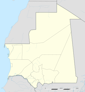
Mauritania location map.svg
Red pog.svg
R' Kiz
Location in Mauritania
Coordinates: 16°55′N15°19′W / 16.917°N 15.317°W / 16.917; -15.317
CountryFlag of Mauritania.svg  Mauritania
Region Trarza
Population (2000)
  Total 10,688
Time zone GMT (UTC+0)

R' Kiz or Rkiz is a town and urban commune in the Trarza Region of south-western Mauritania. [1]

Communes of Mauritania

There are 216 administrative Communes in Mauritania recognised by the Government of Mauritania.

Mauritania Islamic republic in Northwest Africa

Mauritania is a country in Northwest Africa. It is the eleventh largest sovereign state in Africa and is bordered by the Atlantic Ocean to the west, Western Sahara to the north and northwest, Algeria to the northeast, Mali to the east and southeast, and Senegal to the southwest.

In 2000 it had a population of 10,688. [2]

Related Research Articles

Aere Mbar Commune and town in Brakna, Mauritania

Aere Mbar is a town and commune in the Brakna Region of south-western Mauritania. It is located near the border with Senegal.

Aghchorguitt Commune and town in Brakna, Mauritania

Aghchorguitt is a town and commune in the Brakna Region of southern-western Mauritania.

Arr, Mauritania Commune and town in Guidimaka, Mauritania

Arr is a town and commune in the Guidimaka Region of south-eastern Mauritania.

Bababé Commune and town in Brakna, Mauritania

Bababé is a town and commune in the Brakna Region of southern Mauritania.

Bareina Commune and village in Trarza, Mauritania

Bareina is a Bedouin village and rural commune in the Trarza Region of south-western Mauritania. In 2000 it had a population of 14,987.

Ould Birem Commune and village in Brakna, Mauritania

Ould Birem is a village and rural commune in the Brakna Region of southern Mauritania.

Mbagne Commune and town in Brakna, Mauritania

Mbagne is a town and commune in the Brakna Region of southern Mauritania, very close to the border with Senegal. Mbagne has a high unemployment rate and an unstable agriculture system, according to the OECD.

Bagondine is a village and rural commune in the Brakna Region of southern Mauritania.

Bassiknou Commune and town in Hodh Ech Chargui, Mauritania

Bassiknou is a town and commune in the Hodh Ech Chargui Region of south-eastern Mauritania.

Fassala Commune and town in Hodh Ech Chargui, Mauritania

Fassala , Fassale, Fessale, or Vassale is a town and commune in the Hodh Ech Chargui Region of south-eastern Mauritania, on the Malian border.

Mabrouk or El Mabrouk is a village and rural commune in the Hodh Ech Chargui Region of south-eastern Mauritania.

Beneamane or Benamane is a village and rural commune in the Hodh Ech Chargui Region of south-eastern Mauritania.

Ajoueir is a village and rural commune in the Trarza Region of south-western Mauritania.

Keur-Macene Commune and town in Trarza, Mauritania

Keur-Macene or Keurmacen is a town and urban commune in the Trarza Region of south-western Mauritania.

Ndiago, Mauritania Commune and town in Trarza, Mauritania

Ndiago or N'Djiago is a town and urban commune in the Trarza Region of south-western Mauritania.

Mbalal or M'Balel is a town and urban commune in the Trarza Region of south-western Mauritania.

Taguilalett or Taguilalet is a village and rural commune in the Trarza Region of south-western Mauritania.

Ouad Naga Commune and town in Trarza, Mauritania

Ouad Naga is a town and urban commune in the Trarza Region of south-western Mauritania.

Aouleiguatt is a village and rural commune in the Trarza Region of south-western Mauritania.

Tékane Commune and town in Trarza, Mauritania

Tékane is a town and urban commune in the Trarza Region of southern Mauritania. It lies east of Rosso.

References

  1. "Collectivités urbaines à vocation agricole, pastorale ou agropastorale". République Islamique de Mauritanie:Communes de Mauritanie. Retrieved February 1, 2009.
  2. "Statistiques Demographiques: Résultats du RGPH 2000 des Wilayas". République Islamique de Mauritanie. Archived from the original on February 22, 2012. Retrieved February 1, 2009.

Coordinates: 16°55′N15°19′W / 16.917°N 15.317°W / 16.917; -15.317

Geographic coordinate system Coordinate system

A geographic coordinate system is a coordinate system that enables every location on Earth to be specified by a set of numbers, letters or symbols. The coordinates are often chosen such that one of the numbers represents a vertical position and two or three of the numbers represent a horizontal position; alternatively, a geographic position may be expressed in a combined three-dimensional Cartesian vector. A common choice of coordinates is latitude, longitude and elevation. To specify a location on a plane requires a map projection.