This article needs additional citations for verification .(May 2014) |
| RAF Dry Tree | |
|---|---|
| Goonhilly Downs Near Helston, Cornwall in United Kingdom | |
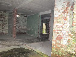 View inside the receiver block at RAF Dry Tree. | |
| Site information | |
| Type | Chain Home radar station |
| Owner | Air Ministry |
| Operator | Royal Air Force |
| Open to the public | yes |
| Location | |
 RAF Dry Tree Shown with Cornwall | |
| Coordinates | 50°2′44.1″N5°12′18.24″W / 50.045583°N 5.2050667°W |
| Height | four 360 feet (110 m) transmitter masts |
| Site history | |
| Built | 1940 |
| In use | 1940- |
| Fate | demolished with the exception of ground level buildings and concrete hardstandings |
| Battles/wars | Second World War |
RAF Dry Tree was a Royal Air Force early warning radar station for detecting enemy aircraft during the Second World War. It was built in 1940 on Goonhilly Downs, on the Lizard peninsula in Cornwall, a short distance to the south-east of the Goonhilly Earth Station. [1] [2] It was named from the standing stone on the land known as the Dry Tree menhir.

