
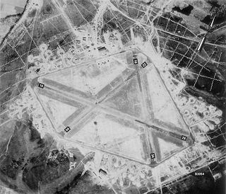
Royal Air Force Croft or more simply RAF Croft is a former Royal Air Force station located 4.6 miles (7.4 km) south of Darlington, County Durham, England and 8 miles (13 km) north-east of Richmond, North Yorkshire. The site is also known locally as Croft Aerodrome or Neasham. Constructed at the same time as many other airfields, it was originally named RAF Dalton-on-Tees after the nearby village Dalton-on-Tees. However, it was quickly renamed RAF Croft after initial confusion with the also newly opened RAF Dalton near Thirsk, just 25 miles away.
Royal Air Force Beaulieu or more simply RAF Beaulieu is a former Royal Air Force station in the New Forest, Hampshire, England. It was also known as Beaulieu airfield, Beaulieu aerodrome and USAAF Station AAF 408. It is located next to the village of East Boldre, about 2 miles (3.2 km) west of the village of Beaulieu and 5 miles (8.0 km) east-northeast of Lymington.

Royal Air Force Kingsnorth or more simply RAF Kingsnorth is a former Royal Air Force Advanced Landing Ground in Kent, England. It was at Bliby Corner approximately 2 miles (3.2 km) southeast of Ashford; about 50 miles (80 km) southeast of London. It is not to be confused with RNAS Kingsnorth, later RAF Kingsnorth, which was an airship station in operation during and after the First World War.

Royal Air Force Ashford or more simply RAF Ashford is a former Royal Air Force Advanced Landing Ground in Kent, England. The landing ground is located approximately 3 miles (4.8 km) west of Ashford just south of the A28 near the junction with Old Surrenden Manor Road; about 50 miles (80 km) southeast of London.
Royal Air Force Staplehurst or more simply RAF Staplehurst is a former Royal Air Force Advanced Landing Ground located in Kent, England. The airfield is located approximately 1 mile (1.6 km) northeast of Staplehurst; about 38 miles (61 km) southeast of London.

Royal Air Force Detling or more simply RAF Detling is a former Royal Air Force station situated 600 feet (180 m) above sea level, located near Detling, a village about 4 miles (6.4 km) miles north-east of Maidstone, Kent.

Royal Air Force East Moor or RAF East Moor is a former Royal Air Force satellite station located 7.4 miles (11.9 km) north of York, North Yorkshire and 5.5 miles (8.9 km) south-east of Easingwold, North Yorkshire, England.

Royal Air Force Acklington, simply known as RAF Acklington, is a former Royal Flying Corps and Royal Air Force station located 3.2 miles (5.1 km) south west of Amble, Northumberland and 8.8 miles (14.2 km) north east of Morpeth, Northumberland.
Royal Air Force Bramcote or more simply RAF Bramcote is a former Royal Air Force station located 3.5 miles (5.6 km) south-east of Nuneaton, Warwickshire, England used during the Second World War. It later became HMS Gamecock and then Gamecock Barracks.

Royal Air Force Bardney or RAF Bardney is a former Royal Air Force station located 1.7 miles (2.7 km) north of Bardney, Lincolnshire, England and 10.2 miles (16.4 km) east of the County town of Lincoln. It was built as a satellite to RAF Waddington in 1943 and the airfield closed in 1963.
Royal Air Force Blyton or more simply RAF Blyton is a former Royal Air Force satellite station located in Lincolnshire, 4.8 miles (7.7 km) north east of Gainsborough, and 9.6 miles (15.4 km) south of Scunthorpe, England.

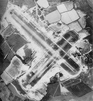
Royal Air Force Hawkinge or more simply RAF Hawkinge is a former Royal Air Force station located 13.23 miles (21.29 km) east of Ashford, 2.2 miles (3.5 km) north of Folkestone, Kent and 7.1 miles (11.4 km) west of Dover, Kent, England. The airfield was used by both the Royal Flying Corps and the Royal Air Force during its lifetime and was involved during the Battle of Britain, as well as other important aerial battles during the Second World War and the early stages of aerial usage in war in the First World War.
RAF Collyweston is a former Royal Air Force satellite station located 3.2 miles (5.1 km) south west of Stamford, Lincolnshire and 11 miles (18 km) north east of Corby, Northamptonshire, England.

Royal Air Force Burn or more simply RAF Burn is a former Royal Air Force satellite station located 5 miles (8 km) south of Selby and 0.5 miles (0.8 km) east of Burn in North Yorkshire, England which opened in 1942 before closing in 1946.

Royal Air Force Charterhall or more simply RAF Charterhall is a former Royal Air Force station located in the Scottish Borders and the historic county of Berwickshire between the village of Greenlaw and Duns. It was originally a First World War landing ground named Eccles Toft. The airfield was reconstructed in 1942 and was used mainly by No. 54 Operational Training Unit during Second World War. The RAF left in 1947 and the airfield was officially closed.

RAF Caistor is a former Royal Air Force Relief Landing Ground located 6.2 miles (10.0 km) south east of Brigg, Lincolnshire and 9.1 miles (14.6 km) north west of Binbrook, Lincolnshire, England, the site is now used for farming.

Royal Air Force Bradwell Bay or more simply RAF Bradwell Bay is a former Royal Air Force station located 9.5 miles (15.3 km) east of Maldon, Essex, England and 3.1 miles (5 km) south west of West Mersea, Essex.
Royal Air Force Macmerry or more simply RAF Macmerry is a former Royal Air Force satellite station located 4.5 miles (7.2 km) west of Haddington, East Lothian, Scotland and 11.4 miles (18.3 km) east of Edinburgh. It was situated immediately to the north east of Macmerry on the north side of the A1 road. It has also been called RNAS Macmerry and unofficially RAF Tranent and RAF Penston during its life.
Royal Air Force Banff or more simply RAF Banff is a former Royal Air Force station located 4 miles (6 km) west of Banff, Aberdeenshire, Scotland and 14 miles (23 km) northeast of Keith, Moray.

Royal Air Force Church Fenton or RAF Church Fenton was a former Royal Air Force (RAF) station located 4.3 miles (6.9 km) south east of Tadcaster, North Yorkshire, England and 6.3 miles (10.1 km) north west of Selby, North Yorkshire, near the village of Church Fenton. The station was opened in 1937 and during the Second World War was home to air defence aircraft, a role retained by the station until the 1960s when it became a training station. It closed in 2013 and is now a civilian airfield known as Leeds East Airport.
