Radio Range, St. John's

Last updated

Radio Range
Village
Country Antigua and Barbuda
Island Antigua
Civil parish Saint John Parish
Government
  TypeVillage Council [1] (possibly dissolved) [2]
Population
 (2011)
  Total328
Time zone UTC-4 (AST)

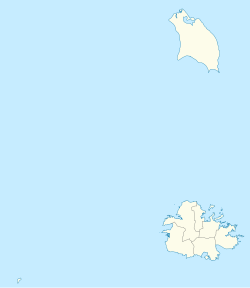
Radio Range is a settlement in Saint John Parish, Antigua and Barbuda.
Demographics

Radio Range has one enumeration district, 14700 Radio Range.

Ethnic [3]
Q48 EthnicCounts%
African descendent23571.70%
Caucasian/White30.96%
East Indian/India10.32%
Mixed (Black/White)41.29%
Mixed (Other)82.57%
Hispanic144.18%
Syrian/Lebanese5817.68%
Other41.29%
Total328100.00%
Religion [4]
Q49 ReligionCounts%
Adventist5015.11%
Anglican4714.47%
Baptist216.43%
Church of God113.22%
Evangelical175.14%
Jehovah Witness20.64%
Methodist154.50%
Moravian82.57%
Nazarene10.32%
None/no religion237.07%
Pentecostal288.68%
Roman Catholic7823.79%
Weslyan Holiness92.89%
Other72.25%
Don't know/Not stated92.89%
Total328100.00%
Country of birth [5]
Q58. Country of birthCounts%
Africa123.54%
Antigua and Barbuda17553.38%
Other Caribbean countries164.82%
Canada10.32%
Other Asian countries51.61%
Dominica72.25%
Dominican Republic51.61%
Guyana164.82%
Jamaica175.14%
Monsterrat61.93%
St. Kitts and Nevis20.64%
St. Lucia10.32%
St. Vincent and the Grenadines10.32%
Syria3510.61%
Trinidad and Tobago61.93%
United Kingdom20.64%
USA175.14%
USVI United States Virgin Islands10.32%
Not Stated20.64%
Total328100.00%
Country of Citizenship [6]
Q71 Country of Citizenship 1Counts%
Antigua and Barbuda24273.95%
Other Caribbean countries123.54%
Canada10.32%
Other Asian and Middle Eastern countries216.43%
Dominica20.64%
Dominican Republic41.29%
Guyana113.22%
Jamaica154.50%
Monsterrat10.32%
St. Lucia10.32%
Trinidad and Tobago20.64%
United Kingdom10.32%
USA41.29%
Other countries113.22%
Total328100.00%
Country of Second/Dual Citizenship [7]
Q71 Country of Citizenship 2 (Country of Second/Dual Citizenship)Counts%
Other Caribbean countries56.94%
Other Asian and Middle Eastern countries1823.61%
Dominica56.94%
Dominican Republic11.39%
Guyana56.94%
Jamaica34.17%
Monsterrat68.33%
St. Vincent and the Grenadines11.39%
Trinidad and Tobago45.56%
United Kingdom79.72%
USA1722.22%
Other countries22.78%
Total76100.00%
NotApp :252

Related Research Articles

<span class="mw-page-title-main">Antigua and Barbuda</span> Country in the Lesser Antilles of the West Indies

Antigua and Barbuda is a sovereign island country in the West Indies. It lies at the conjuncture of the Caribbean Sea and the Atlantic Ocean in the Leeward Islands part of the Lesser Antilles.

Telecommunications in Antigua and Barbuda are via media in the telecommunications industry.

<span class="mw-page-title-main">St. John's, Antigua and Barbuda</span> Capital of Antigua and Barbuda

<span class="mw-page-title-main">Barbuda</span> Island in Antigua and Barbuda

Barbuda is an island located in the eastern Caribbean forming part of the twin-island state of Antigua and Barbuda as an autonomous entity. Barbuda is located approximately 30 miles (48 km) north of Antigua. The sole settlements on the island are Codrington and its surrounding localities. Barbuda is a flat island with the western portion being dominated by Codrington Lagoon, and the eastern portion being dominated by the Barbuda Highlands, with salty ponds and scrubland spread throughout the island. The climate is classified as tropical marine.

<span class="mw-page-title-main">Saint Mary, Antigua and Barbuda</span> Parish in Antigua and Barbuda

Saint Mary, officially the Parish of Saint Mary, is a parish of Antigua and Barbuda on the island of Antigua. Saint Mary borders Saint John to the north, and Saint Paul to the east. Saint Mary is dominated by the Shekerley Mountains, and its northern border is largely defined by the mountains, and by Cooks Creek. The largest city in the parish is Bolans, home to the Jolly Harbour neighbourhood, and the parish church is located in Old Road. Saint Mary was created with the other five original parishes on 11 January 1692. It had a population of 7,341 in 2011, and 8,141 in 2018.

<span class="mw-page-title-main">Saint Paul, Antigua and Barbuda</span> Parish in Antigua and Barbuda

Saint Paul, officially the Parish of Saint Paul, is a parish of Antigua and Barbuda on the island of Antigua. Saint Paul borders Saint Peter and Saint John to the north, Saint Mary to the west, and Saint Philip to the east. Saint Paul is dominated by farmland in the north, with various creeks and Potworks Dam marking its northern border, and low-lying hills to the south, defining its western border with Saint Mary. The largest city fully within the parish is Liberta, the fourth largest city in the country. The parish capital, and the location of the parish church, is Falmouth. The main economic and tourism hub of the parish is English Harbour. Saint Paul was created with the other five original parishes on 11 January 1692. It had a population of 9,004 in 2018.

<span class="mw-page-title-main">Saint Peter, Antigua and Barbuda</span> Parish in Antigua and Barbuda

Saint Peter, officially the Parish of Saint Peter, is a parish of Antigua and Barbuda on the island of Antigua. Saint Peter borders Saint Paul to the south, Saint Philip to the east, and Saint George and Saint John to the west. Saint Peter is dominated by farmland, savanna, and undeveloped fields, and its borders are not well-defined. The largest city fully within the parish is Parham, which is also the capital. However, the portion of the city of All Saints in Saint Peter is significantly larger than Parham. Saint Peter was created with the other five original parishes on 11 January 1692. It had a population of 5,325 in 2011.

<span class="mw-page-title-main">Hinduism in the West Indies</span> Overview of Hinduism in the West Indies territories

Hinduism is the leading single religion of the Indo-Caribbean communities of the West Indies. Hindus are particularly well represented in Guyana, Suriname and Trinidad and Tobago. The Cayman Islands also hosts a sizable Hindu population, with 2.4 percent of the country affiliating with the religion. Smaller groups of Indo-Caribbeans live elsewhere in the Caribbean, especially Puerto Rico, Jamaica, Belize, Barbados, Saint Vincent and the Grenadines, Saint Lucia, and Bahamas.

<span class="mw-page-title-main">Antigua</span> Island in Antigua and Barbuda

Antigua, also known as Waladli or Wadadli by the native population, is an island in the Lesser Antilles. It is one of the Leeward Islands in the Caribbean region and the most populous island of the country of Antigua and Barbuda. Antigua and Barbuda became an independent state within the Commonwealth of Nations on 1 November 1981.

Freetown, officially known as FreeTown, is a town in Antigua. It is located in the southeast of the island, on a peninsula between Willoughby Bay to the south and Nonsuch Bay to the north.

Potters Village is a township located on Antigua in Antigua and Barbuda. It is located in the north of the island, to the east of the capital, St. John's and southwest of Piggotts.

<span class="mw-page-title-main">Education in Antigua and Barbuda</span>

Education in Antigua and Barbuda is compulsory and free for children between the ages of 5 and 16 years. The system is modeled on the British educational system. The current Minister of Education, Sport & Creative Industries is Daryll Sylvester Matthew.

<span class="mw-page-title-main">Foreign relations of Antigua and Barbuda</span>

Antigua and Barbuda maintains diplomatic relations with the United States, Canada, the United Kingdom, and the People's Republic of China, as well as with many Latin American countries and neighbouring Eastern Caribbean states. It is a member of the United Nations, the Commonwealth of Nations, the Organization of American States, the Organisation of Eastern Caribbean States, the Bolivarian Alliance for the Americas, Petrocaribe and the Eastern Caribbean's Regional Security System (RSS).

<span class="mw-page-title-main">Five Islands, Antigua and Barbuda</span> Village in Antigua, Antigua and Barbuda

Five Islands Village is a village located on the northwest coast of Antigua, within Saint John Parish in Antigua and Barbuda.

<span class="mw-page-title-main">Newfield, Antigua and Barbuda</span> Village in Antigua, Antigua and Barbuda

Newfields is a village in Saint Philip Parish, Antigua and Barbuda.

Montpelier is a small village in Saint Philip Parish, Antigua and Barbuda.

<span class="mw-page-title-main">St. Phillip North</span>

St. Phillip North is a parliamentary constituency in Saint Philip Parish, Antigua and Barbuda.

<span class="mw-page-title-main">St. Mary's North</span>

St. Mary's North is a parliamentary constituency in Saint Mary Parish, Antigua and Barbuda.

<span class="mw-page-title-main">Long Bay, Antigua and Barbuda</span> Coastal settlement in Saint Philip, Antigua

Long Bay is a coastal settlement in Saint Philip, Antigua and Barbuda.

Herberts is a major town in Saint John, Antigua and Barbuda.

References

  1. "LAWS OF ANTIGUA AND BARBUDA Chapter 466 – The Village Councils Act" (PDF). 16 June 1945. Retrieved 17 January 2022.
  2. "The political Neanderthal". 12 March 2020.
  3. "Ethnic" (PDF). redatam.org. 2011. Archived from the original (PDF) on 17 January 2022. Retrieved 11 August 2023.
  4. "Religion" (PDF). redatam.org. 2011. Archived from the original (PDF) on 17 January 2022. Retrieved 12 August 2023.
  5. "Country of birth" (PDF). redatam.org. 2011. Archived from the original (PDF) on 17 January 2022. Retrieved 12 August 2023.
  6. "Country of Citizenship" (PDF). redatam.org. 2011. Archived from the original (PDF) on 17 January 2022. Retrieved 12 August 2023.
  7. "Archived copy" (PDF). Archived from the original (PDF) on 18 January 2022. Retrieved 14 August 2023.{{cite web}}: CS1 maint: archived copy as title (link)