
Pak Kret is a district (amphoe) in the northeastern part of Nonthaburi province, central Thailand.
Rama IX Bridge is a bridge in Bangkok, Thailand over the Chao Phraya River. It connects the Yan Nawa District to Rat Burana District as a part of the Tha Ruea – Dao Khanong Section of Chaloem Maha Nakhon Expressway.

The Kanchanaphisek Bridge is a cable stayed bridge crossing the Chao Phraya river in Samut Prakan Province, Thailand. It is part of the Outer Ring Road encircling Bangkok. The bridge was opened to traffic on 15 November 2007 and has a main span of 500 meters. the bridge's name was bestowed by King Bhumibol Adulyadej following the Golden Jubilee celebrations, 'Kanchanaphisek Road', meaning 'Golden Jubilee Bridge'. The bridge is 52 meters above sea level to allow cargo vessels to enter and exit. The bridge is the first bridge in Samut Prakan Province across the Chao Phraya River that connects Phra Pradaeng District on the east and west side.

The Rama III Bridge, also known as the New Krungthep Bridge, is a bridge crossing the Chao Phraya River in Bangkok, Thailand. The bridge was completed in 1999 and was designed to alleviate traffic congestion on the adjacent Krungthep Bridge. The bridge was named in honour of King Nangklao.

Rama VI Bridge is a railway bridge over the Chao Phraya River in Bangkok, in Thailand, connecting the districts Bang Sue and Bang Phlat.

Rama VII Bridge is a bridge over the Chao Phraya River in Bangkok and Nonthaburi, in Thailand, connecting the Bang Sue District and Bang Phlat District. The roadway is in a dual carriageway configuration, with 3 lanes in each direction. The bridge was named in honour of King Prajadhipok. The bridge was constructed to ease the increase in road traffic volumes on the adjacent Rama VI bridge.

Ko Kret is a small island in the Chao Phraya River in Nonthaburi province, Thailand. It is around 3 km (1.9 mi) long and 3 km (1.9 mi) wide with an area of over 4.2 square kilometers. It has seven main villages, the largest and most populous being Ban Mon. The island is best known for Thai-Mon people who make pottery for a living. The island is served by ferries.

The Rama V Bridge is a bridge across the Chao Phraya River in Nonthaburi Province, Thailand. The bridge was named in the honour of King Chulalongkorn. It is not related to Rama V Road in Dusit District, Bangkok.

Maha Chesadabodindranusorn Bridge is an extradosed bridge in area of Mueang Nonthaburi District in Nonthaburi Province, Thailand, over the Chao Phraya River. The bridge is the first extradosed bridge in Thailand. It is located between Phra Nangklao Bridge (upstream) and Rama V Bridge (downstream), connects Nonthaburi 1 Road, on the east side of the river, and Bang Si Mueang - Wat Bot Don Phrom Road and Ratchaphruek Road, on the west side of the river. The bridge was named after King Nangklao, one of whose titles before his accession to the throne was "Prince Chesadabodin".
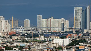
Pak Kret is a city in Nonthaburi province, Thailand. It lies in the Central Thai plains on the east bank of the lower Chao Phraya River, bordering Bangkok to the east, Mueang Nonthaburi district of Nonthaburi province to the south, and Pathum Thani province to the north. It is part of the Bangkok Metropolitan Region megalopolis. With a registered population of 190,272, Pak Kret is the third most populous city municipality in Thailand.

Rama IV Road is a main road in Bangkok, Thailand. It starts at Mo Mi Junction in the area of Bangkok's Chinatown in Samphanthawong and Pom Prap Sattru Phai Districts and ends at the junction with Sukhumvit Road in Khlong Toei District near Bangkok Port, also known as Khlong Toei Port.

Tha Din Daeng is a market and one of the oldest neighbourhoods in Bangkok. It is in the Somdet Chao Phraya and Khlong San Subdistricts of Khlong San District on the Thonburi side.

Samsen or spelled Sam Sen is a road and neighbourhood in Bangkok considered to be one of Bangkok's oldest. Samsen road starts from Bang Lamphu intersection in the area of Bang Lamphu within Phra Nakhon district and wends northeast to Dusit district as far as it ends at Kiakkai intersection, covering 4.6 km (2.8 mi). It runs parallel to east Chao Phraya river all the route.

Rama II Road or Highway 35 is a road in Thailand heading towards the south. Rama II Road starts from Chom Thong District in the Thonburi side of Bangkok, passing through Bang Khun Thian District into Samut Sakhon Province. It then enters Samut Songkhram Province and terminates at a junction with Phet Kasem Road in Ratchaburi Province, with a total distance of 84.041 kilometres (52.221 mi). The road is maintained by the Department of Highways.
Pak Kret Pier, with designated pier number N33.

Nonthaburi Pier or Nonthaburi Pier , with designated pier number N30, is a pier on Chao Phraya River located in the Tambon Suan Yai, Amphoe Mueang Nonthaburi, Nonthaburi Province, Thailand, considered as another main pier of Nonthaburi, apart from Pak Kret Pier.
Bang Tanai is one of twelve tambons (sub-districts) of Pak Kret District, Nonthaburi Province in central Thailand.
Tha It is a tambon (sub-district) in Pak Kret district, Nonthaburi province, outskirts Bangkok.
Phra Nang Klao Bridge is a 4-lane bridge over Chao Phraya River in the area of Mueang Nonthaburi District, Nonthaburi Province.


