The Soberanes Fire was a large wildfire that burned from July to October 2016 in the Santa Lucia Mountains of Monterey County, California. It destroyed 57 homes and killed a bulldozer operator, and cost about $260 million to suppress, making it at the time the most expensive wildfire to fight in United States history. At the fire's peak, over 5,000 personnel were assigned to the blaze. The fire was the result of an illegal campfire in Garrapata State Park. By the time it was finally extinguished, the fire had burned 132,127 acres (53,470 ha) along the Big Sur coast in the Los Padres National Forest, Ventana Wilderness, and adjacent private and public land in Monterey County, ranking it 18th on the list of the largest California wildfires in terms of acreage burned.

The Thomas Fire was a massive wildfire that affected Ventura and Santa Barbara Counties, and one of multiple wildfires that ignited in southern California in December 2017. It burned approximately 281,893 acres before being fully contained on January 12, 2018, making it the largest wildfire in modern California history at the time. It was surpassed by the Ranch Fire, part of the Mendocino Complex, in August 2018. The fire is currently the seventh-largest wildfire in modern California history, as of 2021. The fire was officially declared out on June 1, 2018, after more than two months in which no hotspots were detected. The Thomas Fire destroyed at least 1,063 structures, while damaging 280 others; and the fire caused over $2.2 billion in damages, including $230 million in suppression costs, becoming the seventh-most destructive wildfire in state history at the time. As of August 2020, the Thomas Fire is California's tenth-most destructive wildfire. Ventura's agriculture industry suffered at least $171 million in losses due to the Thomas Fire.

The Tinder Fire was a wildfire that burned 16,309 acres (6,600 ha) of the Coconino National Forest in the U.S. state of Arizona during April and May 2018. The fire was detected by a United States Forest Service (USFS) lookout tower on April 27, 2018, and firefighters began working to contain its spread within the day. Benefiting from strong winds, low humidity, and high temperatures, the fire grew rapidly over late April, prompting the closure of Arizona State Route 87 and evacuation orders for 1,000 houses in Coconino County. These orders remained until May 4. Almost 700 firefighters were involved in combating the fire, which was fully contained on May 24. The investigation into the fire determined that the Tinder Fire was caused by a prohibited campfire.
The Cumero Fire was a wildfire that burned 4,000 acres (1,600 ha) in Pima County, Arizona, and Sonora, Mexico. The fire was detected on July 5, 2018, burning in the Coronado National Forest near the Mexico–United States border. The fire was contained on July 8 and continued to burn until July 10. No structures were destroyed or damaged by the Cumero Fire, nor was a cause for the fire determined.

Vics Peak Fire was wildfire that burned in the Apache Kid Wilderness in the Cibola National Forest in New Mexico, United States. First reported on June 15, 2020, the fire was started by a lightning strike. The fire burned 14,624 acres (5,918 ha). It was contained on August 4, 2020. The fire threatened private property, utilities infrastructure, and natural resources in the area, including the habitat of the Mexican spotted owl. It also impacted recreational activities in the area due to trail and campground closures.
The Polles Fire is a wildfire that burned in the Mazatzal Wilderness Area, 11 miles west of Payson, Arizona, in Tonto National Forest in the United States. The fire, which has burned 628 acres (254 ha), was started by a lightning strike during thunderstorms. The fire is burning in the along the Arizona Trail. As of July 15, it is 92 percent contained. The fire has resulted in the closure of the Tonto Natural Bridge State Park. On July 7, a helicopter working on the fire crashed, resulting in the death of pilot Bryan Boatman.

The Lake Fire was a wildfire that burned during the 2020 California wildfire season in the Angeles National Forest in Los Angeles County in the state of California in the United States. The fire, which was first reported on August 12, 2020, burned 31,089 acres (12,581 ha) near Lake Hughes. It was fully contained on September 28. The cause of the fire remains unknown. The fire has damaged 3 structures, destroyed 12 structures and 21 outbuildings, and injured 4 firefighters.

The 2020 Loyalton Fire was a large wildfire in Lassen, Plumas and Sierra counties in California and Washoe County in Nevada. After it was ignited by lightning on August 14, 2020, the fire burned 47,029 acres (19,032 ha) in the Tahoe National Forest and the Humboldt-Toiyabe National Forest before it was fully contained on August 26. The Loyalton Fire was notable for generating three fire tornadoes on August 15, necessitating first-of-their-kind warnings by the National Weather Service.

The North Complex Fire was a massive wildfire complex that burned in the Plumas National Forest in Northern California in the counties of Plumas and Butte. 21 fires were started by lightning on August 17, 2020; by September 5, all the individual fires had been put out with the exception of the Claremont and Bear Fires, which merged on that date, and the Sheep Fire, which was then designated a separate incident. On September 8, strong winds caused the Bear/Claremont Fire to explode in size, rapidly spreading to the southwest. On September 8, 2020, the towns of Berry Creek and Feather Falls were immediately evacuated at 3:15 p.m. PDT with no prior warning, By September 9, 2020, the towns of Berry Creek and Feather Falls had been leveled, with few homes left standing. The fire threatened the city of Oroville, before its westward spread was stopped. The fire killed 16 people and injured more than 100. Among the 16 fatalities was a 16-year-old boy. The complex burned an estimated 318,935 acres (129,068 ha), and was 100% contained on December 3. The fire was managed by the U.S. Forest Service in conjunction with Cal Fire, with the primary incident base in Quincy. The North Complex Fire was the sixth-largest in California's modern history, and the deadliest fire in the 2020 California wildfire season.

The El Dorado Fire burned 22,744 acres in San Bernardino and Riverside counties of California from September to November 2020. It was ignited on September 5 by a pyrotechnic device at a gender reveal party in El Dorado Ranch Park; it quickly spread to the San Gorgonio Wilderness Area of the San Bernardino National Forest. Burning over a 71-day period, the fire destroyed 20 structures and resulted in one firefighter fatality, for which the couple hosting the party were charged with involuntary manslaughter.

The Goodwin Fire was a wildfire that burned 28,516 acres (11,540 ha) in the U.S. state of Arizona over 16 days, from June 24 to July 10, 2017. The fire destroyed 17 homes and damaged another 19 structures, but no firefighters or civilians were injured or died in the fire. Investigators did not determine any particular cause for the fire.

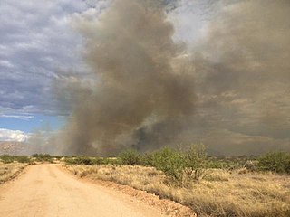
The 2021 Arizona wildfire season was a series of wildfires that burned across the state of Arizona, United States. Wildfires across the state burned 524,428 acres (212,228 ha) of land in at least 1,773 fires throughout the state, fueled in part by a drought, hot temperatures, and thunderstorms producing dry lightning. At one point in late June, over 20 active wildfires were burning across the state.

The Sawmill Fire was a wildfire that burned 46,991 acres (190 km2) in the U.S. state of Arizona in April 2017. The fire was caused by the detonation of a target packed with Tannerite at a gender reveal party in the Coronado National Forest. No injuries or fatalities resulted from the fire, nor were any buildings destroyed, though the fire did come close to the historic Empire Ranch, a National Register of Historic Places property. Over 800 personnel from various federal, state, and local agencies and organizations worked to contain and then extinguish the Sawmill Fire at a cost of $8.2 million.

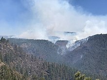
The Antelope Fire was a wildfire that burned in the Klamath National Forest, the Modoc National Forest, the Shasta-Trinity National Forest, and in Lava Beds National Monument in Siskiyou County, California, in the United States. The fire was started by a lightning strike and was first reported on August 1, 2021. As of October 15th, the fire had burned 145,632 acres (58,935 ha).

The 2020 Maricopa County wildfires were a series of major and non-major wildfires that took place in Maricopa County, Arizona, from the month of May to the month of October. In the year 2020, Arizona saw one of its worst fire seasons in the states history. Due to the lack of precipitation needed in Arizona, the state fell into an ongoing drought from late 2020 and 2021. High winds were also present during the summer when fire season is mostly active in the state. These factors led to the wildfires in Maricopa County to be destructive and costly.

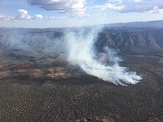
The Tiger Fire was a wildfire that burned 16,278 acres (6,587 ha) in the U.S. state of Arizona from June to July 2021. The fire was caused by a dry lightning strike in the Prescott National Forest. Although Horsethief Basin Lake was evacuated and both the community of Crown King and the census-designated place of Black Canyon City were threatened, no injuries or deaths were reported, and no buildings were destroyed. Over 300 fire personnel were assigned to contain the blaze.

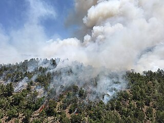
The Frye Fire was a wildfire that burned 48,443 acres (19,604 ha) in Graham County, Arizona, United States, from June 7 to September 1, 2017. The fire was ignited by a lightning strike on Mount Graham, within the Coronado National Forest, and spread rapidly until it was mostly contained on July 12. The Frye Fire destroyed three buildings, briefly threatened the Mount Graham International Observatory, cost $26 million to contain and suppress, and involved more than 800 firefighters. There were no fatalities, but 63 firefighters were quarantined as a result of a strep throat outbreak.
The Snake Ridge Fire was a wildfire that burned 15,333 acres (62.05 km2) of the Coconino National Forest in the U.S. State of Arizona. The fire was ignited by a lightning strike on May 19, 2017, as the United States Forest Service (USFS) was conducting controlled burns within the Coconino National Forest to reduce the severity of future wildfires in the area. The USFS decided to manage the Snake Ridge Fire, named after the feature where the fire was ignited, as a controlled burn. Firefighting efforts focused on protecting infrastructure by burning fuels near power lines. These burns were completed on June 4 and the USFS subsequently allowed the fire, which had by this time been surrounded by firebreaks, to burn out. The fire was allowed to burn until July 13 and cost a total of $1 million to manage and contain. There were no serious environmental consequences as a result of the fire.
The Boundary Fire was a wildfire that burned 17,788 acres (7,199 ha) of the Coconino and Kaibab National Forests in Arizona. The fire was ignited on June 1 when lightning struck a spot on the northeast side of Kendrick Peak within the Coconino National Forest. The Boundary Fire immediately began producing smoke that could be seen from the Grand Canyon, which was blown by high winds that also fanned the fire itself over local communities and infrastructure. The fire burned out on July 3, 2017.