
West Yorkshire is a metropolitan and ceremonial county in the Yorkshire and the Humber region of England. It borders North Yorkshire to the north and east, South Yorkshire and Derbyshire to the south, Greater Manchester to the south-west, and Lancashire to the west. The city of Leeds is the largest settlement.

Batley is a market town in the Kirklees district, in West Yorkshire, England, south-west of Leeds, north-west of Wakefield and Dewsbury, south-east of Bradford and north-east of Huddersfield, in the Heavy Woollen District. In 2011, the population was 48,730.

Brighouse is a town within the metropolitan borough of Calderdale, in West Yorkshire, England. Historically within the West Riding of Yorkshire, it is situated on the River Calder, 4 miles (6.4 km) east of Halifax. It is served by Junction 25 of the M62 motorway and Brighouse railway station on the Caldervale Line and Huddersfield Line. In the town centre is a mooring basin on the Calder and Hebble Navigation. The United Kingdom Census 2001 gave the Brighouse / Rastrick subdivision of the West Yorkshire Urban Area a population of 32,360. The Brighouse ward of Calderdale Council gave a population of 11,195 at the 2011 Census. Brighouse has a HD6 postcode.

Dewsbury is a market town in the Metropolitan Borough of Kirklees in West Yorkshire, England. It lies on the River Calder and on an arm of the Calder and Hebble Navigation waterway. It is to the west of Wakefield, east of Huddersfield and south of Leeds. Historically a part of the West Riding of Yorkshire, after undergoing a period of major growth in the 19th century as a mill town, Dewsbury went through a period of decline. Dewsbury forms part of the Heavy Woollen District of which it is the largest town. The population of the built-up area was 63,722 at the 2021 Census.

Golcar is a village on a hillside crest above the Colne Valley in the Kirklees district, in West Yorkshire, England, 3 miles (5 km) west of Huddersfield, and just north of the River Colne and the Huddersfield Narrow Canal.

Gomersal is a town in the Kirklees district, in West Yorkshire, England. It is south of Bradford, south west of Leeds. east of Cleckheaton and north of Heckmondwike. It is close to the River Spen and forms part of the Heavy Woollen District.

Cleckheaton is a town in the metropolitan borough of Kirklees, West Yorkshire, England. Historically part of the West Riding of Yorkshire, it is situated south of Bradford, east of Brighouse, west of Batley and south-west of Leeds. It is at the centre of the Spen Valley and was the major town in the former borough of Spenborough. Cleckheaton has a history as a mill town and forms part of the Heavy Woollen District.

Linthwaite is a village in the Kirklees district, in West Yorkshire, England. Historically part of the West Riding of Yorkshire, it is situated 4 miles (6.4 km) west of Huddersfield, on the A62 in the Colne Valley. The village together with Blackmoorfoot had a population of 3,835 according to the 2001 census.

Slaithwaite is a town in West Yorkshire, England. Historically part of the West Riding of Yorkshire, it is in the Colne Valley and on the Huddersfield Narrow Canal, 5 miles (8 km) south-west of Huddersfield.
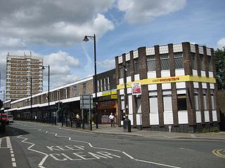
Armley is a district in the west of Leeds, West Yorkshire, England. It starts less than 1 mile (1.6 km) from Leeds city centre. Like much of Leeds, Armley grew in the Industrial Revolution and had several mills, one of which now houses the Leeds Industrial Museum at Armley Mills. Armley is predominantly and historically a largely working class area of the city, still retains many smaller industrial businesses, and has many rows of back-to-back terraced houses.

Yeadon is a town within the metropolitan borough of the City of Leeds, West Yorkshire, England.

Hunslet is an inner-city area in south Leeds, West Yorkshire, England. It is 1 mile (1.6 km) southeast of the city centre and has an industrial past.
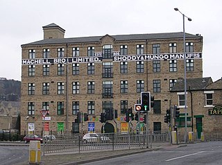
The Heavy Woollen District is a region of textile-focused industrial development in West Yorkshire, England. It acquired the name because of the heavyweight cloth manufactured there from the early 19th century.
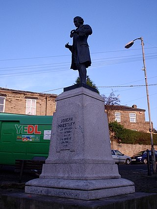
Birstall is a market and mill town in the metropolitan borough of Kirklees, West Yorkshire, England. It is part of the Birstall and Birkenshaw ward, which had a population of 16,298 at the 2011 census. Historically in the West Riding of Yorkshire, and part of the Heavy Woollen District, Birstall is approximately 6 miles (10 km) south-west of Leeds and situated close to the M62 motorway. The town is situated between Leeds, Bradford, Huddersfield and Wakefield.

Churwell is a settlement in the civil parish of Morley, in the Leeds district, in West Yorkshire, England, between Leeds city centre and Morley. It is 3 miles (5 km) south-west of Leeds city centre and 1.5 miles (2 km) away from the Leeds United stadium Elland Road.
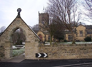
Kirkheaton is a village in the civil parish of Kirkburton, in the Kirklees district of West Yorkshire, England, Historically, it is part of the West Riding of Yorkshire. It is 3 miles (5 km) north-east of Huddersfield, in the Dalton ward of Kirklees Council. In 2021 it had a population of 3,496.
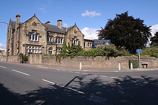
Hipperholme is a village in West Yorkshire, England, located between the towns of Halifax and Brighouse in the Hipperholme and Lightcliffe ward of the Metropolitan Borough of Calderdale. The population of this ward at the 2011 Census was 11,308.
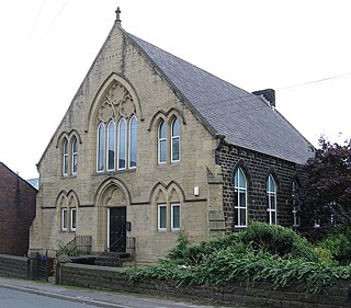
Thurlstone is a village and former civil parish, now in the parish of Penistone, in the metropolitan borough of Barnsley, in South Yorkshire, England. Originally it was a small farming community. Some industries developed using water power from the River Don such as corn milling, wire drawing and various wool and cloth processes. Most of these are now gone and only James Durrans and Service Direct owned by 'Don Eddie' remain. The village is now a dormitory for the urban areas of South and West Yorkshire. The village now falls in the Penistone West ward of the Barnsley MBC.

Holbeck is an inner city area of Leeds, West Yorkshire, England. It begins on the southern edge of Leeds city centre and mainly lies in the LS11 postcode district. The M1 and M621 motorways used to end/begin in Holbeck. Now the M621 is the only motorway that passes through the area since the end of the M1 moved to Hook Moor near Aberford. Since large parts of Holbeck have been vacated in preparation for the regeneration of the area, the district has in large parts suffered from a population exodus. Holbeck had a population of 5,505 in 2011. The district currently falls within the Beeston and Holbeck ward of Leeds City Council.

Birkenshaw is a village in the borough of Kirklees in the county of West Yorkshire, England. It lies at the crossroads between the A58 Leeds to Halifax road and the A651 Bradford to Heckmondwike road. At the 2011 census, the village was located in the ward of Birstall and Birkenshaw, which had a population 16,298. Birkenshaw forms part of the Heavy Woollen District.


