Breznica pod Lubnikom is a village in the Municipality of Škofja Loka in the Upper Carniola region of Slovenia.
Bukov Vrh nad Visokim is a settlement above Visoko pri Poljanah in the Municipality of Škofja Loka in the Upper Carniola region of Slovenia.

Gorski Vrh is a small dispersed settlement in the hills north of the Idrijca River in the Municipality of Tolmin in the Littoral region of Slovenia. It is accessible from the village of Slap ob Idrijci via Šentviška Gora.

Planina is a village in the Municipality of Postojna in the Inner Carniola region of Slovenia.
Grčarevec is a village between Planina and Kalce in the Municipality of Logatec in the Inner Carniola region of Slovenia. In addition to the main settlement of the village, it also comprises the hamlets of Grčarevski Vrh to the north along the road to Kalce, and Kališe in the forest to the northeast.

Brezovica pri Borovnici is a settlement south of Borovnica in the Inner Carniola region of Slovenia. The settlement includes the hamlets of Kapitov Grič, Prod, and Vrbljene.

Dolenje pri Jelšanah is a village north of Jelšane in the Municipality of Ilirska Bistrica in the Inner Carniola region of Slovenia, next to the border with Croatia. The settlement includes the hamlets of Dolnji Kraj, Gornji Kraj, and Vrh Žloštajna.
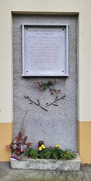
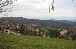
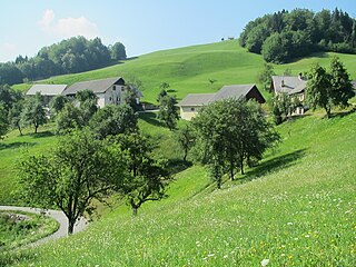
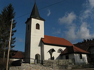
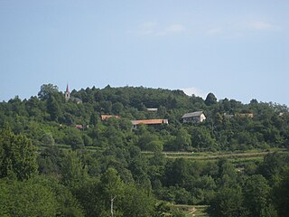
Rožno is a dispersed settlement on the left bank of the Sava River west of Brestanica in the Municipality of Krško in eastern Slovenia. The area is part of the traditional region of Styria. It is now included in the Lower Sava Statistical Region.
Bojanja Vas is a village in the Municipality of Metlika in the White Carniola area of southeastern Slovenia, next to the border with Croatia. The entire area is part of the traditional region of Lower Carniola and is now included in the Southeast Slovenia Statistical Region.
Krašnji Vrh is a small village in the Municipality of Metlika in the White Carniola area of southeastern Slovenia, right on the border with Croatia. The area is part of the traditional region of Lower Carniola and is now included in the Southeast Slovenia Statistical Region.

Onek is a settlement in the hills east of Kočevje in southern Slovenia. The area is part of the traditional region of Lower Carniola and is now included in the Southeast Slovenia Statistical Region.

Spodnja Bilpa is a small settlement on the left bank of the Kolpa River in the Municipality of Kočevje in southern Slovenia. The area is part of the traditional region of Lower Carniola and is now included in the Southeast Slovenia Statistical Region.
Trnovec is a settlement in the hills northeast of the town of Kočevje in southern Slovenia. The area is part of the traditional region of Lower Carniola and is now included in the Southeast Slovenia Statistical Region.
Podplanina is a small settlement in the Municipality of Loški Potok in southern Slovenia, next to the border with Croatia. The source of the Čabranka River lies just west of the village. The area is part of the traditional region of Lower Carniola and is now included in the Southeast Slovenia Statistical Region. It stands on terraces above the Čabranka River on steep slopes below Trava Peak. The settlement consists of a number of hamlets and individual houses. The core of the settlement is in the hamlet of Pri Kapelici.

Jezero is a village in the Municipality of Brezovica in central Slovenia. It lies on the edge of the marshlands south of the capital Ljubljana. The municipality is part of the traditional region of Inner Carniola and is now included in the Central Slovenia Statistical Region. It includes the hamlets of Zaledine, Virje, and Zaobloka.

Srednje Gameljne lies north of the capital Ljubljana in central Slovenia. It belongs to the City Municipality of Ljubljana. It is part of the traditional region of Upper Carniola and is now included with the rest of the municipality in the Central Slovenia Statistical Region.

Toško Čelo is a dispersed settlement on the slope of the hill known as Tošč Face, part of the Polhov Gradec Hills, west of the capital Ljubljana in central Slovenia. The area is part of the traditional region of Upper Carniola and is now included with the rest of the municipality in the Central Slovenia Statistical Region. It belongs to the City Municipality of Ljubljana.

Zgornje Gameljne is a settlement north of the capital Ljubljana in central Slovenia. It belongs to the City Municipality of Ljubljana. It is part of the traditional region of Upper Carniola and is now included with the rest of the municipality in the Central Slovenia Statistical Region.
Sostro is a formerly independent settlement in the eastern part of the capital Ljubljana in central Slovenia. It is part of the traditional region of Lower Carniola and is now included with the rest of the municipality in the Central Slovenia Statistical Region. In addition to the main settlement, Sostro includes the hamlet of Betežica, located to the northeast along Betežčica Creek, and the hamlet of Glastavci in the wooded hills above Betežica. Sostro is also the source of the name of the Sostro District, the largest district of the capital.

Mačji Dol is a small settlement northwest of Šentlovrenc in the Municipality of Trebnje in eastern Slovenia. The municipality is part of the historical region of Lower Carniola and is now included in the Southeast Slovenia Statistical Region.