Related Research Articles

The English River is a river in Kenora District and Thunder Bay District in Northwestern Ontario, Canada. It flows through Lac Seul to join the Winnipeg River at Tetu Lake as a right tributary. The river is in the Hudson Bay drainage basin, is 615 kilometres (382 mi) long and has a drainage basin of 52,300 square kilometres (20,200 sq mi). Although there are several hydroelectric plants on this river, the English River upstream of Minnitaki Lake is notable as one of the few large river systems in northwestern Ontario with a natural flow and without any upstream source of pollution. It is the fourth longest river entirely in Ontario.

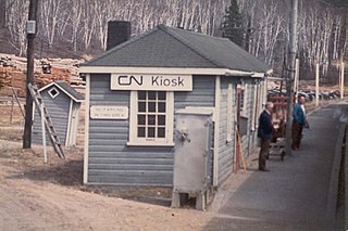
Kiosk is an unincorporated place and former railway point and community in geographic Pentland Township in the Unorganized South Part of Nipissing District in northeastern Ontario, Canada. Kiosk is surrounded by but not within Algonquin Provincial Park, for which it provides a road access point via Ontario Highway 630, and is located on Kioshkokwi Lake on the Amable du Fond River on the right bank of the outlet of that river from the lake and across the river from the unincorporated place of Coristine. The name "Kiosk" is an abbreviated form of the lake's name, which means "lake of many gulls".

English River is an unincorporated place on the border of geographic Corman Township, Kenora District and the Unorganized Part of Thunder Bay District in Northwestern Ontario, Canada. It was a Hudson's Bay Company trading post between 1894 and 1911, and is located where Ontario Highway 17 crosses the English River at its confluence with the Scotch River.
Kashabowie is an unincorporated place and Compact Rural Community in southwestern Thunder Bay District in Northwestern Ontario, Canada. It is on the Canadian National Railway Kashabowie Subdivision main line, built originally as the Canadian Northern Railway transcontinental main line, between the Planet flag stop to the west and the Postans flag stop to the east, and has a passing siding.
Raith is a dispersed rural community and unincorporated area in geographic Golding Township in the Unorganized Part of Thunder Bay District in Northwestern Ontario, Canada.

Esnagi Lake is a large V-shaped lake in the Unorganized North part of Algoma District, Ontario, Canada. Part of the Great Lakes Basin, it is about 45 kilometres (28 mi) long and 5.0 kilometres (3.1 mi) wide and lies at an elevation of 344 metres (1,129 ft), with the "V" on its side and the apex facing west. The primary inflows are the Magpie River from Mosambik Lake at the north end of the lake, Tripoli Creek on the west side, and other unnamed creeks. The primary outflow is also the Magpie River, which flows downstream from the south end of the lake at the east switch of the siding at Swanson on the Canadian Pacific Railway transcontinental mainline, and eventually into Lake Superior.

Sucker Lake is an endorheic lake in the municipality of Assiginack, Manitoulin District in Northeastern Ontario, Canada. It is on Manitoulin Island about 5 kilometres (3.1 mi) southwest of the community of Manitowaning and about 1.5 kilometres (0.93 mi) southeast of the much larger Lake Manitou. It has three islands, the largest of which is named Maple island, and there is a prevalent population of brown trout near a shoal off Bubs Island. The lake can be accessed from Sucker Lake Road, which connects to Ontario Highway 6.
The Matawin River is a river in Thunder Bay District in Northwestern Ontario, Canada. It is in the Great Lakes Basin and is a right tributary of the Kaministiquia River.
Agate is an unincorporated place and railway point in geographic Kapuskasing Township, in the Unorganized North part of Algoma District in northeastern Ontario, Canada. It is on the Canadian National Railway transcontinental railway main line between the railway points of Dunrankin to the west and Elsas to the east, has a passing track, and is passed but not served by Via Rail transcontinental Canadian trains. The place is just northwest of Kapuskasing Lake, the source of the Kapuskasing River.
Salem Creek is a stream in the municipal township of Cramahe, Northhumberland County in Central Ontario, Canada. It is a tributary of Lake Ontario. The creek takes its name from the community of Salem which it flows past.
Darlington Creek is a stream in the municipality of Clarington, Regional Municipality of Durham in Ontario, Canada. It is a tributary of Lake Ontario and is located in geographic Darlington Township, after which it is named.
The Jocko River is a river in Nipissing District in Northeastern Ontario, Canada. It is in the Saint Lawrence River drainage basin, is a right tributary of the Ottawa River, and lies entirely within Jocko Rivers Provincial Park.
Osborne Township is a geographic township in the Unorganized North Part of Nipissing District in Northeastern Ontario, Canada. The Ontario Northland Railway, constructed in the early 20th century, runs from the middle south to the northwest of the township. The dispersed rural community of Jocko, without any passing sidings, and the railway point of Osborne, with one passing siding, are at the middle south and northwest of the township respectively.
La Salle Township is a geographic township in the Unorganized North Part of Nipissing District in Northeastern Ontario, Canada. The Ontario Northland Railway, constructed in the early 20th century, runs through the southwestern tip of the township.
Boland Lake is an endorheic lake in geographic La Salle Township in the Unorganized North Part of Nipissing District in Northeastern Ontario, Canada. It is adjacent to the La Salle Lakes and is about 5.5 kilometres (3.4 mi) northeast of the railway point of Diver, on the Ontario Northland Railway. The lake has one, unnamed island.
McLaren's Bay is a Dispersed rural community and unincorporated place in geographic Parkman Township in the Unorganized North Part of Nipissing District in Central Ontario, Canada. The community lies on the eponymous McLaren's Bay on the west shore of Lake Timiskaming, at the mouth of Opimika Creek. McLaren's Point is just north of the community.
Little Sucker Lake is a lake in geographic Osborne Township in the Unorganized North Part of Nipissing District in Northeastern Ontario, Canada, about 7 kilometres (4.3 mi) east of the railway point of Osborne on the Ontario Northland Railway. It is in the Saint Lawrence River drainage basin, and is the location of the mouth of Sucker Creek, the lake's only inflow, arriving at the northwest of the lake from the direction of Sucker Lake. The outflow from Little Sucker Lake flows out at the south as a left tributary of the Jocko River, which flows via Ottawa River to the Saint Lawrence River. The lake is entirely within Jocko Rivers Provincial Park.
Sucker Lake is a lake in geographic La Salle Township and geographic Osborne Township in the Unorganized North Part of Nipissing District in Northeastern Ontario, Canada, about 5.5 kilometres (3.4 mi) east of the railway point of Diver on the Ontario Northland Railway. It is in the Saint Lawrence River drainage basin and is the source of Sucker Creek.
Sucker Creek is a stream in geographic Osborne Township in the Unorganized North Part of Nipissing District in Northeastern Ontario, Canada. It is in the Saint Lawrence River drainage basin and is a tributary of Little Sucker Lake. Sucker Creek forms part of the border of Jocko Rivers Provincial Park.
Duffy is a railway point and unincorporated place in geographic Medora Township in the municipality of Muskoka Lakes, District Municipality of Muskoka in Central Ontario, Canada. It is on the Canadian Pacific Railway main line between the railway point of Roderick to the south and the dispersed rural community of Mactier to the north. Duffy is on Haggart Creek, and adjacent to Cassady Lake (upstream) and Roderick Lake (downstream) on that creek.
References
- ↑ "McCoy" (PDF). Geology Ontario - Historic Claim Maps. Ontario Ministry of Northern Development, Mines and Forestry. Archived from the original (PDF) on 2016-02-06. Retrieved 2016-02-05.
- Lavallée, Omer (1977) [First published in 1974]. Van Horne's road : an illustrated account of the construction and first years of operation of the Canadian Pacific transcontinental railway. A Railfare book. Don Mills, Ont: Fitzhenry & Whiteside. ISBN 9780889024199. OCLC 15177792.
Map sources:
- Map 14 (PDF) (Map). 1 : 1,600,000. Official road map of Ontario. Ministry of Transportation of Ontario. 2014. Retrieved 2016-02-05.[ permanent dead link ]
- Restructured municipalities - Ontario map #2 (Map). Restructuring Maps of Ontario. Ontario Ministry of Municipal Affairs and Housing. 2006. Retrieved 2016-02-05.
- Atlas of Canada. Map sheet 042D16 - Goodchild Lake. Retrieved 2016-02-05