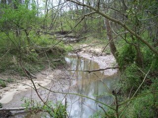
Rend City, Illinois

Last updated
Rend City, Illinois
Unincorporated community
USA Illinois location map.svg
Red pog.svg
Rend City, Illinois
Usa edcp location map.svg
Red pog.svg
Rend City, Illinois
Coordinates: 38°01′37″N88°59′05″W / 38.02694°N 88.98472°W / 38.02694; -88.98472 Coordinates: 38°01′37″N88°59′05″W / 38.02694°N 88.98472°W / 38.02694; -88.98472
Country United States
State Illinois
County Franklin
Elevation 410 ft (120 m)
Time zone Central (CST) (UTC-6)
  Summer (DST) CDT (UTC-5)
Area code(s) 618
GNIS feature ID 416523 [1]

Rend City is an unincorporated community in Browning Township, Franklin County, Illinois, United States. The community is located along County Route 9 4.1 miles (6.6 km) west-northwest of Benton. [2]

Browning Township, Franklin County, Illinois Township in Illinois, United States

Browning Township is one of twelve townships in Franklin County, Illinois, USA. As of the 2010 census, its population was 2,450 and it contained 1,184 housing units.

Franklin County, Illinois County in the United States

Franklin County is a county located in the U.S. state of Illinois. According to the 2010 census, it has a population of 39,561. Its county seat is Benton. It is located in the southern portion of Illinois known locally as "Little Egypt".

Illinois State of the United States of America

Illinois is a state in the Midwestern and Great Lakes region of the United States. It has the fifth largest gross domestic product (GDP), the sixth largest population, and the 25th largest land area of all U.S. states. Illinois is often noted as a microcosm of the entire United States. With Chicago in northeastern Illinois, small industrial cities and immense agricultural productivity in the north and center of the state, and natural resources such as coal, timber, and petroleum in the south, Illinois has a diverse economic base, and is a major transportation hub. Chicagoland, Chicago's metropolitan area, encompasses over 65% of the state's population. The Port of Chicago connects the state to international ports via two main routes: from the Great Lakes, via the Saint Lawrence Seaway, to the Atlantic Ocean and from the Great Lakes to the Mississippi River, via the Illinois Waterway to the Illinois River. The Mississippi River, the Ohio River, and the Wabash River form parts of the boundaries of Illinois. For decades, Chicago's O'Hare International Airport has been ranked as one of the world's busiest airports. Illinois has long had a reputation as a bellwether both in social and cultural terms and, through the 1980s, in politics.

Related Research Articles

Jackson County, Illinois County in the United States

Jackson County is a county located in the U.S. state of Illinois with a population of 60,218 at the 2010 United States Census. Its county seat is Murphysboro, and its most populous city is Carbondale, home to the main campus of Southern Illinois University. The county was incorporated on January 10, 1816 and named for Andrew Jackson. The community of Brownsville served as the fledgling county's first seat.

West Frankfort, Illinois City in Illinois, United States

West Frankfort is a city in Franklin County, Illinois, United States. The population was 8,182 at the 2010 census. The city is part of the Metro Lakeland area.

Rend Lake lake of the United States of America

Rend Lake is a 13 miles (20.9 km)-long, 3 miles (4.8 km)-wide reservoir located in Southern Illinois in Franklin and Jefferson Counties near the town of Benton. It contains 18,900 acres (76 km²) of water, stores 185,000 acre feet (228,000,000 m3) of water, and supplies over 15 million gallons of water per day to 300,000 persons in over 60 communities. The reservoir is up to 35 feet (10.7 m) deep, but its average depth is closer to 9.7 feet (3.0 m). Its elevation is 405 feet (123.4 m) above sea level.

Casey Creek (Illinois) river in the United States of America

Casey Creek is a major tributary of the Big Muddy River in Illinois, United States. It is about 39.0 miles (62.8 km) long, measured from the junction of its arm of Rend Lake with the arm formed by the Big Muddy River.

Rend Lake State Fish and Wildlife Area

Rend Lake State Fish and Wildlife Area is an Illinois state park on 38,900 acres (15,700 ha) in Franklin and Jefferson Counties, United States.

Barren Township, Franklin County, Illinois Township in Illinois, United States

Barren Township is one of twelve townships in Franklin County, Illinois, USA. As of the 2010 census, its population was 496 and it contained 224 housing units.

Ewing Township, Franklin County, Illinois Township in Illinois, United States

Ewing Township is one of twelve townships in Franklin County, Illinois, USA. As of the 2010 census, its population consisted of 1,345 in 657 households.

Six Mile Township, Franklin County, Illinois Township in Illinois, United States

Six Mile Township is one of twelve townships in Franklin County, Illinois, USA. As of the 2010 census, its population was 3,885 and it contained 1,741 housing units.

Weaver, Illinois Unincorporated community in Illinois, United States

Weaver is an unincorporated community in Clark County, Illinois, United States. Weaver is located along U.S. Route 40 northeast of Marshall, between Pond Creek and Big Muddy River.

Whittington, Illinois Unincorporated community in Illinois, United States

Whittington is an unincorporated community in Franklin County, Illinois, United States. Whittington is located near the eastern shore of Rend Lake and Exit 77 of Interstate 57. It is the site of the headquarters of Wayne Fitzgerrell State Recreation Area. Whittington has a post office with ZIP code 62897.

Rust, Illinois Unincorporated community in Illinois, United States

Rust is an unincorporated community in Eastern Township, Franklin County, Illinois, United States. The community is located along County Route 17 8.7 miles (14.0 km) east of Benton.

Akin Junction, Illinois Unincorporated community in Illinois, United States

Akin Junction is an unincorporated community in Eastern Township, Franklin County, Illinois, United States. The community is located at a Canadian National Railroad junction along County Route 17, 8.7 miles (14.0 km) east of Benton.

Parrish, Illinois Unincorporated community in Illinois, United States

Parrish is an unincorporated community in Cave Township, Franklin County, Illinois, United States. The community is located near Illinois Route 34 3.2 miles (5.1 km) west-northwest of Thompsonville.

Ferber, Illinois Unincorporated community in Illinois, United States

Ferber is an unincorporated community in Cave Township, Franklin County, Illinois, United States. The community is located along the Canadian National Railroad at the southeast border of Thompsonville.

West End, Illinois Unincorporated community in Illinois, United States

West End is an unincorporated community in Franklin and Saline counties in the U.S. state of Illinois. The portion of the community in Franklin County is part of Cave Township, while the portion in Saline County is part of Tate Township. The community is located along Illinois Route 34 3.7 miles (6.0 km) east-southeast of Thompsonville.

Pershing, Illinois Unincorporated community in Illinois, United States

Pershing is an unincorporated community in Denning Township, Franklin County, Illinois, United States. The community is located along County Route 6 2.5 miles (4.0 km) west-southwest of West Frankfort.

Plumfield, Illinois Unincorporated community in Illinois, United States

Plumfield is an unincorporated community in Denning Township, Franklin County, Illinois, United States. The community is located along Illinois Route 149 4.5 miles (7.2 km) west of West Frankfort.

Cleburne, Illinois Unincorporated community in Illinois, United States

Cleburne is an unincorporated community in Six Mile Township, Franklin County, Illinois, United States. The community is located along Illinois Route 148 2.5 miles (4.0 km) north of Zeigler.

References