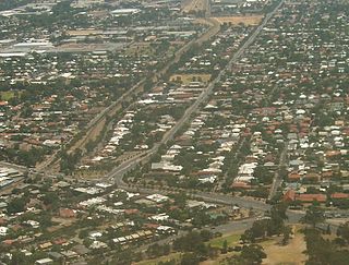
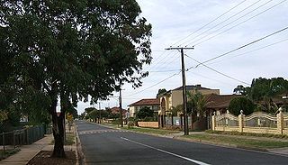
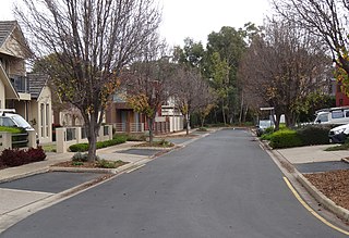
Maylands is a suburb of Adelaide located within the City of Norwood Payneham St Peters, and bounded by the main roads Portrush Road and Magill Road.

Para Hills is a residential suburb of Adelaide, South Australia. There is a light aircraft airport close to its boundary, and numerous sporting facilities, abundant parks and schools and two medium-sized shopping centres. Most of the suburb is in the City of Salisbury while some is in the City of Tea Tree Gully.

Prospect is the seat of the City of Prospect and an inner northern suburb of greater Adelaide. It is located 5 km (3.1 mi) north of Adelaide's centre.
Glenside is a suburb in the local government area known as the City of Burnside, Adelaide, South Australia. The suburb is 4.9 kilometres south-east of the Adelaide city centre, home to 2,422 people in a total land area of 1.40 km2.

Plympton Park is an inner south-western suburb of Adelaide 8 km from the CBD, in the state of South Australia and falls under the City of Marion. The post code for Plympton Park is 5038. It is adjacent to Park Holme, Plympton, South Plympton, and Morphettville. It is bordered to the east by Marion Road, to the west by Park Terrace, to the south by Taranna Avenue and to the north by the Glenelg tram line.
Regency Park is an inner-northern suburb of Adelaide, 6 km from the City Centre, in the state of South Australia, Australia. It is located in the City of Port Adelaide Enfield, and is adjacent to Wingfield, Angle Park, Ferryden Park, Kilburn, Prospect, Dudley Park and Croydon Park. It is bounded to the north by Grand Junction Road, east by the Gawler railway line, south by Regency Road and to the west by Days and South Roads. The postcode for Regency Park is 5010.
Pennington is a northern suburb of Adelaide, South Australia, located about 10 km from the Adelaide city centre. It is located in the City of Charles Sturt.

Croydon Park is a north-western suburb of Adelaide 5.9 km from the CBD, in the state of South Australia, Australia and is within the City of Port Adelaide Enfield. It is adjacent to Dudley Park, Devon Park, Renown Park, Regency Park, Ferryden Park Kilkenny, and West Croydon. The post code for Croydon Park is 5008. It is bounded to the south by Lamont Street and Torrens Road, to the north by Regency Road and in the east and west by Harrison Road and Goodall Avenue respectively. Croydon Park is predominantly a residential suburb, with a warehousing presence on the northern edges near Regency Road. Croydon Park has been completely divided by the North-South Motorway.

Holden Hill is a suburb in the inner north-eastern suburbs of Adelaide, the capital of South Australia. It is around 10 km from the Adelaide CBD.

Ingle Farm is an established, residential suburb, with some parklands, of about 8,500 people in the South Australian capital city of Adelaide. It is located at the base of the Mount Lofty Ranges foothills, around 12 kilometres north-east of Adelaide's central business district. It covers an area of 4.47 km2 with a population density of 19.41 people per hectare in 2001.

Vista is a small north-eastern suburb of Adelaide, South Australia and is within the City of Tea Tree Gully local government area. It is adjacent to Houghton, Tea Tree Gully, St Agnes and Hope Valley.
Salisbury East is a suburb of Adelaide, South Australia, located 20 kilometres north of the Adelaide CBD. The residential part of the suburb is in the local government area (LGA) of the City of Salisbury, however the eastern part of the Cobbler Creek Recreation Park is in the boundaries of the City of Tea Tree Gully.

Mansfield Park is a north-western suburb of Adelaide 10 km from the CBD, in the state of South Australia, Australia and falls under the City of Port Adelaide Enfield. It is adjacent to Wingfield, Angle Park, Woodville Gardens, and Athol Park. The postcode for Mansfield Park is 5012. It is bounded to the north by Grand Junction Road, and to the west by Hanson Road. It is named after the Mansfield in East Ayrshire, Scotland.

Modbury North is a suburb 14 km northeast of Adelaide, capital city of South Australia.
Cumberland Park is an inner-southern suburb of Adelaide, South Australia in the City of Mitcham.

Parafield Gardens is a suburb of Adelaide, South Australia. The suburb is largely residential, with a pocket of industrial land in the southwest corner. There are two small shopping centres in the area, one on Salisbury Highway, and another on Sheperdson Road.
Modbury Heights is a medium-sized suburb in the City of Tea Tree Gully, Adelaide. The suburb is located in the foothills of the Mount Lofty Ranges around 16 kilometres north east of the Central business district. Much of the suburb is residential but there is a small shopping area along Ladywood Road.

Glenelg East is a residential suburb 9 kilometres (5.6 mi) south-west of the centre of Adelaide, South Australia. It is characterised by quarter-acre blocks with heritage homes and parks intermingled with contemporary modern homes and low-rise multi-dwelling units.

Underdale is a western suburb of South Australia's capital city Adelaide on Kaurna land. It sits between Henley Beach Road and the River Torrens. It is largely residential with a very small industrial section on the Eastern side of Holbrook's Road near the river.

Richmond is an inner suburb of Adelaide, South Australia. It is located on Kaurna land in the City of West Torrens.


