Theresa Oswald is a politician in Manitoba, Canada. She was a New Democratic Party member of the Legislative Assembly of Manitoba from 2003 to 2016 and a cabinet minister from 2004 until she stepped down in 2014 to unsuccessfully challenge Premier Greg Selinger for the party's leadership.
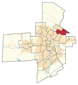
Radisson is a provincial electoral division in the Canadian province of Manitoba. It was created by redistribution in 1957, and has formally existed since the 1958 provincial election. The riding is located in the northeastern section of the City of Winnipeg and is named after Pierre-Esprit Radisson, a seventeenth-century explorer.
Transcona is a provincial electoral division in the Canadian province of Manitoba. The riding was created by redistribution in 1968, and has formally existed since the 1969 provincial election.
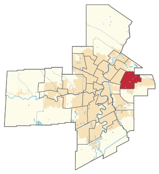
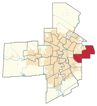
Rossmere is a provincial electoral division in the Canadian province of Manitoba. It was created by redistribution in 1968, and has formally existed since the provincial election of 1969. The riding is located in the northeastern section of the City of Winnipeg.

St. Johns is a provincial electoral division in the Canadian province of Manitoba. It was created by redistribution in 1957, and has formally existed since 1958. It is located in the north-end of Winnipeg. The constituency is bordered by Kildonan to the north and west, Burrows to the west, Elmwood to the east, and Point Douglas to the south.

Wolseley is a provincial electoral division in the Canadian province of Manitoba. It was created by redistribution in 1957, and has formally existed since the 1958 provincial election. The riding is located in the centre of the City of Winnipeg. It is named for Col. Garnet Joseph Wolseley, the nineteenth-century army officer who played a significant role in crushing the Red River Rebellion in 1870.

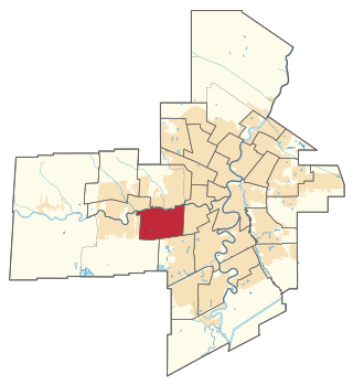
St. James is a provincial electoral division in the Canadian province of Manitoba.

Assiniboia is a provincial electoral division in the Canadian province of Manitoba. It was first created for the 1879 provincial election, was eliminated in 1888, and was re-established in 1903. It is located in the westernmost tip of the City of Winnipeg.

Kirkfield Park is a provincial electoral division in the Canadian province of Manitoba. It was created by redistribution in 1979, and has formally existed since the provincial election of 1981. The riding is located in the westernmost tip of the City of Winnipeg. It contains the neighbourhoods of Glendale, Westwood, Kirkfield Park, Woodhaven, Birchwood, Booth, Silver Heights and part of Assiniboia Downs
Tuxedo is a provincial electoral division in the Canadian province of Manitoba. It was created by redistribution in 1979, and has formally existed since the provincial election of 1981. The riding is located in the southwest section of the city of Winnipeg.
River Heights is a provincial electoral division in the Canadian province of Manitoba. It was created by redistribution in 1957, and formally came into existence in the 1958 provincial election. The riding is located in the south-central region of the City of Winnipeg.

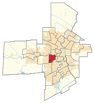
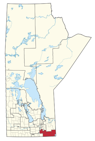
St. Vital is a provincial electoral division in the Canadian province of Manitoba.

Southdale is a provincial electoral division in the Canadian province of Manitoba. It was created in the provincial redistribution 1999, mostly out of Niakwa and part of St. Vital. The riding is located in the southeastern section of the City of Winnipeg.

Fort Garry is a provincial electoral division in the Canadian province of Manitoba that existed from 1958 to 2011 and was re-created in 2019. It was first created by redistribution in 1957 from parts of Iberville, Assiniboia and St. Boniface, and formally existed beginning with the 1958 provincial election. The riding is in the south-central and southwestern region of the city of Winnipeg. It is named for the historical Fort Garry which was occupied by supporters of Louis Riel during the Red River Rebellion of 1870.

Fort Whyte is a provincial electoral division in the Canadian province of Manitoba. It was created in 1999, after the provincial electoral boundaries commission determined that southwestern Winnipeg had experienced enough population growth to deserve an extra seat. Fort Whyte was created from territory formerly belonging to the divisions of Tuxedo, Fort Garry and St. Norbert.

Seine River is a provincial electoral division in the Canadian province of Manitoba. It was created by redistribution in 1989, and has formally existed since the 1990 provincial election. The constituency is located in the southern section of the City of Winnipeg.
La Vérendrye is a provincial electoral district in the Canadian province of Manitoba. It was created by redistribution in 1879, and has existed since that time, making it one of the oldest ridings in Manitoba.

Fort Richmond is a provincial electoral division in the southern suburban part of Winnipeg in the Canadian province of Manitoba. It was formed by redistribution in 2008 out of parts of the electoral divisions of St. Norbert and Fort Garry.
Nahanni Fontaine is a Canadian provincial politician, who was elected as the Member of the Legislative Assembly of Manitoba for the riding of St. Johns in the 2016 and 2019 elections. She held the seat for the NDP after incumbent MLA Gord Mackintosh did not seek re-election.
Rochelle Squires is a former Canadian politician who served as the Member of the Legislative Assembly of Manitoba for the riding of Riel from 2016 to 2023.

