
Sir Thomas Bouch was a British railway engineer. He was born in Thursby, near Carlisle, Cumberland, and lived in Edinburgh. As manager of the Edinburgh and Northern Railway he introduced the first roll-on/roll-off train ferry service in the world. Subsequently as a consulting engineer, he helped develop the caisson and popularised the use of lattice girders in railway bridges. He was knighted after the successful completion of the first Tay Railway Bridge, but his reputation was destroyed by the subsequent Tay Bridge disaster, in which 75 people are believed to have died as a result of defects in design, construction and maintenance, for all of which Bouch was held responsible. He died within 18 months of being knighted.

The River Welland is a lowland river in the east of England, some 65 miles (105 km) long. It drains part of the Midlands eastwards to The Wash. The river rises in the Hothorpe Hills, at Sibbertoft in Northamptonshire, then flows generally northeast to Market Harborough, Stamford and Spalding, to reach The Wash near Fosdyke. It is a major waterway across the part of the Fens called South Holland, and is one of the Fenland rivers which were laid out with washlands. There are two channels between widely spaced embankments with the intention that flood waters would have space in which to spread while the tide in the estuary prevented free egress. However, after the floods of 1947, new works such as the Coronation Channel were constructed to control flooding in Spalding and the washes are no longer used solely as pasture, but may be used for arable farming.
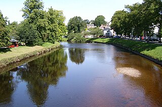
The River Eden is a river that flows through the Eden District of Cumbria, England, on its way to the Solway Firth.
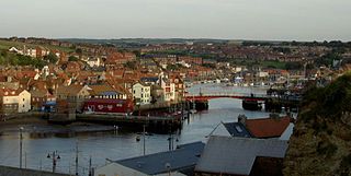
The River Esk is a river in North Yorkshire, England that empties into the North Sea at Whitby after a course of around 28 miles (45 km) through the valley of Eskdale, named after the river itself. The river's name is derived from the Brythonic word "isca" meaning "water". The Esk is the only major river in Yorkshire that flows directly into the North Sea; all other watercourses defined as being major rivers by the Environment Agency, either flow to the North Sea via the River Tees or the Humber Estuary.

The Eden Valley Railway (EVR) was a railway in Cumbria, England. It ran between Clifton Junction near Penrith and Kirkby Stephen via Appleby-in-Westmorland.

The River Wiske is a tributary of the River Swale in Yorkshire, England. The Wiske gives its name to several villages it passes through. The name Wiske is derived from an Old English word wisca meaning a water meadow. It was once known as the Foulbroke, a name for which some writers commented that it was well deserved.

The South Durham & Lancashire Union Railway (SD&LUR) built a railway line linking the Stockton & Darlington Railway near Bishop Auckland with the Lancaster and Carlisle Railway at Tebay, via Barnard Castle, Stainmore Summit and Kirkby Stephen. The line opened in 1861 and became known as the Stainmore Line.

Barras railway station was situated on the South Durham & Lancashire Union Railway between Barnard Castle and Kirkby Stephen East.

The River Went is a river in Yorkshire, England. It rises close to Featherstone and flows eastward, joining the River Don at Reedholme Common.

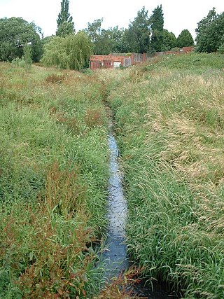
The River Freshney is a river in the English county of North East Lincolnshire. The town of Grimsby stands on its banks. It rises from at least four springs on the edge of the Lincolnshire Wolds, although local folklore and oral tradition has it springing from Welbeck Hill. Originally it entered the tidal River Humber at Pyewipe, north west of Grimsby, but has been re-routed and now supplies Grimsby Docks. There was an existing haven within the borough of Grimsby but this suffered greatly with silting problems so in 1669 landowners agreed to the diversion of the Freshney through the town to the haven to provide fresh water and improve the flow. It is believed the work was completed in the very early 18th century.

Stainmore is a remote geographic area in the Pennines on the border of Cumbria, County Durham and North Yorkshire. The name is used for a civil parish in the Eden District of Cumbria, England, including the villages of North Stainmore and South Stainmore. The parish had a population of 253 in the 2001 census, increasing to 264 at the Census 2011. Stainmore Forest stretches further east into County Durham, towards Bowes.
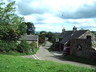
Waitby is a small village and civil parish in the Eden district of Cumbria, England. The parish contains two small villages, Waitby and Smardale, plus the small hamlets of Riddlesay, Stripes and Leases, all of which are in the farmed and enclosured northern part at an elevation of around 200–300m. The southern half of the parish is mostly heath and unused for agriculture, it rises to Smardale fell; which it includes, at elevations between 300 and 400m. The civil parish of Ravenstonedale forms the boundary to the south. The western border with Crosby Garrett civil parish is formed by Scandal Beck. To the north and east lie Soulby and Kirkby Stephen civil parishes respectively. The population of the civil parish as measured at the 2011 Census was less than 100. Details are included in the parish of Crosby Garrett.
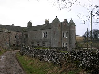
Smardale is a small village and former civil parish, now in the parish of Waitby, in the Eden district, in Cumbria, England. In 1891 the parish had a population of 36.

The Belah Viaduct was a railway viaduct on the South Durham and Lancashire Union Railway, crossing the River Belah, in Cumbria, England, about 1 mile (1.6 km) south of the village of Barras and 4 miles (6.4 km) east north east of Kirkby Stephen. It was completed in 1860 and was demolished in 1963.

The Eller Beck is a small river in North Yorkshire, England, that flows through the town of Skipton and is a tributary of the River Aire. Its channel was heavily modified to supply water to mills in the 18th and 19th centuries, and although all the mills have closed, the water now supplies power to the National Grid, generated by a turbine at High Corn Mill. The beck flows through several underground culverts in Skipton that contribute to the flood risk. To alleviate flooding in Skipton town centre, a scheme involving two flood water storage reservoirs was designed and eventually completed in 2017.

Pickering Beck is a river that runs for over 18 miles (29 km) from its source in the North York Moors National Park through the town of Pickering and on to its confluence with Costa Beck at Kirby Misperton. It is a meandering river that is fed by numerous named and unnamed becks and streams which flow over sandstone and limestone beds and an alluvia of sand, clay silt and gravel. The beck is known for flooding and in recent times has been a beneficiary of funding and experimental flood protection schemes.

The River Burn is a river that flows wholly within North Yorkshire, England. The river starts as several small streams on Masham Moor and drains Colsterdale flowing eastwards before emptying into the River Ure just south of Masham. Conservation work on removing a weir, and introducing fish to the river in 2016, has meant that salmon have been recorded spawning in the river for the first time in over 100 years.

Wyke Beck is a stream that runs from Roundhay Park to the River Aire in east Leeds, West Yorkshire, England. Described as an Urban Beck, the stream flows through housing estates and then an industrial landscape in its lower reaches. Wyke Beck has been prone to flooding so often, that remediation of its course and flood storage schemes have been initiated by Leeds City Council.
Holgate Beck is a small watercourse that flows north-eastwards through Holgate across the west side of the City of York, England. Primarily flowing through Holgate, from which it derives its name, the beck drains a large part of Askham Bog and Hob Moor, then running underneath the various lines near York railway station. It empties into the River Ouse at Water End, being one of five main tributaries for the River Ouse in York, and consequently added to the flooding in the river and immediate environs. To counter this, some flood diversionary schemes have been implemented near to Askham Bog and Hob Moor.
Oak Beck is a watercourse that flows eastwards across the northern part of Harrogate in North Yorkshire, England. The beck flows through a broad V-shaped valley, before emptying into the River Nidd at Bilton, just upstream from the Nidd Gorge Viaduct. Water from Oak Beck has been used as a water supply for Harrogate and also for industrial purposes further downstream.
