Rocky Mound, Texas

Last updated

Rocky Mound, Texas
TXMap-doton-RockyMound.PNG
Location of Rocky Mound, Texas
Camp County RockyMound.svg
Coordinates: 33°01′15″N95°01′54″W / 33.02083°N 95.03167°W / 33.02083; -95.03167
Country United States
State Texas
County Camp
Area
[1]
  Total0.41 sq mi (1.05 km2)
  Land0.41 sq mi (1.05 km2)
  Water0.00 sq mi (0.00 km2)
Elevation
[2]
427 ft (130 m)
Population
 (2020)
  Total78
  Density184.73/sq mi (71.36/km2)
Time zone UTC-6 (Central (CST))
  Summer (DST) UTC-5 (CDT)
Area code 903, 430
FIPS code 48-62870 [3]
GNIS feature ID2412567 [2]

Rocky Mound is a town in Camp County, Texas, United States. The population was 75 at the 2010 census, [4] down from 93 at the 2000 census; in 2020, its population increased to 78. [5]

Contents

Geography

Rocky Mound is located in northern Camp County 4 miles (6 km) northwest of Pittsburg, the county seat. According to the United States Census Bureau, Rocky Mound has a total area of 0.4 square miles (1.1 km2), all of it land. [4]

Demographics

Historical population
CensusPop.Note
1980 123
1990 53−56.9%
2000 9375.5%
2010 75−19.4%
2020 784.0%
U.S. Decennial Census [6]

As of the census of 2000, there were 93 people, 41 households, and 30 families residing in the town. [3] The population density was 228.3 inhabitants per square mile (88.1/km2). There were 62 housing units at an average density of 152.2 per square mile (58.8/km2). The racial makeup of the town was 50.54% White, 45.16% African American, 2.15% Native American, 1.08% from other races, and 1.08% from two or more races. Hispanic or Latino of any race were 6.45% of the population.

There were 41 households, out of which 31.7% had children under the age of 18 living with them, 51.2% were married couples living together, 17.1% had a female householder with no husband present, and 26.8% were non-families. 26.8% of all households were made up of individuals, and 14.6% had someone living alone who was 65 years of age or older. The average household size was 2.27 and the average family size was 2.73.

In the town, the population was spread out, with 26.9% under the age of 18, 5.4% from 18 to 24, 23.7% from 25 to 44, 25.8% from 45 to 64, and 18.3% who were 65 years of age or older. The median age was 40 years. For every 100 females, there were 97.9 males. For every 100 females age 18 and over, there were 83.8 males.

The median income for a household in the town was $23,125, and the median income for a family was $24,063. Males had a median income of $36,250 versus $20,781 for females. The per capita income for the town was $12,382. None of the population or families were below the poverty line. Rocky Mound is served by the Pittsburg Independent School District.

Related Research Articles

<span class="mw-page-title-main">Moundville, Alabama</span> Town in Alabama, United States

Moundville is a town in Hale and Tuscaloosa counties in the U.S. state of Alabama. It was incorporated on December 22, 1908. From its incorporation until the 1970 census, it was wholly within Hale County. At the 2010 census the population was 2,427, up from 1,809 at the 2000 census. It is part of the Tuscaloosa Metropolitan Statistical Area. Within the town is Moundville Archaeological Site, the location of a prehistoric Mississippian culture political and ceremonial center.

<span class="mw-page-title-main">Mounds, Illinois</span> City in Illinois, United States

Mounds is a city in Pulaski County, Illinois, United States. The population was 661 in the 2020 census.

<span class="mw-page-title-main">Pittsburg, Illinois</span> Village in Illinois, United States

Pittsburg is a village in Williamson County, Illinois. The population was 572 at the 2010 census.

<span class="mw-page-title-main">West Harrison, Indiana</span> Town in Indiana, United States

West Harrison is a town in Harrison Township, Dearborn County, Indiana, United States. The population was 289 at the 2010 census.

<span class="mw-page-title-main">Mound Valley, Kansas</span> City in Labette County, Kansas

Mound Valley is a city in Labette County, Kansas, United States. As of the 2020 census, the population of the city was 348.

<span class="mw-page-title-main">Westernport, Maryland</span> Town in Maryland, United States

Westernport is a town in Allegany County, Maryland, United States, along the Georges Creek Valley. It is part of the Cumberland, MD-WV Metropolitan Statistical Area. The population was 1,888 at the 2010 census.

<span class="mw-page-title-main">Moundville, Missouri</span> Village in Missouri, United States

Moundville is a village in southwest Vernon County, Missouri, United States. The population was 124 at the 2010 census.

<span class="mw-page-title-main">Clarksville, New Hampshire</span> Town in New Hampshire, United States

Clarksville is a town in northern Coös County, New Hampshire, United States. The population was 294 at the 2020 census. It is part of the Berlin, NH-VT Micropolitan Statistical Area.

<span class="mw-page-title-main">Tarlton, Ohio</span> Village in Ohio, United States

Tarlton is a village in Fairfield and Pickaway counties in the U.S. state of Ohio. The population was 254 at the 2020 census.
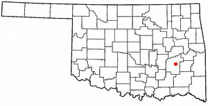
<span class="mw-page-title-main">Alderson, Oklahoma</span> Town in Oklahoma, United States

Alderson is a town in Pittsburg County, Oklahoma, United States. The population was 304 at the 2010 census.

Pittsburg is a town in Pittsburg County, Oklahoma, United States. The population was 280 at the 2000 census.
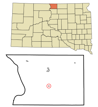
<span class="mw-page-title-main">Mound City, South Dakota</span> Town in South Dakota, United States

Mound City is a town in and the county seat of Campbell County, South Dakota, United States. The population was 69 at the 2020 census.

<span class="mw-page-title-main">Dewhurst, Wisconsin</span> Town in Wisconsin, United States

Dewhurst is a town in Clark County in the U.S. state of Wisconsin. The population was 323 at the 2010 census. The ghost town of Trow was located in the town.

<span class="mw-page-title-main">Guenther, Wisconsin</span> Town in Wisconsin, United States

Guenther is a town in Marathon County, Wisconsin, United States. It is part of the Wausau, Wisconsin Metropolitan Statistical Area. The population was 341 at the 2010 census. The unincorporated communities of Ashley and Rocky Corners are located partially in the town.

<span class="mw-page-title-main">Harmony, Vernon County, Wisconsin</span> Town in Wisconsin, United States

Harmony is a town in Vernon County, Wisconsin, United States. The population was 739 at the 2000 census. The unincorporated community of Newton is located in the town.

<span class="mw-page-title-main">Wheatland, Vernon County, Wisconsin</span> Town in Vernon County, Wisconsin, United States

Wheatland is a town in Vernon County, Wisconsin, United States. The population was 533 at the 2000 census. The unincorporated communities of Red Mound, and Victory are located in Wheatland.

<span class="mw-page-title-main">Byron, Wyoming</span> Town in Big Horn County, Wyoming, United States

Byron is a town in Big Horn County, Wyoming, United States. The population was 562 according to the 2020 census.

<span class="mw-page-title-main">Sharpsburg, North Carolina</span> Town in North Carolina, United States

Sharpsburg is a town in Edgecombe, Nash, and Wilson counties, North Carolina, United States. It is part of the Rocky Mount, North Carolina Metropolitan Statistical Area. The population was 2,024 at the 2010 Census.

<span class="mw-page-title-main">Rocky Ripple, Indiana</span> Town in Indiana, United States

Rocky Ripple is a town in Marion County, Indiana, United States. The population was 655 at the 2020 census. It was founded in 1927, and the town was incorporated as an "included town" as part of Unigov in 1970. It is part of Indianapolis, but retains a separate functioning town government under IC 36-3-1-11. Although not far from the city center, Rocky Ripple is a somewhat isolated area, located between the Central Canal and the White River; only two traffic-supporting bridges over the canal provide access to the town.

<span class="mw-page-title-main">Blue Mounds (town), Wisconsin</span> Town in Wisconsin, United States

Blue Mounds is a town in Dane County, Wisconsin, United States. The population was 899 at the 2020 census. The Village of Blue Mounds is located within the town.

References

  1. "2019 U.S. Gazetteer Files". United States Census Bureau. Retrieved August 7, 2020.
  2. 1 2 U.S. Geological Survey Geographic Names Information System: Rocky Mound, Texas
  3. 1 2 "U.S. Census website". United States Census Bureau . Retrieved January 31, 2008.
  4. 1 2 "Geographic Identifiers: 2010 Census Summary File 1 (G001): Rocky Mound town, Texas". U.S. Census Bureau, American Factfinder. Archived from the original on February 13, 2020. Retrieved July 23, 2015.
  5. "Geography Profile: Rocky Mound town, Texas". data.census.gov. Retrieved April 21, 2022.
  6. "Census of Population and Housing". Census.gov. Retrieved June 4, 2015.