Rosedale Township, Mahnomen County, Minnesota

Last updated

Rosedale Township, Minnesota
USA Minnesota location map.svg
Red pog.svg
Rosedale Township, Minnesota
Location within the state of Minnesota
Usa edcp location map.svg
Red pog.svg
Rosedale Township, Minnesota
Rosedale Township, Minnesota (the United States)
Coordinates: 47°16′28″N95°52′46″W / 47.27444°N 95.87944°W / 47.27444; -95.87944
Country United States
State Minnesota
County Mahnomen
Area
  Total36.3 sq mi (94.1 km2)
  Land34.9 sq mi (90.4 km2)
  Water1.4 sq mi (3.7 km2)
Elevation
1,250 ft (381 m)
Population
 (2000)
  Total136
  Density3.9/sq mi (1.5/km2)
Time zone UTC-6 (Central (CST))
  Summer (DST) UTC-5 (CDT)
FIPS code 27-55618 [1]
GNIS feature ID0665462 [2]

Rosedale Township is a township in Mahnomen County, Minnesota, United States. The population was 136 at the 2000 census.

Contents

Rosedale Township was named for the abundant wild roses within its borders. [3]

Geography

According to the United States Census Bureau, the township has a total area of 36.3 square miles (94.1 km2), of which 34.9 square miles (90.4 km2) of it is land and 1.4 square miles (3.7 km2) of it (3.94%) is water.

Demographics

As of the census [1] of 2000, there were 136 people, 48 households, and 38 families residing in the township. The population density was 3.9 people per square mile (1.5/km2). There were 52 housing units at an average density of 1.5/sq mi (0.6/km2). The racial makeup of the township was 92.65% White, 0.74% Native American, 0.74% Asian, and 5.88% from two or more races.

There were 48 households, out of which 31.3% had children under the age of 18 living with them, 68.8% were married couples living together, 2.1% had a female householder with no husband present, and 20.8% were non-families. 20.8% of all households were made up of individuals, and 12.5% had someone living alone who was 65 years of age or older. The average household size was 2.83 and the average family size was 3.29.

In the township the population was spread out, with 29.4% under the age of 18, 6.6% from 18 to 24, 23.5% from 25 to 44, 17.6% from 45 to 64, and 22.8% who were 65 years of age or older. The median age was 42 years. For every 100 females, there were 109.2 males. For every 100 females age 18 and over, there were 113.3 males.

The median income for a household in the township was $36,250, and the median income for a family was $38,125. Males had a median income of $20,938 versus $15,625 for females. The per capita income for the township was $13,134. There were 10.8% of families and 15.8% of the population living below the poverty line, including 12.0% of under eighteens and 8.7% of those over 64.

Related Research Articles

<span class="mw-page-title-main">Rosedale, Indiana</span> Town in Indiana, United States

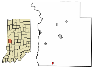
Rosedale is a town in Florida Township, Parke County, in the U.S. state of Indiana. The population was 725 at the 2010 census.

Seavey Township is a township in Aitkin County, Minnesota, United States. The population was 61 as of the 2010 census.

Verona Township is a township in Faribault County, Minnesota, United States. The population was 391 at the 2000 census.

Harmony Township is a township in Fillmore County, Minnesota, United States. The population was 396 at the 2000 census.

Bath Township is a township in Freeborn County, Minnesota, United States. The population was 479 at the 2000 census.

Bowstring Township is a township in Itasca County, Minnesota, United States. The population was 230 at the 2010 census.

Lake Jessie Township is a township in Itasca County, Minnesota, United States. The population was 303 at the 2010 census.

Spang Township is a township in Itasca County, Minnesota, United States. The population was 264 at the 2010 census.

Stokes Township is a township in Itasca County, Minnesota, United States. The population was 230 at the 2010 census.

Third River Township is a township in Itasca County, Minnesota, United States. The population was 50 at the 2010 census.

Hay Brook Township is a township in Kanabec County, Minnesota, United States. The population was 218 at the 2000 census.

Clow Township is a township in Kittson County, Minnesota, United States. The population was 37 at the 2000 census.

Jupiter Township is a township in Kittson County, Minnesota, United States. The population was 136 at the 2000 census.

Hobart Township is a township in Otter Tail County, Minnesota, United States. The population was 733 at the 2000 census.

Leaf Mountain Township is a township in Otter Tail County, Minnesota, United States. The population was 309 at the 2000 census.

Oak Valley Township is a township in Otter Tail County, Minnesota, United States. The population was 362 at the 2000 census.

Oscar Township is a township in Otter Tail County, Minnesota, United States. The population was 218 at the 2000 census.

Tumuli Township is a township in Otter Tail County, Minnesota, United States. The population was 434 at the 2000 census.

<span class="mw-page-title-main">Green Isle, Minnesota</span> City in Minnesota, United States

Green Isle is a city in Sibley County, Minnesota, United States. The population was 522 at the 2020 census.

<span class="mw-page-title-main">Echo, Minnesota</span> City in Minnesota, United States

Echo is a city in Yellow Medicine County, Minnesota, United States. The population was 243 at the 2020 census.

References

  1. 1 2 "U.S. Census website". United States Census Bureau . Retrieved January 31, 2008.
  2. "US Board on Geographic Names". United States Geological Survey. October 25, 2007. Retrieved January 31, 2008.
  3. Upham, Warren (1920). Minnesota Geographic Names: Their Origin and Historic Significance. Minnesota Historical Society. p. 323.