Ellastone is a rural village in the West Midlands of England on the Staffordshire side of the River Dove, between Uttoxeter and Ashbourne in north Staffordshire.

Milford is a village in Derbyshire, England, on the River Derwent, between Duffield and Belper on the A6 trunk road.
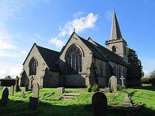
Rocester is a village and civil parish in the East Staffordshire district of Staffordshire, England. Its name is spelt Rowcestre in the Domesday Book. It is located on the Derbyshire border.

Bilsby is a village and civil parish in the East Lindsey district of Lincolnshire, England. It lies on the main A1111 road between Alford and Sutton-on-Sea, 1 mile (1.6 km) east of Alford. Thurlby and Asserby are hamlets within Bilsby parish. The censuses showed a parish population of 538 in 2001 and 487 in 2011, with an estimate of 489 in 2019.

North Wingfield is a large village and civil parish in the North East Derbyshire district in the county of Derbyshire, England. Located approximately 4½ miles south-east of Chesterfield, and 1 mile north-east of Clay Cross. The population of the civil parish as of the 2011 census was 6,505. The A6175 road from the M1 motorway to the A61 road runs through the village.

Coton in the Elms is a village and parish in the English county of Derbyshire. At 70 miles (110 km) from the coast, it is the one of the furthest places in the United Kingdom from coastal waters. The population of the civil parish as of the 2011 census was 896. It is located 5 miles (8.0 km) southwest of Swadlincote and 6 miles (9.7 km) south of Burton upon Trent.

Arleston is a hamlet in the South Derbyshire district of Derbyshire, England, about 4 miles (6.4 km) south of the centre of Derby. It is located 1.2 miles (1.9 km) northwest of Barrow upon Trent and is part of that village's civil parish. The Trent and Mersey Canal passes through Arleston.

Brailsford is a small red-brick village and civil parish in Derbyshire on the A52 midway between Derby and Ashbourne. The parish also includes Brailsford Green. The civil parish population at the 2011 Census was 1,118. The village has a pub, a golf club, a post office and a school. There are many fine houses in the district including two 20th-century country houses: Brailsford Hall built in 1905 in Jacobean style, and Culland Hall.

Elvaston is a small village and civil parish in Derbyshire, England. The parish also includes two hamlets, Ambaston and Thulston, and a modern housing estate, Boulton Moor. The population of the civil parish taken at the 2011 Census was 1,801. Located to the south-east of Derby, Elvaston itself is dominated by Elvaston Castle, a country house which is currently in the ownership of Derbyshire County Council, who plan to lease the site to a private company. The move has proved controversial, attracting a petition of 60,000 signatures against the proposals collected by the Elvaston Castle Estate Trust, who want to keep the site in public ownership. At the present time the Castle is rarely open to the public and has been somewhat neglected, while the grounds are open throughout the summer.

Norbury is a hamlet and civil parish in the unitary authority of Cheshire East and the ceremonial county of Cheshire, England. The parish lies on the boundary with Cheshire West and Chester, and also includes the small settlements of Gauntons Bank, Hurst Green, Swanwick Green, Norbury Common and Holtridge, with a total population of nearly 200 people in 2011. The hamlet of Norbury lies around 5 miles (8 km) north of Whitchurch in Shropshire. Nearby villages include No Man's Heath, Marbury and Wrenbury.

Ingleby is a hamlet and civil parish in South Derbyshire, England, situated to the south of the River Trent on a rise between Stanton by Bridge and Repton.

Weston Underwood is an agricultural village and civil parish in the Amber Valley district of Derbyshire. The population of the Civil Parish as taken at the 2011 Census was 374. It is just over five miles (8 km) from Derby. Nearby places are Mugginton, Kedleston Hall and Carsington Water.

Cowley is a small dispersed hamlet in North East Derbyshire, consisting of a few private houses and functioning farms strung out along Cowley Lane, which runs between the village of Holmesfield and the "Hill Top" neighbourhood of the town of Dronfield. Until 2001 it held an annual well dressing in the grounds of Cowley Mission, a small chapel founded in 1888 and still active.
Yeldersley is a manor mentioned in the Domesday book. It is located near Ashbourne in Derbyshire. Today there is Yeldersley Hall. This hamlet had a population of 200 in 1831. It is about 5 kilometres (3 mi) south of Ashbourne.

Shottle is a village approximately 3 miles (4.8 km) south of the market town of Wirksworth in Derbyshire. The population of the civil parish at the 2011 Census was 266.

Norbury Manor is a 15th-century Elizabethan manor house and the adjoining 13th-century stone-built medieval Norbury Hall, known as The Old Manor in Norbury near Ashbourne, Derbyshire. It is a Grade I listed building.

Kings Newton is a village in South Derbyshire. The population of the village is included in Melbourne. The Holy well (pictured) was constructed around 1660, but has been refurbished at the end of the twentieth century.

Norbury is a village in Derbyshire, England. It is located 3 miles (4.8 km) north of Rocester, on the B5033 road and the River Dove. The hamlet has links with George Eliot's family, the Evans. George Eliot's father, Robert Evans, was born in Roston Common and sang in the choir at Norbury church, and most of George Eliot's paternal ancestors are buried there.
The Hundreds of Derbyshire were the geographic divisions of the historic county of Derbyshire for administrative, military and judicial purposes. They were established in Derbyshire some time before the Norman conquest. In the Domesday Survey of 1086 AD the hundreds were called wapentakes. By 1273 the county was divided into 8 hundreds with some later combined, becoming 6 hundreds over the following centuries. The Local Government Act 1894 replaced hundreds with districts. Derbyshire is now divided into 8 administrative boroughs within the Derbyshire County Council area.
Norbury and Roston is a civil parish in the Derbyshire Dales district of Derbyshire, England. The parish contains nine listed buildings that are recorded in the National Heritage List for England. Of these, two are listed at Grade I, the highest of the three grades, and the others are at Grade II, the lowest grade. The parish contains the village of Norbury, the hamlet of Roston, and the surrounding countryside. The listed buildings consist of a church and graves in the churchyard, a medieval hall house and an attached 17th-century country house, a former water mill and a drying kiln, a smaller house, and two bridges.

