Sage, Bethel, and Pleasant Hill, Texas

Last updated
Sage, Bethel, and Pleasant Hill, TX
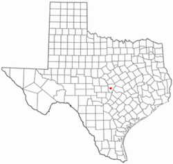
TXMap-doton-Burnet.PNG
Location of Sage within Burnet County, Texas.
Coordinates: 30°52′29″N98°09′10″W / 30.87472°N 98.15278°W / 30.87472; -98.15278 Coordinates: 30°52′29″N98°09′10″W / 30.87472°N 98.15278°W / 30.87472; -98.15278
Time zone UTC-6 (CST)
  Summer (DST) UTC-5 (CDT)
ZIP code
78611
Area code(s) 512
FIPS code 48-11464 [1]
GNIS feature ID1353341 [2]

Sage, Bethel, and Pleasant Hill were small closely linked unincorporated communities in Burnet County, Texas. They were close to the small town of Lake Victor and seven or eight miles away from Burnet, Texas.

Contents

Sage

Sage is located on the north fork of the San Gabriel River where the old Austin-San Saba Road and the old Burnet-Lampasas Road cross. Many believe the name Sage comes from the large amount of sage grass that is located there. The first people came to Sage before the 1860s and consisted of A.N. Murphy, J.A. Murphy, Hugh McCoy, Alfred Shelby. Other families came to the area in later years and consisted of Andy Fields, George Newt Jones (and family), the Harkriders, Pates, Bentons, Hodges, Hahns, Purcells, Everetts, Pipers, and many other families. These families were primarily from Mississippi, Kentucky, and South Carolina. Many people from Sage were veterans of The Civil War and both World Wars.

General store

In 1890 George Newt Jones built the general store that was on the land owned by the Murphys. Jones was the storekeeper and went to Lampasas twice a month to get supplies. Some supplies included pickles, vinegar, candy, flour, corn meal, sugar, green coffee and every once in a while apples and oranges (every thing came in sacks or barrels). Mark Baily was the last storekeeper when the store closed in 1918. The store joined the Feild land and created a picnic ground and every year they held a barbecue on the Fourth of July that would sometimes last for more than a day there was games, a swimming hole and even candidates would speak. And in the winter they would put up a tent and entertain the residents. The old store building still stands today.

Other businesses

Hugh M. Murphy built the first Sage gin and then after many years of wear and tear Hugh Murphy's son, Herb, made a new gin in 1900 which operated until 1929. Ira Feild was the last operator of the gin (1924–1929). The only other operators of the gin was Jim Everett and his family.

Sage established a post office on November 17, 1874 which had Jesse G.W. Howard as Post Master but was discontinued from 1884-1898 (during which time the people of sage got their mail from Sunny Lane). The post office then reopened and ultimately closed in 1906 when the mail was redirected to Burnet.

In 1884 Sage had three churches, and a steam corn mill. There was no school or cemetery in Sage so the residents sent their children to school in either nearby Bethel or Pleasant Hill and also buried their dead in the same locations.

Stage stop

For many years Sage was a stop on the stage route between Burnet and Lampasas. The stage route ran from Lampasas to Burnet Twice a week for many years until travel to and from Lampasas and Burnet became higher in demand. Then the stage ran everyday both ways.

Growth and decline

In 1884 Sage had 75 residents, and in 1900 Sage had 242 residents at its highest population total. Sage began to decline after the small town was bypassed by the Houston and Central Texas railway in 1903 and by 1940 only a few scattered houses marked the place where sage once stood and by the 1980s there was nothing but the old city limit sign and general store building to mark the once prominent town.

Bethel

Bethel was a small sister town to Sage and used Sage' gin, store, and post office but Bethel had a church, cemetery, community center and school.

Bethel is around eight miles northeast of Burnet on R.R. 963 and on county road 202. The name Bethel comes from the biblical village of Bethel.

The people of Bethel were mostly from Kentucky, South Carolina, and Mississippi, like Sage.

School

The Bethel school was established in 1869 with John T. Chamberlain as the teacher even though there was no land given to the school until 1874 and on July 11, 1874 A.R. Johnson and T.E. Hammond deeded 3 acres to Thomas Glimp and Jesse G.W. Howard for the Bethel school (Volume I, Page 320, DRBC) and they gave 3 more acres to Thomas Glimp, C.H. Hahn, and Jesse G.W. Howard for the school(Volume I, Page 456, DRBC). The school had one teacher and 25 students in the 1890s and closed in 1941 with John L. Chamberlain and Ruth Fluitt.

Growth and decline

Just like Sage, Bethel declined after Sage was bypassed by the Houston and Central Texas Railway but it did not decline quite as fast as Sage. Several houses and the cemetery marked Bethel in the 1940s. Scattered houses, a community center, and the cemetery marked Bethel in 1990. And today only a few houses, the cemetery, and historical marker what used to be the town of Bethel.

Historical marker

The historical marker reads

Bethel Cemetery: The REV. Richard Howard (1817 - 1882) moved to this area of Burnet County in 1885. The frontier settlement he joined would later be known as the Bethel Community. In 1874 he deeded two acres at this site for the community use. The first recorded burial was that of Howard's Grand-daughter, Harriet Ruthie Howard, in 1875. Since then this site has been used as the Bethel Community Cemetery. Buried here are veterans of the Civil War to World War II and many of the area's early settlers and their descendants. The Bethel Cemetery Association was established in 1930.

Pleasant Hill

Pleasant Hill was a small community located about nine miles Northeast of Burnet on Farm to Market 2340 between Bethel and Lake Victor and was closely linked to Sage and Bethel but also Lake Victor. Pleasant Hill had its own school and cemetery. The people in Pleasant Hill were, like Sage and Bethel, mostly from Kentucky, Mississippi, and South Carolina.

School

The School at Pleasant Hill was a two-room structure built in 1884 and was deeded along with 5 acres on October 14, 1885 to School District #2 by William Hodge and T.J. Stewart. The school was then given to the Lake Victor and Bethel school districts in 1905 because of overcrowding in those communities schools. This school was called 'Pleasant View'.

Growth and decline

Pleasant Hill also started to decline under the same lines as Sage and Bethel. All that marked Pleasant Hill in the 1990s was the cemetery and scattered houses. Now the old grounds of Pleasant Hill are only marked by the cemetery and a couple houses.

Bibliography

Related Research Articles

Lampasas County, Texas County in Texas, United States

Lampasas County is a county located on the Edwards Plateau in the U.S. state of Texas. As of the 2020 census, its population was 21,627. Its county seat is Lampasas. The county is named for the Lampasas River.

Burnet County, Texas County in Texas, United States

Burnet County is a county located on the Edwards Plateau in the U.S. state of Texas. As of the 2020 census, the population was 49,130. Its county seat is Burnet. The county was founded in 1852 and later organized in 1854. It is named for David Gouverneur Burnet, the first (provisional) president of the Republic of Texas. The name of the county is pronounced with the emphasis or accent on the first syllable, just as is the case with its namesake.

Burnet, Texas City in Texas, United States

Burnet is a city in and the county seat of Burnet County, Texas, United States. The population was 6,436 at the 2020 census.

Copperas Cove, Texas City in Texas, United States

Copperas Cove is a city located in central Texas at the southern corner of Coryell County with smaller portions in Lampasas and Bell counties. Founded in 1879 as a small ranching and farming community, today the city is the largest in Coryell County, with 32,032 residents as of the 2010 census and an estimated 33,235 residents in 2019. The city's economy is closely linked to nearby Fort Hood, making it part of the Killeen-Temple-Fort Hood Metropolitan Statistical Area. Local people usually refer to the town as just "Cove".

Westphalia is a small unincorporated community in Falls County, Texas, United States located 35 mi (56 km) south of Waco on State Highway 320. Westphalia has a strong German and Catholic background. The Church of the Visitation was, until recently, the largest wooden church west of the Mississippi River. Westphalia is mainly noted for its historic church and convents, but also for its meat market and for its annual church picnic, which is one of the largest in the area. Westphalia is also known for the Westphalia Waltz.
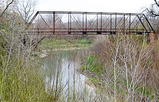
Little River (Texas)

The Little River is a river in Central Texas in the Brazos River watershed. It is formed by the confluence of the Leon River and the Lampasas River near Little River, Texas in Bell County. It flows generally southeast for 75 miles (121 km) until it empties into the Brazos River about 5 miles (8.0 km) southwest of Hearne, at a site called Port Sullivan in Milam County. The Little River has a third tributary, the San Gabriel River, which joins the Little about 8 miles (13 km) north of Rockdale and five miles southwest of Cameron. Cameron, the county seat of Milam County and the only city of any significant size on the Little River, was established in 1846.

Huckabay, Texas Unincorporated community in Texas, United States

Huckabay is an unincorporated community located at the intersection of State Highway 108 and Farm Road 219, ten miles northwest of Stephenville in Erath County, Texas, United States. It had a population of approximately 150 in 2000.

McGirk is a ghost town located in Hamilton County near the Lampasas River in Central Texas. Founded in the early 1870s, the town acquired a post office in 1882. John A. McGirk, the town's namesake also served as the first postmaster. A steam-operated cotton gin on the Lampasas River remained in place for many years. The post office closed by 1920 and the school was gone by the mid-1930s. The town still had a population of 25 in 1945 but post war opportunities drew off that meager number and the town became a ghost.

Frelsburg is an unincorporated community in Colorado County, Texas, United States. It lies at the intersection of Farm to Market Road 109 and Farm to Market Road 1291. The community was founded around 1837 by immigrants from Germany. It is home to one of the oldest surviving general stores in Texas. Continuously operated since 1865 and owned by the Heinsohn family since 1920, the store is called Heinsohn's Country Store.

High Hill, Texas

High Hill is an unincorporated community in southwestern Fayette County, Texas, United States. It is located on Farm Road 2672, three miles northwest of Schulenburg, Texas.

Calf Creek is a small community located in southern McCulloch County, Texas on Farm Road 1311 approximately 15 miles (24 km) southwest of Brady.

Oatmeal, Texas

Oatmeal is an unincorporated community in Burnet County, Texas, United States. It is situated along RM 243, approximately eight miles southeast of Burnet and 56 miles (90 km) northwest of Austin.

Paige, Texas City in Texas, United States

Paige is an unincorporated community in Bastrop County, Texas, United States. Paige has a post office with the ZIP code 78659.

The Grove, Texas Unincorporated community in Texas, United States

The Grove is an unincorporated community in Coryell County, Texas, United States. It is located some 16 miles southeast of Gatesville, Texas in the eastern portion of the county. The Grove is located on Texas State Highway 36. The area is known for its abundance of Texas bluebonnet flowers during the spring.

Peeltown is an unincorporated community in Kaufman County, located in the U.S. state of Texas.

Joppa is an unincorporated community located in Burnet County, Texas, United States. Joppa is located on the North Fork of the San Gabriel River seven miles northeast of the City of Bertram. First settlers of this farming and ranching community included the William Alexander Faires family who moved to the area in 1874 and the Martin Luther Ater family who moved from nearby Mahomet in 1875.

Nix, Texas Unincorporated community in Texas, United States

Nix is an unincorporated community in southwestern Lampasas County, Texas, United States. It was once a stop on a stagecoach route.

Hills Prairie, or Hill's Prairie, is an unincorporated community in Bastrop County, Texas, United States. It is located off Farm to Market Road 304, 8 miles (13 km) southeast of the town of Bastrop, 8 miles (13 km) northwest of Smithville and 40 miles (64 km) southeast of Austin.

Grassyville is a ghost town located in Bastrop County, Texas, United States. The community was founded in the northeast corner of the county near the intersection of Farm to Market Road 2104 and Farm to Market Road 2239, 6 miles south of Paige, 14 miles east of Bastrop, and 50 miles east of Austin.

Oak Hill is a ghost town in Bastrop County, Texas, United States. It is located 4 miles southwest of McDade, 12 miles southeast of Elgin, 13 miles northeast of Bastrop, and 37 miles southeast of Austin on the old Bastrop-McDade Road.
References

  1. "U.S. Census website". United States Census Bureau . Retrieved 2008-01-31.
  2. "US Board on Geographic Names". United States Geological Survey. 2007-10-25. Retrieved 2008-01-31.