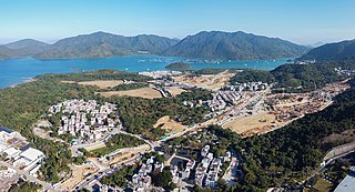
Hong Kong has a long coastline that is full of twists and turns with many bays and beaches. Many of them are well sheltered by mountains nearby,as Hong Kong is a mountainous place. As a result,large waves seldom appear at the bays,making them suitable for human swimming.

Tai Po District is one of the 18 districts of Hong Kong. The suburban district covers the areas of Tai Po New Town,Tai Po Tau,Tai Po Kau,Hong Lok Yuen,Ting Kok,Plover Cove,Lam Tsuen Valley,Tai Mei Tuk and other surrounding areas,and its exclaves Sai Kung North,in the northern part of the Sai Kung Peninsula and including islands such as Grass Island,and Ping Chau. Tai Po proper and Sai Kung North are divided by the Tolo Channel and the Tolo Harbour. The district is located in the Eastern New Territories. The de facto administrative centre of the district is Tai Po New Town.
Hong Kong counts approximately 600 temples,shrines and monasteries. While Buddhism and Christianity are the most widely practiced religions,most religions are represented in the Special Administrative Region.

The Sai Kung Peninsula is a peninsula in the easternmost part of the New Territories in Hong Kong. Its name comes from Sai Kung Town in the central southern area of the peninsula. The southern part of the peninsula is administrated by Sai Kung District,the north by Tai Po District and the northwest by Sha Tin District.

Telephone numbers in Hong Kong are mostly eight-digit. Fixed land line numbers start with 2 or 3,mobile (cellular) phone numbers with 5,6,7 or 9,pager numbers with 7 and forwarding service with 8. Since the end of 1989,there have been no area codes within Hong Kong.

Plover Cove also known for its Chinese names Shuen Wan Hoi or Shuen Wan (船灣),is a cove in the Tai Po District of Hong Kong,near Tolo Channel and Tolo Harbour.

Shap Sze Heung,sometimes transliterated as Shap Sz Heung,is an area in Hong Kong located in the northern part of the Sai Kung Peninsula.
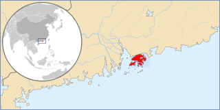
Articles related to Hong Kong include:

Tin Hau temples in Hong Kong are dedicated to Tin Hau (Mazu). Over 100 temples are dedicated to Tin Hau in Hong Kong. A list of these temples can be found below.

Sham Chung is a Hakka village and an area of Neolithic settlement in Hong Kong. It is located in the south of Tolo Channel,beside Three Fathoms Cove on the Sai Kung Peninsula. Administratively,it is part of Tai Po District.

Several fishermen villages were established in Hong Kong to house fishermen families.


