
Alma is a town in Saguenay–Lac-Saint-Jean, in the Canadian province of Quebec.

L'Anse-Saint-Jean, French for "The Cove of Saint John" is a municipality in the Saguenay–Lac-Saint-Jean region of Quebec, Canada. Its population was 1208 in the Canada 2011 Census.

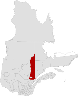
Saguenay–Lac-Saint-Jean is a region in Quebec, Canada. It contains the Saguenay Fjord, the estuary of the Saguenay River, stretching through much of the region. It is also known as Sagamie in French, from the first part of "Saguenay" and the last part of "Piekouagami", the Innu name for Lac Saint-Jean, with the final "e" added to follow the model of other existing region names such as Mauricie, Témiscamie, Jamésie, and Matawinie. With a land area of 98,712.71 km2, the Saguenay–Lac-Saint-Jean is, after the Nord-du-Québec and Côte-Nord regions, the third-largest of Quebec regions in the area.

Saint-Louis-du-Ha! Ha! is a parish municipality in the Témiscouata Regional County Municipality of the Bas-Saint-Laurent region of Quebec. The population is 1,318. Its economy is mainly agricultural. It is located southeast of Rivière-du-Loup and west of Cabano along the Trans-Canada Highway, about halfway to Edmundston in New Brunswick.

Lac-Saint-Jean-Est is a regional county municipality in the Saguenay–Lac-Saint-Jean region of Quebec, Canada. The seat is Alma. In 2016, 99.3% reported that they spoke French most often at home, according to the census.

La Haute-Côte-Nord is a regional county municipality in northeastern Quebec, Canada, in the Côte-Nord region. It is located on the Gulf of Saint Lawrence where the Saguenay River flows into it. The seat is Les Escoumins. The municipality has a land area of 11,612.68 square kilometres (4,483.68 sq mi) and its population was 10,846 inhabitants as of the 2016 census. Its largest community is the city of Forestville.
Le Fjord-du-Saguenay is a regional county municipality in the Saguenay-Lac-Saint-Jean region of Quebec, Canada. Its seat is Saint-Honoré, which is also its most populous municipality.
Maria-Chapdelaine is a regional county municipality in the Saguenay–Lac-Saint-Jean region of Quebec, Canada. Its seat is in Dolbeau-Mistassini.

Saint-Augustin is a parish municipality in the Maria-Chapdelaine Regional County Municipality in the Saguenay–Lac-Saint-Jean region of Quebec, Canada. The municipality had a population of 351 as of the Canada 2016 Census.
Petit-Saguenay is a municipality in the Canadian province of Quebec, located in Le Fjord-du-Saguenay Regional County Municipality. The municipality, located on Route 170 near L'Anse-Saint-Jean, had a population of 727 in the Canada 2011 Census, which dropped to 634 in the 2016 census.
Saint-Félicien is a city in the Canadian province of Quebec. The town is located within the Le Domaine-du-Roy Regional County Municipality in the Saguenay-Lac-Saint-Jean region. Its population as of 2006 is 10,477.

Hébertville-Station is a village municipality in Lac-Saint-Jean-Est Regional County Municipality in the Saguenay–Lac-Saint-Jean region of Quebec.

Saint-Ambroise-de-Kildare is a municipality in the Lanaudière region of Quebec, Canada, part of the Joliette Regional County Municipality.

Saint-Gédéon or Saint-Gédéon-de-Grandmont is a municipality in Quebec, Canada, in the regional county municipality of Lac-Saint-Jean-Est and the administrative region of Saguenay–Lac-Saint-Jean. It is on the eastern shore of Lac Saint-Jean at the mouth of the Belle River.

Rivière-Éternité is a municipality, being part of Le Fjord-du-Saguenay Regional County Municipality, located in the administrative region of Saguenay–Lac-Saint-Jean, in Quebec, Canada.

Sainte-Rose-du-Nord is a village on the north shore of the Saguenay River in Quebec, Canada.

Mont-Valin is an unorganized territory in the Canadian province of Quebec. It makes up over 87% of Le Fjord-du-Saguenay Regional County Municipality and is the largest subdivision of the Saguenay–Lac-Saint-Jean region. The territory, named after Mount Valin, had a population of 10 as of the Canada 2021 Census, and covered a land area of 33,540.39 km2.

Sagard is an unorganized territory and hamlet in the Capitale-Nationale region of Quebec, Canada, part of the Charlevoix-Est Regional County Municipality. The hamlet of Sagard is located on the eastern banks of the Little Saguenay River, along Route 170 between Saint-Siméon and Petit-Saguenay.
The Rivière à l'Ours is a tributary of the rivière des Aulnaies, flowing on the northwest bank of the Saint Lawrence River, successively in the municipalities of Bégin and Saint-Ambroise, in the Fjord-du-Saguenay, in the region administrative Saguenay–Lac-Saint-Jean, in the Province of Quebec, in Canada.
The rivière des Aulnaies is a tributary of the Saguenay River, flowing on the northwest shore of the Saint Lawrence River, successively in the municipalities of Bégin and Saint-Ambroise, in the Le Fjord-du-Saguenay Regional County Municipality, in the administrative region of Saguenay–Lac-Saint-Jean, in the Province of Quebec, in Canada.


