Portneuf County is a historic county in Quebec, Canada west of Quebec City on the Saint Lawrence River in Canada.

Mékinac is a regional county municipality (RCM) of 5,607 km2 located in the administrative region of Mauricie, along the Saint-Maurice River, which also crosses the RCM from one end to the other, and the Matawin River, a tributary of the Saint-Maurice. Located in the province of Quebec, Canada.

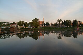
Saint-Raymond, also called Saint-Raymond de Portneuf, is a city in Quebec, Canada, located about 63 kilometres (39 mi) north-west of Quebec City. It is the largest city in population and area of the Portneuf Regional County Municipality.

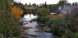
Saint-Casimir is a municipality of about 1800 people in the Portneuf Regional County Municipality in the province of Quebec, Canada. It is located on the Sainte-Anne River, about 80 kilometres (50 mi) southwest of Quebec City and 50 kilometres (31 mi) northeast of Trois-Rivières. It was founded in 1836 by people who came from Ste-Anne-de-la-Pérade following to the east along the Sainte-Anne.

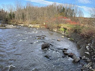
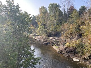
Sainte-Anne River, Teyaiar River, rivière Sainte-Anne (French), flows from north to south on the north shore in the estuary section of the St. Lawrence River, in Les Chenaux, Portneuf and La Jacques-Cartier RCM, Mauricie and National Capital regions, Quebec, Canada.
Saint-Adelphe is a parish municipality located in the Mékinac Regional County Municipality (RCM), located in Mauricie, Quebec province, Canada.

Saint-Prosper-de-Champlain is a municipality of 516 people in the Les Chenaux Regional County Municipality, in Quebec, Canada. It is the smallest municipality in terms of population in the regional county.
Saint-Stanislas, old name Deux-Rivières (Village), is a municipality part of Les Chenaux Regional County Municipality, in Mauricie, Quebec, Canada.

Sainte-Christine-d'Auvergne (Municipality), formerly Sainte-Catherine, is located along the banks of the Sainte-Anne River, in the Capitale-Nationale region, Portneuf RCM, Quebec, Canada.

Saint-Maurice is a parish municipality in the Mauricie region of the province of Quebec in Canada.

Lac-aux-Sables is a parish municipality in the Mékinac Regional County Municipality, in administrative district of the Mauricie region of the province of Quebec in Canada. Its population centres are Lac-aux-Sables and Hervey-Jonction.

Notre-Dame-de-Montauban is a municipality in the Mauricie region in Quebec, Canada. The municipality is on the northern edge of Mékinac Regional County Municipality and the administrative region of Mauricie and includes the population centres of Notre-Dame-des-Anges and Montauban-les-Mines. Both communities are located along route 367 and are about 7 kilometres (4.3 mi) apart.

Portneuf is a municipality in the Portneuf Regional County Municipality, in the province of Quebec, Canada. It is located on the Saint Lawrence River, between Quebec City and Trois-Rivières. The Portneuf River runs on the east side of the town centre.

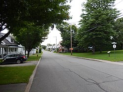
Saint-Thuribe is a parish municipality in the Capitale-Nationale region of Quebec, Canada.
Saint-Alban (Municipality) is crossed in its southern part by the Sainte-Anne River, in Portneuf RCM, Capitale-Nationale, Quebec, Canada.

The North Mekinac River flows from North to South, in three municipalities, in Mauricie region, Mékinac Regional County Municipality, Quebec, Canada.
The Charest River originates from Charest Lake in the Montauban-les-Mines area, located in the eastern part of Notre-Dame-de-Montauban, within the Mekinac Regional County Municipality, in the administrative region of Mauricie in the province of Quebec, Canada. It flows southward, passing through several regions and receiving water from lakes such as Mine, Perron, Perreault, and End in its upper course.

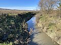
The Blanche River (St-Casimir) is a stream flowing in the municipalities of Saint-Ubalde, Saint-Thuribe, Saint-Alban and Saint-Casimir, in Portneuf RCM, Capitale-Nationale, Quebec, Canada.

The Weller River (Stream) is a tributary left bank of the Blanche River (St-Casimir) whose confluence is found east of the municipality of Saint-Ubalde, in the Portneuf Regional County Municipality, in the administrative region of Capitale-Nationale, in the province of Quebec in Canada.

The Niagarette River is a stream flowing in the municipalities of Saint-Ubalde, Saint-Thuribe and Saint-Casimir, in the Portneuf Regional County Municipality, in the administrative region of Capitale-Nationale, in Quebec, in Canada.