Saint-Étienne-du-Bois, Ain

Last updated • 1 min readFrom Wikipedia, The Free Encyclopedia

Saint-Étienne-du-Bois
Saint-Etienne du bois Ferme des Mangettes.JPG
Mangettes farm
Blason ville fr Saint-Etienne-du-Bois (Ain).svg
Location of Saint-Étienne-du-Bois
Saint-Etienne-du-Bois, Ain
France location map-Regions and departements-2016.svg
Red pog.svg
Saint-Étienne-du-Bois
Auvergne-Rhone-Alpes region location map.svg
Red pog.svg
Saint-Étienne-du-Bois
Coordinates: 46°17′19″N5°17′39″E / 46.2886°N 5.2942°E / 46.2886; 5.2942
Country France
Region Auvergne-Rhône-Alpes
Department Ain
Arrondissement Bourg-en-Bresse
Canton Saint-Étienne-du-Bois
Intercommunality CA Bassin de Bourg-en-Bresse
Government
  Mayor (20222026) Alain Chapuis [1]
Area
1
28.38 km2 (10.96 sq mi)
Population
 (2021) [2]
2,553
  Density90/km2 (230/sq mi)
Time zone UTC+01:00 (CET)
  Summer (DST) UTC+02:00 (CEST)
INSEE/Postal code
01350 /01370
Elevation213–259 m (699–850 ft)
(avg. 235 m or 771 ft)
1 French Land Register data, which excludes lakes, ponds, glaciers > 1 km2 (0.386 sq mi or 247 acres) and river estuaries.

Saint-Étienne-du-Bois (French pronunciation: [sɛ̃tetjɛndybwa] ) is a commune in the Ain department, eastern France.

Contents

Geography

The Sevron forms part of the commune's eastern border then flows northwest through the commune.

Climate

Saint-Étienne-du-Bois has an oceanic climate (Köppen climate classification Cfb). The average annual temperature in Saint-Étienne-du-Bois is 11.5 °C (52.7 °F). The average annual rainfall is 1,137.6 mm (44.79 in) with October as the wettest month. The temperatures are highest on average in July, at around 20.4 °C (68.7 °F), and lowest in January, at around 2.6 °C (36.7 °F). The highest temperature ever recorded in Saint-Étienne-du-Bois was 39.4 °C (102.9 °F) on 13 August 2003; the coldest temperature ever recorded was −17.8 °C (0.0 °F) on 30 December 2005.

Climate data for Saint-Étienne-du-Bois (1981–2010 averages, extremes 1998−2020)
MonthJanFebMarAprMayJunJulAugSepOctNovDecYear
Record high °C (°F)18.2
(64.8)
20.0
(68.0)
23.5
(74.3)
28.8
(83.8)
33.1
(91.6)
37.3
(99.1)
39.1
(102.4)
39.4
(102.9)
34.3
(93.7)
27.5
(81.5)
22.8
(73.0)
17.5
(63.5)
39.4
(102.9)
Mean daily maximum °C (°F)5.8
(42.4)
7.9
(46.2)
12.6
(54.7)
16.7
(62.1)
21.1
(70.0)
25.1
(77.2)
26.6
(79.9)
26.1
(79.0)
21.9
(71.4)
17.0
(62.6)
10.0
(50.0)
5.9
(42.6)
16.4
(61.5)
Daily mean °C (°F)2.6
(36.7)
3.9
(39.0)
7.5
(45.5)
11.0
(51.8)
15.4
(59.7)
18.9
(66.0)
20.4
(68.7)
19.8
(67.6)
16.3
(61.3)
12.6
(54.7)
6.6
(43.9)
2.9
(37.2)
11.5
(52.7)
Mean daily minimum °C (°F)−0.7
(30.7)
−0.1
(31.8)
2.4
(36.3)
5.2
(41.4)
9.7
(49.5)
12.7
(54.9)
14.2
(57.6)
13.6
(56.5)
10.7
(51.3)
8.2
(46.8)
3.2
(37.8)
0.0
(32.0)
6.6
(43.9)
Record low °C (°F)−15.9
(3.4)
−16.5
(2.3)
−12.6
(9.3)
−6.7
(19.9)
−0.2
(31.6)
2.8
(37.0)
5.8
(42.4)
3.5
(38.3)
1.2
(34.2)
−5.8
(21.6)
−11.2
(11.8)
−17.8
(0.0)
−17.8
(0.0)
Average precipitation mm (inches)80.6
(3.17)
83.7
(3.30)
91.5
(3.60)
92.3
(3.63)
109.3
(4.30)
67.3
(2.65)
90.1
(3.55)
96.8
(3.81)
94.7
(3.73)
127.4
(5.02)
117.7
(4.63)
86.2
(3.39)
1,137.6
(44.79)
Average precipitation days (≥ 1.0 mm)12.510.611.79.812.37.89.310.79.212.312.612.3131.0
Source: Meteociel [3]

Population

Historical population
YearPop.±% p.a.
1793 1,629    
1800 1,405−2.09%
1806 1,207−2.50%
1821 1,521+1.55%
1831 1,605+0.54%
1836 1,640+0.43%
1841 1,646+0.07%
1846 1,672+0.31%
1851 1,710+0.45%
1856 1,648−0.74%
1861 1,613−0.43%
1866 1,652+0.48%
1872 1,603−0.50%
1876 1,558−0.71%
1881 1,502−0.73%
1886 1,607+1.36%
1891 1,551−0.71%
1896 1,528−0.30%
YearPop.±% p.a.
1901 1,518−0.13%
1906 1,507−0.15%
1911 1,505−0.03%
1921 1,368−0.95%
1926 1,378+0.15%
1931 1,382+0.06%
1936 1,383+0.01%
1946 1,422+0.28%
1954 1,435+0.11%
1962 1,349−0.77%
1968 1,355+0.07%
1975 1,443+0.90%
1982 1,876+3.82%
1990 1,982+0.69%
1999 2,046+0.35%
2007 2,397+2.00%
2012 2,489+0.76%
2017 2,448−0.33%
Source: EHESS [4] and INSEE (1968-2017) [5]

See also

Related Research Articles

<span class="mw-page-title-main">Bénonces</span> Commune in Auvergne-Rhône-Alpes, France

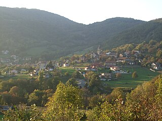
Bénonces is a commune in the Ain department in eastern France.

<span class="mw-page-title-main">Ceyzériat</span> Commune in Auvergne-Rhône-Alpes, France

Ceyzériat is a commune in the Ain department, Auvergne-Rhône-Alpes region in eastern France. Ceyzériat station has rail connections to Bourg-en-Bresse and Oyonnax.

<span class="mw-page-title-main">Cessy</span> Commune in Auvergne-Rhône-Alpes, France

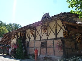
Cessy is a commune in the Ain department in eastern France. The area was first inhabited by two farming families in the eleventh century, and as the town has grown its agricultural heritage has remained a significant feature, with the populated area surrounded by a vast expanse of fields and an annual agricultural festival.

<span class="mw-page-title-main">Giron, Ain</span> Commune in Auvergne-Rhône-Alpes, France

Giron is a commune in the Ain department in eastern France.

<span class="mw-page-title-main">Loyettes</span> Commune in Auvergne-Rhône-Alpes, France

Loyette is a commune in the Ain department in eastern France.

<span class="mw-page-title-main">Saint-Rambert-en-Bugey</span> Commune in Auvergne-Rhône-Alpes, France

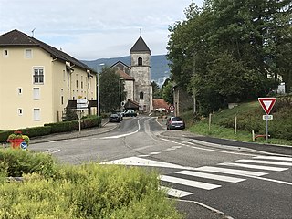
Saint-Rambert-en-Bugey is a commune in the Ain department in eastern France.

<span class="mw-page-title-main">Saint-Hilaire-du-Harcouët</span> Commune in Normandy, France

Saint-Hilaire-du-Harcouët is a commune in the Manche department in Normandy in north-western France. On 1 January 2016, the former communes of Saint-Martin-de-Landelles and Virey were merged into Saint-Hilaire-du-Harcouët.

<span class="mw-page-title-main">Courtes</span> Commune in Auvergne-Rhône-Alpes, France

Courtes is a commune in the Ain department in eastern France.

<span class="mw-page-title-main">Marlieux</span> Commune in Auvergne-Rhône-Alpes, France

Marlieux is a commune in the Ain department in eastern France. Marlieux—Châtillon station has rail connections to Bourg-en-Bresse and Lyon.

<span class="mw-page-title-main">Montagnieu, Ain</span> Commune in Auvergne-Rhône-Alpes, France

Montagnieu is a commune in the Ain department in eastern France. It is sited on the eastern bank of the river Rhone, which forms the border with the Isere department to the west.

<span class="mw-page-title-main">Plonévez-du-Faou</span> Commune in Brittany, France

Plonévez-du-Faou is a commune in the Finistère department of Brittany in north-western France.

<span class="mw-page-title-main">Spézet</span> Commune in Brittany, France

Spézet is a commune in the Finistère department of Brittany in north-western France.

<span class="mw-page-title-main">Saint-Julien-sur-Reyssouze</span> Commune in Auvergne-Rhône-Alpes, France

Saint-Julien-sur-Reyssouzè is a commune in the Ain department in eastern France.

<span class="mw-page-title-main">Vieu-d'Izenave</span> Commune in Auvergne-Rhône-Alpes, France

Vieu-d'Izenave is a commune in the Ain department in eastern France.

Saint-Martin-du-Mont is a commune in the Côte-d'Or department in eastern France.

<span class="mw-page-title-main">Le Poizat-Lalleyriat</span> Commune in Auvergne-Rhône-Alpes, France

Le Poizat-Lalleyriat is a commune in the Ain department of eastern France. The municipality was established on 1 January 2016 and consists of the former communes of Lalleyriat and Le Poizat.

<span class="mw-page-title-main">Valserhône</span> Commune in Auvergne-Rhône-Alpes, France

Valserhône is a commune in the Ain department in the Auvergne-Rhône-Alpes region in Eastern France. It is the result of the merger, on 1 January 2019, of the communes of Bellegarde-sur-Valserine, Châtillon-en-Michaille and Lancrans. In 2018, the three communes had a combined population of 16,431, with Bellegarde-sur-Valserine as the major population centre. This makes Valserhône the third-most populated commune of Ain, after Bourg-en-Bresse and Oyonnax.

<span class="mw-page-title-main">Arvière-en-Valromey</span> Commune in Auvergne-Rhône-Alpes, France

Arvière-en-Valromey is a commune in the Ain department in eastern France. The municipality was established on 1 January 2019 by merger of the former communes of Brénaz, Chavornay, Lochieu and Virieu-le-Petit.

<span class="mw-page-title-main">Plateau d'Hauteville</span> Commune in Auvergne-Rhône-Alpes, France

Plateau d'Hauteville is a commune in the Ain department in eastern France. The municipality was established on 1 January 2019 by merger of the former communes of Cormaranche-en-Bugey, Hauteville-Lompnes, Hostiaz and Thézillieu.

<span class="mw-page-title-main">Valromey-sur-Séran</span> Commune in Auvergne-Rhône-Alpes, France

Valromey-sur-Séran is a commune in the Ain department in eastern France. The municipality was established on 1 January 2019 by merger of the former communes of Belmont-Luthézieu, Lompnieu, Sutrieu and Vieu.

References

  1. "Répertoire national des élus: les maires" (in French). data.gouv.fr, Plateforme ouverte des données publiques françaises. 13 September 2022. Archived from the original on 28 June 2020. Retrieved 7 May 2024.
  2. "Populations légales 2021" (in French). The National Institute of Statistics and Economic Studies. 28 December 2023.
  3. "Normales et records pour Saint Etienne du Bois (01)". Meteociel. Archived from the original on 14 June 2022. Retrieved 14 June 2022.
  4. Des villages de Cassini aux communes d'aujourd'hui: Commune data sheet Saint-Étienne-du-Bois, EHESS (in French).
  5. Population en historique depuis 1968 Archived 2 September 2022 at the Wayback Machine , INSEE