Mijoux

Last updated

Mijoux
Commune
Mijoux01.jpg
Blason ville fr Mijoux (Ain).svg
Location of Mijoux
Mijoux
France location map-Regions and departements-2016.svg
Red pog.svg
Mijoux
Auvergne-Rhone-Alpes region location map.svg
Red pog.svg
Mijoux
Coordinates: 46°21′58″N5°59′46″E / 46.3661°N 5.9961°E / 46.3661; 5.9961
Country France
Region Auvergne-Rhône-Alpes
Department Ain
Arrondissement Gex
Canton Thoiry
Intercommunality CA Pays de Gex
Government
  Mayor (20212026) Martine Viallet [1]
Area
1
22.00 km2 (8.49 sq mi)
Population
 (Jan. 2020) [2]
299
  Density14/km2 (35/sq mi)
Time zone UTC+01:00 (CET)
  Summer (DST) UTC+02:00 (CEST)
INSEE/Postal code
01247 /01410
Elevation866–1,614 m (2,841–5,295 ft)
(avg. 990 m or 3,250 ft)
1 French Land Register data, which excludes lakes, ponds, glaciers > 1 km2 (0.386 sq mi or 247 acres) and river estuaries.

Mijoux is a commune and village in the Ain department in eastern France.

Contents

Geography

The village is situated in the upper section of the narrow Valserine valley, nestled between high limestone cliffs to the south-east that form the first anticline of the Jura mountains and the edge of the Lajoux plateau to the northwest. However, only the south-eastern side of the valley is within the commune's boundary, which stretches from the source of the Valserine river in the north, to the entry into Lélex, further down the valley, in the south. The commune is roughly 16 km long and 2 km wide.

Despite its high altitude (just under 1000 m), the village is built around a crossroads of regional importance: the valley road (D991) which links Bellegarde-sur-Valserine with Les Rousses here crosses the D936 which links Saint-Claude with Geneva over the Col de la Faucille. Both are former routes nationales.

History

Origins

In 1334 the valley was declared common property and revenue was shared between Jean II de Rossillon and Hugues de Joinville, Sire of Gex. The agreement thereby struck up stated that a hospice should be paid for and built within the valley.

The hospice was inhabited by monks who were charged with caring for the poorest pilgrims visiting the tombs of the Saints of Condat in Saint-Claude. Most of the pilgrims were from Geneva or Savoy. This was the first building to be inhabited year-round in Mijoux.

The 15th to 18th centuries

Because of climate conditions within the valley that meant that winter was harsh and that spring was virtually nonexistent, the valley had remained uninhabited for a long time. However, due to the hospice, houses gradually appeared and work to clear the pines began so as to allow agriculture.

At first houses were built along the road that links Lajoux to the Col de la Faucille and it would not be until 1601 at the Treaty of Lyon that the river that bisects the town would become a border: the south-eastern side of the valley became French. In 1612 at the Franco-Spanish treaty, signed in Auxonne, the Valserine was chosen as the border between France and Spain. The north-western side of the valley was ceded to France in 1678 at the Treaties of Nijmegen.

The 19th century until today

At the Treaty of Paris in 1815, after Napoleon's downfall, the new border was defined, as it remains today: it passes along Mijoux's thin northern edge. The French customs, however, were set up along the Valserine as Mijoux, Lélex, Chézery-Forens and the Pays de Gex became a pays franc. Today, the Valserine river serves as the border between the regions of Franche-Comté and Auvergne-Rhône-Alpes, Mijoux lying within the latter for its most part.

During this time, the valley was inhabited by numerous families, whose jobs changed depending on the season. During the summer, tasks included collecting fodder for the livestock, cultivating barley and potatoes as well as collecting firewood. In winter, when the ground was covered in snow, the same families cut and polished gems.

However, the bloodshed of the Great War and the resulting economic crisis contributed to the abandonment of farms and a downturn in population levels that left the commune with only half the population it had had 50 years previously.

Today and since 1969, tourism is revitalising this village, mainly due to winter sports. The commune has, for the past 20 years, belonged to the Parc naturel régional du Haut-Jura.

Population

Historical population
YearPop.±% p.a.
1968 227    
1975 191−2.44%
1982 200+0.66%
1990 258+3.23%
1999 312+2.13%
2009 380+1.99%
2014 348−1.74%
2020 299−2.50%
Source: INSEE [3]

Economy

Mijoux's economy is largely driven by tourism, for the winter sports practised here. Since 1999, Mijoux has been part of the Monts Jura ski resort. Ski lifts link Mijoux to the Col de la Faucille at 1308 m and to Mont Rond, at an altitude of 1543 m above sea level, one of the highest in the Jura Mountains. This part of the ski station is used mostly by downhill skiers. La Vattay, further up the valley but still within Mijoux, is a centre for cross-country skiing.

Sights

See also

Related Research Articles

<span class="mw-page-title-main">Franche-Comté</span> Region of France

Franche-Comté is a cultural and historical region of eastern France. It is composed of the modern departments of Doubs, Jura, Haute-Saône and the Territoire de Belfort. In 2016, its population was 1,180,397.

<span class="mw-page-title-main">Ain</span> Department in Auvergne-Rhône-Alpes, France

Ain is a French department in the Auvergne-Rhône-Alpes region, Eastern France. Named after the Ain river, it is bordered by the Saône and Rhône rivers. Ain is located on the country's eastern edge, on the Swiss border, where it neighbours the cantons of Geneva and Vaud. In 2019, it had a population of 652,432.

<span class="mw-page-title-main">Savoie</span> Department in Auvergne-Rhône-Alpes, France

Savoie is a department in the Auvergne-Rhône-Alpes region, Southeastern France. Located in the French Alps, its prefecture is Chambéry. In 2019, Savoie had a population of 436,434.

<span class="mw-page-title-main">Jura Mountains</span> Mountain chain in Switzerland and France

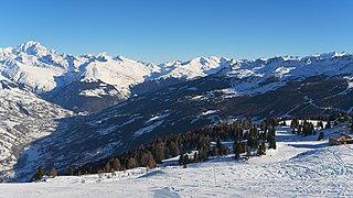
The Jura Mountains are a sub-alpine mountain range a short distance north of the Western Alps and mainly demarcate a long part of the French–Swiss border. While the Jura range proper is located in France and Switzerland, the range continues as the Table Jura northeastwards through northern Switzerland and Germany.

<span class="mw-page-title-main">Gex, Ain</span> Subprefecture and commune in Auvergne-Rhône-Alpes, France

Gex is a commune in the Ain department in eastern France and a subprefecture of the department.

<span class="mw-page-title-main">Ornex</span> Commune in Auvergne-Rhône-Alpes, France

Ornex is a commune in the Ain department in eastern France.

<span class="mw-page-title-main">Crozet, Ain</span> Commune in Auvergne-Rhône-Alpes, France

Crozet is a commune in the Ain department in eastern France.

<span class="mw-page-title-main">Anglefort</span> Commune in Auvergne-Rhône-Alpes, France

Anglefort is a commune in the department of Ain in the Auvergne-Rhône-Alpes region of eastern France.

<span class="mw-page-title-main">Bellegarde-sur-Valserine</span> Part of Valserhône in Auvergne-Rhône-Alpes, France

Bellegarde-sur-Valserine is a former commune in the Ain department in the Auvergne-Rhône-Alpes region in Eastern France. In 2019, it had a population of 11,326. On 1 January 2019, it was merged into the new commune of Valserhône.

<span class="mw-page-title-main">Belleydoux</span> Commune in Auvergne-Rhône-Alpes, France

Belleydoux is a commune in the Ain department in eastern France.

<span class="mw-page-title-main">Arrondissement of Gex</span> Arrondissement in Auvergne-Rhône-Alpes, France

The arrondissement of Gex is an arrondissement of France in the Ain department in the Auvergne-Rhône-Alpes region. It approximately corresponds to the historical region of the Pays de Gex. It has 27 communes. Its population is 93,027 (2016), and its area is 404.9 km2 (156.3 sq mi).

<span class="mw-page-title-main">Arrondissement of Nantua</span> Arrondissement in Auvergne-Rhône-Alpes, France

The arrondissement of Nantua is an arrondissement of France in the Ain department in the Auvergne-Rhône-Alpes region. It has 62 communes. Its population is 93,404 (2016), and its area is 899.6 km2 (347.3 sq mi).

<span class="mw-page-title-main">La Dôle</span> Mountain in Switzerland

La Dôle is a mountain of the Jura, overlooking Lake Geneva in the westernmost part of the canton of Vaud. Rising to an altitude of 1677 meters, it is the second highest peak in the Swiss portion of the Jura, after Mont Tendre. Administratively, the summit is split between the municipalities of Gingins, Chéserex and La Rippe. The mountain is also close to and easily accessible from Saint-Cergue and the Col de la Givrine to the north, both above 1000 meters and connected to Nyon on Lake Geneva by road and by the Nyon–St-Cergue–Morez Railway. A paved road also climbs to the Chalet de la Dôle below the summit from Gingins.

The Route nationale 5, or RN 5, is a trunk road (nationale) in France now connecting Dijon with the frontier of Switzerland. It is also numbered the European route E21.

<span class="mw-page-title-main">Saint-Genis-Pouilly</span> Commune in Auvergne-Rhône-Alpes, France

Saint-Genis-Pouilly is a commune in the Ain department within the Auvergne-Rhône-Alpes region of eastern France.

<span class="mw-page-title-main">Col de la Faucille</span> Mountain pass in France

Col de la Faucille is a high mountain pass in the department of Ain in the French Jura Mountains. It connects the town of Gex in Ain to the towns of Les Rousses and Saint-Claude in the department of Jura.

<span class="mw-page-title-main">Sergy, Ain</span> Commune in Auvergne-Rhône-Alpes, France

Sergy is a commune in the Ain department in eastern France.

<span class="mw-page-title-main">Valserine</span> River in eastern France

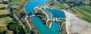
The river Valserine is a tributary of the Rhône that flows for 47.6 kilometres (29.6 mi) from the Col de la Faucille in the Jura Mountains to its confluence with the Rhône at Bellegarde-sur-Valserine. The Valserine Valley has great charm; it includes the Pont des Pierres that spans the river between Montanges and Mulaz, as well as the Pertes de la Valserine just north of Bellegarde-sur-Valserine, a canyon in which during the dry season the Valserine runs underground.

<span class="mw-page-title-main">Parc naturel régional du Haut-Jura</span>

Parc naturel régional du Haut-Jura is a French regional natural park located in the southwest of the Jura Mountain Range in France, on the French-Swiss border.

Communauté d'agglomération du Pays de Gex is the communauté d'agglomération, an intercommunal structure, centred on the town of Gex. It is located in the Ain department, in the Auvergne-Rhône-Alpes region, eastern France. Created in 1995, the administrative seat is located in its namesake commune of Gex. Its area is 404.9 km2. Its population was 98,257 in 2019, of which 13,121 lived in Gex proper.

References

  1. "Répertoire national des élus: les maires" (in French). data.gouv.fr, Plateforme ouverte des données publiques françaises. 13 September 2022.
  2. "Populations légales 2020". The National Institute of Statistics and Economic Studies. 29 December 2022.
  3. Population en historique depuis 1968, INSEE