Kunwarmau is a village in Chhatoh block of Rae Bareli district, Uttar Pradesh, India. It is located 11 km from Jais, the nearest large town. As of 2011, Kunwarmau has a population of 5,184 people, in 992 households. It has one primary school and no healthcare facilities.

Shahpur is a village in Lalganj block of Rae Bareli district, Uttar Pradesh, India. It is located 8 km from Lalganj, the block and tehsil headquarters. As of 2011, it has a population of 689 people, in 126 households. It has 1 primary school and no healthcare facilities, and it hosts both a permanent market and a weekly haat. It belongs to the nyaya panchayat of Behta Kalan.

Chak Nizam is a village in Rahi block of Rae Bareli district, Uttar Pradesh, India. It is located 8 km from Rae Bareli, the district headquarters. As of 2011, it has a total population of 806 people, in 137 households. It has one primary school and no medical facilities and it does not host a weekly haat or a permanent market. It belongs to the nyaya panchayat of Bhaon.
Bakwara is a village in Rahi block of Rae Bareli district, Uttar Pradesh, India. It is located 15 km from Rae Bareli, the district headquarters. As of 2011, it has a total population of 1,540 people, in 257 households. It has one primary school and no medical facilities and it hosts a weekly haat but not a permanent market. It belongs to the nyaya panchayat of Rustampur.
Chak Lodipur is a village in Rahi block of Rae Bareli district, Uttar Pradesh, India. It is located 8 km from Rae Bareli, the district headquarters. As of 2011, it has a total population of 449 people, in 89 households. It has one primary school and no medical facilities and it does not host a weekly haat or a permanent market. It belongs to the nyaya panchayat of Rustampur.
Saidanpur is a village in Rahi block of Rae Bareli district, Uttar Pradesh, India. It is located 9 km from Rae Bareli, the district headquarters. As of 2011, it has a total population of 1,854 people, in 330 households. It has one primary school and no medical facilities and it hosts a permanent market but not a weekly haat. It belongs to the nyaya panchayat of Khagipur Sandwa.
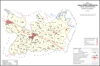
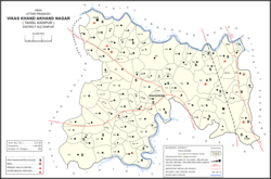
Gaimau is a village in Jagdishpur block of Sultanpur district, Uttar Pradesh, India. It is located 50 km from Sultanpur, the district headquarters. As of 2011, it has a population of 1,617 people, in 255 households. It has one primary school and no healthcare facilities and does not host a permanent market or weekly haat. It belongs to the nyaya panchayat of Harimau.

Muradabad is a village in Akhand Nagar block of Kadipur tehsil in Sultanpur district, Uttar Pradesh, India. As of 2011, it has a population of 1,543 people, in 238 households. It has one primary school and no healthcare facilities and it hosts both a regular market and a weekly haat. It belongs to the nyaya panchayat of Sajampur.
Karai is a village in Akhand Nagar block of Kadipur tehsil in Sultanpur district, Uttar Pradesh, India. As of 2011, it has a population of 1,399 people, in 196 households. It has one primary school and no healthcare facilities and it does not host a regular market or a weekly haat. It belongs to the nyaya panchayat of Sajampur.
Raipur is a village in Akhand Nagar block of Kadipur tehsil in Sultanpur district, Uttar Pradesh, India. As of 2011, it has a population of 1,738 people, in 307 households. It has one primary school and no healthcare facilities and it does not host a regular market or a weekly haat. It belongs to the nyaya panchayat of Sajampur.
Ramnagar is a village in Akhand Nagar block of Kadipur tehsil in Sultanpur district, Uttar Pradesh, India. As of 2011, it has a population of 983 people, in 144 households. It has no healthcare facilities and it does not host a regular market or a weekly haat. It belongs to the nyaya panchayat of Sajampur.

Daulatpur is a village in Kadipur block of Kadipur tehsil in Sultanpur district, Uttar Pradesh, India. As of 2011, it has a population of 1,261 people, in 172 households. It has one primary school and no healthcare facilities and it does not host a regular market or a weekly haat. It belongs to the nyaya panchayat of Kalikapur Kalan.

Masirpur is a village in Jaisinghpur block of Sultanpur district, Uttar Pradesh, India. As of 2011, it has a population of 967 people, in 163 households. It has no schools and no healthcare facilities. It belongs to the nyaya panchayat of Jaisinghpur.
Daulatpur is a village in Jaisinghpur block of Sultanpur district, Uttar Pradesh, India. As of 2011, it has a population of 974 people, in 169 households. It has one primary school and no healthcare facilities and it does not host a permanent market or weekly haat. It belongs to the nyaya panchayat of Saraiya.

Bhawanshahpur is a village in Gauriganj block of Amethi district, Uttar Pradesh, India. As of 2011, it has a population of 821 people, in 154 households. It has no schools and no healthcare facilities and does not host a permanent market or weekly haat. It belongs to the nyaya panchayat of Semuai.
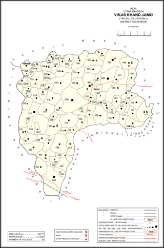
Jamo, also spelled Jamun or Jamon, is a village and community development block headquarters in Gauriganj tehsil of Amethi district, Uttar Pradesh, India. As of 2011, it has a population of 6,734 people, in 1,182 households. It was historically the capital of the pargana of Gaura Jamun. It is located at the intersection of four minor district roads, some of which are prone to flooding during the rainy season.
Dakhinwara is a village in Jamo block of Amethi district, Uttar Pradesh, India. As of 2011, it has a population of 3,840 people, in 613 households. It has two primary schools and one maternity and child welfare centre and it hosts a weekly haat but not a periodic market. It belongs to the nyaya panchayat of Jamo.
Katari is a village in Jamo block of Amethi district, Uttar Pradesh, India. It is located by a stream called the Naiya or Kandu nala, which flows east toward the Gomti river. The main highway from Lucknow to Jaunpur passes further north. Katari was historically the seat of a taluqdari estate held by a leading branch of the Kanhpuria Rajputs.
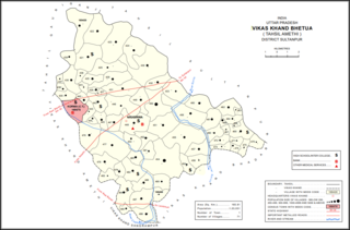
Bhetua is a village in Amethi tehsil of Amethi district, Uttar Pradesh, India. As of 2011, it has a population of 1,680 people, in 260 households. It has one primary school and no healthcare facilities and does not host a weekly haat or permanent market. Bhetua serves as the headquarters of a community development block, which includes 71 rural villages as well as the census town of Korwa. It also serves as the headquarters of a nyaya panchayat that also includes 14 other villages.
Piparpur is a village in Bhetua block of Amethi district, Uttar Pradesh, India. As of 2011, it has a population of 1,025 people, in 186 households. It has one primary school and no healthcare facilities and hosts a weekly haat but not a permanent market. It belongs to the nyaya panchayat of Amey Maphi.