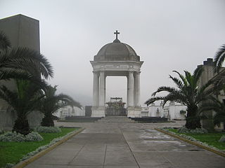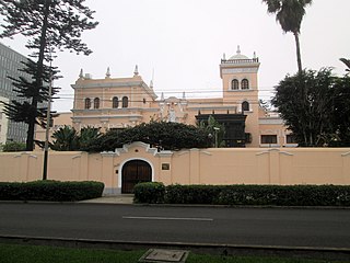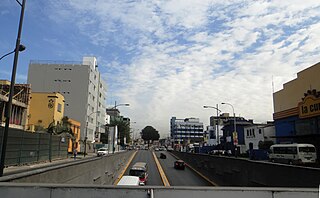
La Victoria is one of the forty-three districts that make up the province of Lima, located in Peru. It borders to the north and northeast with the district of Lima, to the east with the district of San Luis, to the southeast with the district of San Borja, to the south with the district of San Isidro, and to the west with the district of Lince and again with the Lima district. La Victoria is a historical and very busy public district located in downtown Lima. The current mayor of La Victoria is Rubén Dioscorides Andrés Cano Altez.

Jesús María is one of the most centrally located districts of Lima, Peru. It is an upper class, high-density district and it usually ranks in the top districts with the best quality of life in Peru with an HDI of 0.8372 (2019), only behind the districts of La Molina and Lince.

Presbyter Matías Maestro Cemetery, formerly the General Cemetery of Lima, is a cemetery, museum and historical monument located in the Barrios Altos neighbourhood of Lima District, in Lima, Peru. Inaugurated on May 31, 1808, it was the first pantheon in the city since burials were previously held in the city's churches. It was named in honour of its designer, Spanish priest Matías Maestro.

The Campo de Marte, also known as the Plaza de la Revolución, is a public park in Jesús María District, Lima, Peru. It is one of the largest parks in the metropolitan area of the city, and similar in size to the Park of the Exhibition and the Park of the Reserve. It was originally part of the Santa Beatriz area of Lima District and, from 1903 to 1938, housed the Santa Beatriz Hippodrome until its replacement by the one in San Felipe estate, located further south in the district.

Limatambo International Airport(IATA: LIM, ICAO: SPIM) was an airport of Lima, Peru that operated from its inauguration by Óscar R. Benavides in 1935 until its closure on New Year's Day of 1964, when it was replaced by the Jorge Chávez International Airport in Callao. Today, the terminal is the headquarters of the Ministry of the Interior of Peru, and the runways are incorporated within the city as the Guardia Civil and José Gálvez Barrenechea avenues.

The Embassy of the United States in Lima is the official diplomatic mission of the United States of America to the Republic of Peru. The chancery is located in the upper-scale district of Santiago de Surco since 1995.

The Embassy of the Russian Federation in Lima is the official diplomatic mission of Russia to the Republic of Peru. It served as the embassy of the Soviet Union from its inauguration until the country's dissolution in 1991.

Arequipa Avenue, formerly known as Leguía Avenue, is one of the main avenues of Lima, Peru. It extends from north to south in the districts of Lima, Lince, San Isidro and Miraflores along 52 blocks. It has a bike path located along its entire central berm.

The Moorish Arch, also called the Friendship Arch or Spanish Arch, was a triumphal arch installed at the beginning of Leguía Avenue in Lima, Peru. It was made in a neo-Moorish style, inaugurated in 1924 as part of the Centennial of the Independence of Peru and demolished in 1939.

28 de Julio Avenue is one of the main avenues in the city of Lima, Peru. It extends from west to east in the districts of Jesús María, Lima and La Victoria along 31 blocks.

St. Rose Bridge is one of the main bridges located in the historic centre of Lima, Peru. It connects Lima with Rímac District and follows the path of Tacna Avenue. It is named after the Sanctuary of Saint Rose of Lima, located next to its southern entrance.

Uruguay Avenue is an avenue of the historic centre of Lima, Peru. It begins at its intersection with the Jirón de la Unión and continues until it reaches Alfonso Ugarte Avenue, where its path is continued by Venezuela Avenue, which crosses the entirety of the city until it reaches Callao.

Brazil Avenue, formerly known as Magdalena or Piérola, is a major avenue in Lima, Peru. It crosses the districts of Lima, Breña, Jesús María, Pueblo Libre, and Magdalena del Mar. It has a total length of forty-two city blocks.

The Hippodrome of Santa Beatriz was a hippodrome located in Jesús María District, Lima, Peru. Now almost completely demolished, its former premises are now occupied by El Campo de Marte.

The Hippodrome of San Felipe was a hippodrome located next to Salaverry Avenue in Jesús María District, Lima, Peru. It was preceded by the racetrack in Santa Beatriz, disestablished with the expansion of the city of Lima. It has since been demolished, with its premises currently occupied by the Residencial San Felipe.

María Graña Ottone Friendship Park is a public park located at the intersection of Alfredo Benavides and Caminos del Inca avenues, in Santiago de Surco, Lima, Peru. It features a monumental arch based on the one that once stood at Arequipa Avenue, in Lima District.

Caminos del Inca Avenue is a major avenue that crosses through the district of Santiago de Surco in Lima, Peru. It starts at its intersection with Angamos Avenue, and continues southbound until it reaches Tomás Marsano Avenue.

Óscar R. Benavides Avenue, formerly known as Colonial Avenue, is a major avenue in Lima, Peru. It connects Lima District of the eponymous province with the districts of Bellavista and Callao of the neighbouring city, both within the Lima Metropolitan Area.

Edgardo Rebagliati Martins National Hospital, formerly known as the Central Hospital of Lima and as the Employee Hospital is a Level IV public hospital in Jesús María District, Lima, Peru. Named after its promoter, Edgardo Rebagliati, it is the most important social security hospital complex in Peru.

Heroes of Independence Park, originally known as Matamula Forest, is a public park next to Salaverry Avenue in Jesús María District, Lima.


