Saline Landing, Illinois

Last updated
Saline Landing, Illinois
Saline Landing main street.jpg
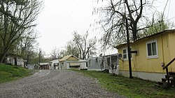
The community's main street
USA Illinois location map.svg
Red pog.svg
Saline Landing
Usa edcp location map.svg
Red pog.svg
Saline Landing
Coordinates: 37°34′12″N88°07′49″W / 37.57000°N 88.13028°W / 37.57000; -88.13028 Coordinates: 37°34′12″N88°07′49″W / 37.57000°N 88.13028°W / 37.57000; -88.13028
Country United States
State Illinois
County Hardin
Elevation
[1]
381 ft (116 m)
Time zone UTC-6 (Central (CST))
  Summer (DST) UTC-5 (CDT)
Area code 618
GNIS feature ID425440 [1]

Saline Landing is an unincorporated community in northeast Hardin County, Illinois, United States. [1] Saline Landing is located on the Ohio River at the mouth of the Saline River.

It is adjacent to Saline Island which is listed on the National Register of Historic Places.

Related Research Articles

<span class="mw-page-title-main">Saline County, Illinois</span> County in Illinois, United States

Saline County is a county in Southern Illinois. At the 2020 census, it had a population of 23,768. The largest city and county seat is Harrisburg. This area of Southern Illinois is known locally as "Little Egypt".

<span class="mw-page-title-main">Hardin County, Illinois</span> County in Illinois, United States

Hardin County is a county located in the U.S. state of Illinois. According to the 2020 census, it has a population of 3,649, making it the least populous county in Illinois. Its county seat is Elizabethtown. Hardin County is located in the part of the state known as Little Egypt. Hardin County was named for Hardin County, Kentucky, which was named in honor of Colonel John Hardin, an officer in the American Revolutionary War and the Northwest Indian War.

<span class="mw-page-title-main">Gallatin County, Illinois</span> County in Illinois, United States

Gallatin County is a county located in the U.S. state of Illinois. According to the 2020 census, it has a population of 4,946, making it the third-least populous county in Illinois. Its county seat is Shawneetown. It is located in the southern portion of Illinois known locally as Little Egypt. Located at the mouth of the Wabash River, Gallatin County, along with neighboring Posey County, Indiana, and Union County, Kentucky form the tri-point of the Illinois-Indiana-Kentucky Tri-State Area.

<span class="mw-page-title-main">Equality, Illinois</span> Village in Illinois, United States

Equality is a village in Gallatin County, Illinois, United States. The population was 595 at the 2010 census, down from 721 at the 2000 census. Near the village are two points of interest, the Crenshaw House and the Garden of the Gods Wilderness. Equality was the county seat of Gallatin County from 1826–1851.

<span class="mw-page-title-main">Harrisburg, Illinois</span> Settlement in Illinois, United States

Harrisburg is a city in and the county seat of Saline County, Illinois, United States. It is located about 57 miles southwest of Evansville, Indiana, and 111 mi (179 km) southeast of St. Louis, Missouri. Its 2020 population was 8,219, and the surrounding Harrisburg Township had a population of 10,037, including the city residents. Harrisburg is included in the Illinois–Indiana–Kentucky tri-state area and is the principal city in the Harrisburg micropolitan statistical area with a combined population of 24,913.

Saline may refer to:

<span class="mw-page-title-main">Vermilion River (Wabash River tributary)</span> River in the United States

The Vermilion River is a tributary of the Wabash River in the states of Illinois and Indiana, United States.

<span class="mw-page-title-main">Saline River (Illinois)</span> River in Illinois, United States

The Saline River is a tributary of the Ohio River, approximately 27 miles (43 km) long, in the Southern Illinois region of the U.S. state of Illinois. The river drains a large section of southeast Illinois, with a drainage basin of 1,762 square miles (4,564 km2). The major tributaries include the South Fork, Middle Fork and North Fork, all lying within the Saline Valley. The once meandering swampy river was important among Native Americans and early settlers as a source of salt from numerous salt springs where it was commercially extracted in the early 19th century.

<span class="mw-page-title-main">Boneyard Creek</span> Creek in Illinois, U.S.

Boneyard Creek is a 3.3-mile-long (5.3 km) waterway that drains much of the cities of Champaign and Urbana, Illinois. It is a tributary of the Saline Branch of the Salt Fork Vermilion River, which is a tributary of the south-flowing Vermilion River and the Wabash River. The creek flows through the northern sections of the campus of the University of Illinois Urbana-Champaign. The newsletter of the university's ACM chapter is Banks of the Boneyard, named after the creek.

The Ray Norbut State Fish and Wildlife Area is a 1,140-acre (460 ha) state park located near Griggsville in Pike County, Illinois. It borders on the Illinois River and is primarily made of steeply sloped bluffland that is part of the river's valley. Heavily wooded, this region is managed for whitetail deer hunting. The Ray Norbut complex also includes Big Blue Island, a 100-acre (40 ha) riparian island in the Illinois River. The park is managed by the Illinois Department of Natural Resources (IDNR).

Griggsville Landing, also known as Phillips Landing or Phillips Ferry, was located in Flint Township, just south of Valley City, Illinois. It is a former town site on the Illinois River in Pike County. The town was a steamboat stop which began sometime in the 1830s. There was a lime kiln there that was part of a commercial lime operation prior to post-Civil War industrial intensification in the lime industry. The town at Griggsville Landing was home to a boat yard, a grist mill and a hotel in addition to the Griggsville Landing Lime Kiln, built around 1850, which is still standing as of 2007. The town was eventually abandoned, rendering it a ghost town. Griggsville Landing is adjacent to the Ray Norbut State Fish and Wildlife Area.

Saline County State Fish and Wildlife Area is an Illinois state park on 1,270 acres (510 ha) in Saline County, Illinois, United States.

Saline River may refer to:

<span class="mw-page-title-main">Illinois–Indiana–Kentucky tri-state area</span> Tri-state region of the United States

The Illinois–Indiana–Kentucky tri-state area is a tri-state area where the U.S. states of Illinois, Indiana, and Kentucky intersect. The area is defined mainly by the television viewing area and consists of ten Illinois counties, eleven Indiana counties, and nine Kentucky counties, centered upon the Ohio and Wabash Rivers.

La Saline is an abandoned village located in Beauvais Township in Sainte Genevieve County, Missouri, United States. La Saline is located approximately six miles south of Sainte Genevieve.

<span class="mw-page-title-main">Illinois Salines</span> Archaeological site in Illinois, United States

The Illinois Salines, also known as the Saline Springs or Great Salt Springs, is a salt spring site located along the Saline River in Gallatin County, Illinois. The site was a source of salt for Illinois' prehistoric settlers and is now an archaeological site with a large quantity of organic remains. After European settlement of Illinois, the salt springs became part of Illinois' first major industry and were one of the only places in Illinois where slavery was legal after 1818.

<span class="mw-page-title-main">Saline County Courthouse (Illinois)</span> Local government building in the United States

The Saline County Courthouse is a government building in Harrisburg, the county seat of Saline County, Illinois, United States. Built in 1967, it is the fifth courthouse to serve the county and the third in Harrisburg.

<span class="mw-page-title-main">Saline Island (Kentucky)</span> United States historic place

Saline Island, also known as Johnson Island, in the Ohio River near Saline Landing, Illinois, has historical significance in 1862 and 1864 during the American Civil War when it was used for incursion into Illionois. It was listed on the National Register of Historic Places in 1998.

References