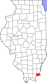
Hardin County is a county located in the U.S. state of Illinois. According to the 2020 census, it has a population of 3,649, making it the least populous county in Illinois. Its county seat is Elizabethtown. Hardin County is located in the part of the state known as Little Egypt. Hardin County was named for Hardin County, Kentucky, which was named in honor of Colonel John Hardin, an officer in the American Revolutionary War and the Northwest Indian War.

Elizabethtown is a village in and the county seat of Hardin County, Illinois, United States, along the Ohio River. The population was 220 at the 2020 census. It is the least-populous county seat in the state.
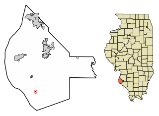
Fults is a village in the Renault precinct of Monroe County, Illinois, United States. The population was 28 at the 2020 census. It is located entirely within the American Bottom floodplain of the Mississippi River.
Belleview Precinct is located in Calhoun County, Illinois. The population was 227 at the 2020 census, down from 283 at the 2010 census, and it contained 144 housing units.
Crater Precinct is located in Calhoun County, Illinois, USA. As of the 2020 census the population was 502, a decline from 525 at the 2010 census.

Gilead Precinct is located in Calhoun County, Illinois. The population was 314 at the 2020 census, a decrease from 342 at the 2010 census.

Hamburg Precinct is located in Calhoun County, Illinois. The population at the 2020 census was 454, a decline from 561 at the 2010 census.

Hardin Precinct is located in Calhoun County, Illinois. The population was 1,170 at the 2020 census, a decrease from 1,330 at the 2010 census.
Richwood Precinct is located in Calhoun County, Illinois. The population was 844 at the 2010 census, an increase from 820 in 2000.
French Creek Precinct is one of the 12 precincts of Edwards County, Illinois. The precinct seat is Grayville. As of the 2020 census, the population was 922.

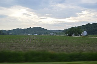
McFarlan Precinct is located in Hardin County, Illinois, USA. As of the 2020 census, its population was 527.

Monroe Precinct is located in Hardin County, Illinois, USA. As of the 2020 census, its population was 580.

Rock Precinct is located in Hardin County, Illinois, USA. As of the 2020 census, there were 155 households and a population of 411.

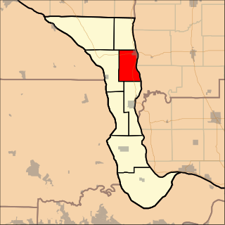
Stone Church Precinct is located in Hardin County, Illinois, USA. As of the 2020 census, its population was 524.

Cairo Precinct is located in Alexander County, Illinois, United States. As of the 2020 census, its population was 1,733. The precinct is coterminous with the city of Cairo.

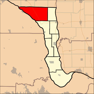
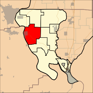
Rosiclare Precinct is located in Hardin County, Illinois, USA. As of the 2020 census, its population was 1,082. At some point prior to 2010, Rosiclare Precinct was formed from a merger of East Rosiclare and West Rosiclare Precincts.
Albion No. 3 is an election precinct, or township equivalent, in Edwards County, Illinois. As of the 2020 Census the population was 723.

Sandusky Precinct is located in Alexander County, Illinois, United States. As of the 2020 census, its population was 420.

Tamms Precinct is one of the seven precincts, or county divisions, in Alexander County, Illinois, United States. As of the 2020 census, its population was 899.
Thebes Precinct is located in Alexander County, Illinois, United States. As of the 2020 census, its population was 580.