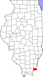
Elizabethtown is a village in and the county seat of Hardin County, Illinois, United States, along the Ohio River. The population was 220 at the 2020 census. It is the least-populous county seat in the state.

Brooklyn is a town in Clay and Brown townships, Morgan County, Indiana, United States. The population was 2,511 at the 2020 census, up from 1,598 in 2010.

Buckeye is a city in Hardin County, Iowa, United States. The population was 86 at the time of the 2020 census.

Petersburg is a city in Monroe County in the U.S. state of Michigan. The population was 1,171 at the 2020 census.

Alger is a village in Hardin County, Ohio, United States. The population was 837 at the 2020 census.

Mount Victory is a village in Hardin County, Ohio, United States. The population was 601 at the 2020 census.
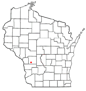
Jefferson is a town in Monroe County, Wisconsin, United States. The population was 800 at the 2000 census. The unincorporated community of St. Mary's is located within the town.
Belleview Precinct is located in Calhoun County, Illinois. The population was 227 at the 2020 census, down from 283 at the 2010 census, and it contained 144 housing units.
Crater Precinct is located in Calhoun County, Illinois, USA. As of the 2020 census the population was 502, a decline from 525 at the 2010 census.

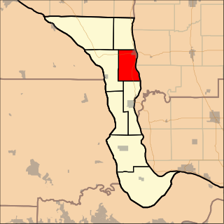
Gilead Precinct is located in Calhoun County, Illinois. The population was 314 at the 2020 census, a decrease from 342 at the 2010 census.

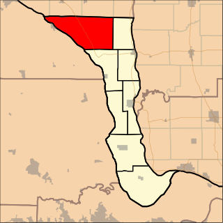
Hardin Precinct is located in Calhoun County, Illinois. The population was 1,170 at the 2020 census, a decrease from 1,330 at the 2010 census.
Richwood Precinct is located in Calhoun County, Illinois. The population was 844 at the 2010 census, an increase from 820 in 2000.
French Creek Precinct is one of the 12 precincts of Edwards County, Illinois. The precinct seat is Grayville. As of the 2020 census, the population was 922.

Cave-In-Rock Precinct is located in Hardin County, Illinois, USA. As of the 2020 census, its population was 525.

McFarlan Precinct is located in Hardin County, Illinois, USA. As of the 2020 census, its population was 527.

Rock Precinct is located in Hardin County, Illinois, USA. As of the 2020 census, there were 155 households and a population of 411.

Stone Church Precinct is located in Hardin County, Illinois, USA. As of the 2020 census, its population was 524.

Cairo Precinct is located in Alexander County, Illinois, United States. As of the 2020 census, its population was 1,733. The precinct is coterminous with the city of Cairo.

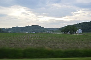
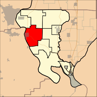
Rosiclare Precinct is located in Hardin County, Illinois, USA. As of the 2020 census, its population was 1,082. At some point prior to 2010, Rosiclare Precinct was formed from a merger of East Rosiclare and West Rosiclare Precincts.
Thebes Precinct is located in Alexander County, Illinois, United States. As of the 2020 census, its population was 580.