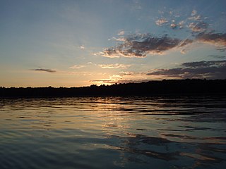
Negwegon State Park is an undeveloped public recreation area in Alpena County and Alcona County, Michigan, lying 5 miles (8.0 km) southeast of the unincorporated community of Ossineke. The state park's 3,738 acres (1,513 ha) include low land areas with small ridges, mature pine forest, pockets of open meadows, and a long sand beach on Lake Huron.

Fountain Bluff Township is one of sixteen townships in Jackson County, Illinois, USA. As of the 2010 census, its population was 208 and it contained 110 housing units.

Grand Tower Township is one of sixteen townships in Jackson County, Illinois, USA. As of the 2010 census, its population was 707 and it contained 336 housing units.

Kinkaid Township is one of sixteen townships in Jackson County, Illinois, USA. As of the 2010 census, its population was 486 and it contained 227 housing units.

Levan Township is one of sixteen townships in Jackson County, Illinois, USA. As of the 2010 census, its population was 850 and it contained 365 housing units.

Murphysboro Township is one of sixteen townships in Jackson County, Illinois, USA. As of the 2010 census, its population was 10,563 and it contained 5,174 housing units.

Pomona Township is one of sixteen townships in Jackson County, Illinois, USA. As of the 2010 census, its population was 802 and it contained 372 housing units.

Somerset Township is one of sixteen townships in Jackson County, Illinois, USA. As of the 2010 census, its population was 4,205 and it contained 1,886 housing units.

Grimsby is an unincorporated community in Sand Ridge Township, Jackson County, Illinois, United States. Grimsby is located on County Route 6 and the Union Pacific Railroad 6.3 miles (10.1 km) west of Murphysboro.

Crain is an unincorporated community in Kinkaid Township, Jackson County, Illinois, United States. Crain is located on Illinois Route 3, 9.5 miles (15.3 km) west of Murphysboro.

Farm Ridge is an unincorporated community in Farm Ridge Township, LaSalle County, Illinois, United States. Farm Ridge is 4.3 miles (6.9 km) west of Grand Ridge.

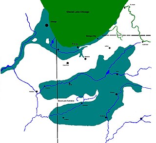
Lake Kankakee formed 14,000 years before present (YBP) in the valley of the Kankakee River. It developed from the outwash of the Michigan Lobe, Saginaw Lobe, and the Huron-Erie Lobe of the Wisconsin glaciation. These three ice sheets formed a basin across Northwestern Indiana. It was a time when the glaciers were receding, but had stopped for a thousand years in these locations. The lake drained about 13,000 YBP, until reaching the level of the Momence Ledge. The outcropping of limestone created an artificial base level, holding water throughout the upper basin, creating the Grand Kankakee Marsh.

Neunert is an unincorporated community in Fountain Bluff Township, Jackson County, Illinois, United States. The community is located at the intersection of County Highways 9 and 10 3.3 miles (5.3 km) west of Gorham.

West Point is an unincorporated community in Bradley Township, Jackson County, Illinois, United States. The community is located along County Route 1 4.5 miles (7.2 km) west-southwest of Campbell Hill.

Jones Ridge is an unincorporated community in Degognia Township, Jackson County, Illinois, United States. The community is located along County Route 9 and the Union Pacific Railroad 9.5 miles (15.3 km) west-northwest of Gorham.

Etherton is an unincorporated community in Pomona Township, Jackson County, Illinois, United States. The community is located along Illinois Route 127 5.5 miles (8.9 km) south of Murphysboro.


