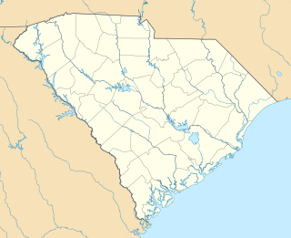
Sans Souci is a census-designated place (CDP) in Greenville County, South Carolina, United States. The population was 7,869 at the 2010 census. It is part of the Greenville-Anderson-Mauldin, SC Metropolitan Statistical Area.

Cap-Haïtien often referred to as Le Cap or Au Cap, is a commune of about 190,000 people on the north coast of Haiti and capital of the department of Nord. Previously named, Cap‑Français and Cap‑Henri, it was historically nicknamed the Paris of the Antilles, because of its wealth and sophistication, expressed through its beautiful architecture and artistic life. It was an important city during the colonial period, serving as the capital of the French Colony of Saint-Domingue from the city's formal foundation in 1711 until 1770 when the capital was moved to Port-au-Prince. After the Haitian Revolution, it became the capital of the Kingdom of Northern Haiti under King Henri Christophe until 1820.

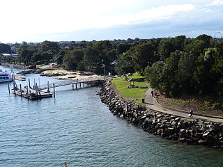
Dolls Point is a small suburb in southern Sydney, in the state of New South Wales, Australia. Dolls Point is located 17 km south of the Sydney central business district and is part of the St George area. Dolls Point is in the local government area of the Bayside Council.
Sans Souci, sometimes spelled Sans-Souci, Sans-souci, or Sanssouci, may refer to:

Sans Souci is a southern Sydney suburb in the state of New South Wales, Australia. Sans Souci is 17 kilometres south of the Sydney central business district and lies across the local government areas of the Bayside Council and the Georges River Council. It is part of the St George area.
San Souci, sometimes spelled Sansouci or SanSouci, may refer to:

Rockdale is an electoral district of the Legislative Assembly in the Australian state of New South Wales. Suburbs within the electoral district include Arncliffe, Banksia, Bardwell Park, Bardwell Valley, Beverley Park, Bexley, Bexley North, Brighton-Le-Sands, Dolls Point, Kogarah, Kogarah Bay, New South Wales, Kyeemagh, Monterey, Ramsgate, Ramsgate Beach, Rockdale, Sandrigham, Sans Souci, Turella and Wolli Creek.
Sans or SANS may refer to:

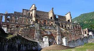
The Sans-Souci Palace is a palace in Haiti in the town of Milot, Nord, located approximately 5 kilometres (3.1 mi) northeast of the Citadelle Laferrière, and 13 kilometres (8.1 mi) southwest of the Three Bays Protected Area.

The Northern Kingdom of Haiti was the state established by Henri Christophe on 28 March 1811 when he was self-proclaimed as King Henri I after having previously ruled as president. This was Haiti's second attempt at monarchical rule, as Jean-Jacques Dessalines had previously ruled over the Empire of Haiti. Following the assassination of Emperor Jacques, the country was split. Henri ruled over the north of the country as President of the State of Haiti and Alexandre Pétion, a free person of color, ruled as President of the Republic of Haiti in the south.

Sans Souci is an unincorporated community in Clay Township of St. Clair County in the U.S. state of Michigan on the eastern shore of Harsens Island. The name is French and can be literally translated to "carefree", "without worries" or "without concerns".

George Lycurgus (1858–1960) was a Greek American businessman who played an influential role in the early tourist industry of Hawaii. He ran afoul of the government of the Republic of Hawaii and was accused of treason. Later he was instrumental in the development of the Hawaiian Volcano Observatory and Hawaiʻi Volcanoes National Park.

USS Sans Souci II (SP-301) was an armed motorboat that served in the United States Navy as a patrol vessel from 1917 to 1919.

The Sans Souci Hotel was a hotel located in Ballston Spa, Saratoga County, New York. It was built in 1803 and torn down in 1887.

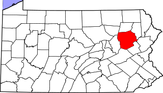
Korn Krest is a village in Hanover Township, Luzerne County, Pennsylvania. It is located in the Wyoming Valley between Wilkes-Barre and Nanticoke on the south side of the Sans Souci Parkway, which is a main thoroughfare connecting the two cities and is locally pronounced "San Suey." Hanover Township Area Jr/Sr High School is located in Korn Krest on the former site of Sans Souci Park, an amusement park that closed in 1970 and was first named Hanover Park from 1893 to 1905. The village uses the Wilkes-Barre/Hanover Township zip code of 18706.

The Sydney trolleybus system in New South Wales consisted of two unconnected lines in the Eastern Suburbs and St George areas of Sydney.

Sans Souci is an unincorporated community in Mississippi County, Arkansas, United States. Sans Souci is located on Arkansas Highway 198, 3.75 miles (6.04 km) south-southeast of Osceola.
Jean-Baptiste Sans-Souci was a leader of rebel slaves during the Haitian Revolution. He was assassinated by rival black rebel leader, Henri Christophe, in 1803, shortly before Haiti won its independence. Sans-Souci is notable as one of the most effective military leaders during the revolution, particularly against French forces led by Charles Leclerc in 1802 and 1803.
Sans Souci Valley was the name of a valley in San Francisco, California, in the area corresponding to present day's Lower Haight and Duboce Triangle neighborhoods. This valley once allowed excess storm water to flow from Buena Vista Hill and Lone Mountain, through the Panhandle, to the area located near Duboce Park, along the path today known to cyclists as The Wiggle. The creek was not a surface creek in the dune region except as overflow.


