KwaDukuza

Last updated
KwaDukuza
Stanger
South Africa KwaZulu-Natal location map.svg
Red pog.svg
KwaDukuza
South Africa adm location map.svg
Red pog.svg
KwaDukuza
Coordinates: 29°20′00″S31°17′30″E / 29.33333°S 31.29167°E / -29.33333; 31.29167
Country South Africa
Province KwaZulu-Natal
District iLembe
Municipality KwaDukuza
Established1825 as Dukuza, 1873 as Stanger [1]
Area
[2]
  Total102.37 km2 (39.53 sq mi)
Population
 (2023) [2]
  Total101,224
  Density990/km2 (2,600/sq mi)
Racial makeup (2011)
[2]
   Black African 53.0%
   Coloured 1.9%
   Indian/Asian 43.7%
   White 0.7%
  Other0.7%
First languages (2011)
[2]
   English 47.7%
   Zulu 46.0%
   Xhosa 1.4%
  Other4.8%
Time zone UTC+2 (SAST)
Postal code (street)
4449
PO box
4450

KwaDukuza , previously known as Stanger, is a city in KwaZulu-Natal, South Africa. In 2006, the municipal name was changed to KwaDukuza (which incorporates towns such as Stanger, Ballito and Shakaskraal), but the Zulu people in the area called it "Dukuza" well before then.

Contents

The city has undergone major economic construction since 2015, having built a multi-million rand regional shopping mall in 2018. [3] [4] [5] KwaDukuza also has a college called North Coast Agricultural College located in Shakaskraal.

History

Albert Luthuli statue in KwaDukuza Albert Luthuli.jpg
Albert Luthuli statue in KwaDukuza
King Shaka memorial stone in KwaDukuza Shaka Zulu Memorial.jpg
King Shaka memorial stone in KwaDukuza

The city was founded about 1820 by King Shaka and was named KwaDukuza (Zulu : Place of the Lost Person) because of the capital's labyrinth of huts. After Shaka was assassinated on 22 September 1828 during a coup by two of his half-brothers, Dingane and Umthlangana (Mhlangane), the city was burnt to the ground. In 1873, European settlers built a town on the site, naming it Stanger after William Stanger, the surveyor-general of Natal.

Stanger became a municipality in 1949 and is the commercial, magisterial and railway centre of an important sugar-producing district. A small museum adjoins the site of Shaka's grave, a grain pit in the city centre. The city and its vibrant inhabitants are surrounded by sugar cane fields, bush and the mahogany tree where Shaka held meetings, which still stands in front of the municipal offices. The Shaka Day festival, a colourful ceremony of 10,000 or more Zulus, is held at the KwaDukuza Recreation Grounds on 24 September every year. The festival is usually attended by dignitaries to mark the significance of the Zulu nation.

In 2006, the Minister of Arts and Culture approved a name change from Stanger to KwaDukuza, which was published in the Government Gazette of South Africa on 3 March 2006.

The KwaDukuza Museum houses historical items and information on Shaka, the sugar industry and local history. The city has a South Asian influence because of the influx of labourers from India in the late 19th and the early 20th centuries for sugarcane barons, such as Liege Hulett. The first few hundred Indian families left Port Natal for the cane farms on 17 November 1860. The importation of Indian labourers was stopped in 1911, when their numbers exceeded 100,000. Most Indians did not return when their work contracts expired, but exchanged their return-trip passes for money or property. The growth of the Indian community changed the economic and cultural nature of the city and has successfully developed it into what it is today. Celebrations include Diwali and the Winter Fair, the latter being a fundraiser for child welfare. [ citation needed ]

In July, 2021, the city was significantly impacted by large scale looting, vandalism, property damage and civil unrest caused during the 2021 South African unrest, much to the dismay of the Indian population. [6] [7] [8]

Law and government

KwaDukuza forms part of the KwaDukuza Local Municipality and the larger iLembe District Municipality, serving as the seat for both municipalities. It has a Magistrate's Court and most central and provincial government departments maintain regional branches or other offices in the town.

Geography

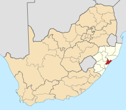
Located on the hilly North Coast of KwaZulu-Natal, KwaDukuza lies approximately 73 km (45 mi) north-west of Durban and 106 km (67 mi) south-west of Richards Bay. Morevover, the city is situated 8 kilometres (5 miles) inland from Blythedale Beach on the Mbozamo River.

The nearest settlements to KwaDukuza other than Blythedale Beach include Darnall (12 km), Shakaskraal (16 km), Tinley Manor Beach (18 km), Zinkwazi Beach (21 km) and Ballito (30 km).

Suburban areas [9]

Climate

The Köppen–Geiger climate classification system classifies the KwaDuzuka climate as humid subtropical (Cfa), [10] with more rain in the summer.

The highest record temperature was 43 °C (109 °F) on February 3, 2008, and the lowest record temperature was 5 °C (41 °F) on June 12, 2013. [11]

Climate data for KwaDukuza
MonthJanFebMarAprMayJunJulAugSepOctNovDecYear
Record high °C (°F)40
(104)
43
(109)
41
(106)
38
(100)
39
(102)
37
(99)
35
(95)
39
(102)
43
(109)
41
(106)
41
(106)
41
(106)
43
(109)
Mean daily maximum °C (°F)28.4
(83.1)
28.7
(83.7)
28.3
(82.9)
26.5
(79.7)
24.8
(76.6)
23.2
(73.8)
22.8
(73.0)
23.8
(74.8)
24.6
(76.3)
25.2
(77.4)
26.2
(79.2)
27.8
(82.0)
25.9
(78.5)
Daily mean °C (°F)24.2
(75.6)
24.5
(76.1)
23.9
(75.0)
21.8
(71.2)
19.4
(66.9)
17.3
(63.1)
16.9
(62.4)
18.2
(64.8)
19.6
(67.3)
20.8
(69.4)
21.9
(71.4)
23.5
(74.3)
21.0
(69.8)
Mean daily minimum °C (°F)20.1
(68.2)
20.4
(68.7)
19.5
(67.1)
17.1
(62.8)
14.1
(57.4)
11.5
(52.7)
11.1
(52.0)
12.6
(54.7)
14.6
(58.3)
16.4
(61.5)
17.7
(63.9)
19.3
(66.7)
16.2
(61.2)
Record low °C (°F)16
(61)
15
(59)
15
(59)
11
(52)
6
(43)
5
(41)
6
(43)
6
(43)
5
(41)
10
(50)
7
(45)
14
(57)
5
(41)
Average precipitation mm (inches)118
(4.6)
120
(4.7)
125
(4.9)
72
(2.8)
60
(2.4)
37
(1.5)
33
(1.3)
41
(1.6)
60
(2.4)
92
(3.6)
114
(4.5)
119
(4.7)
991
(39)
Source 1: Climate-Data.org (altitude: 60m) [10]
Source 2: Voodoo Skies for record temperatures [11]

Infrastructure

Healthcare

KwaDukuza has of two major hospitals, General Justice Gizenga Mpanza Regional Hospital, in the city centre which serves as iLembe's largest and main public hospital and the KwaDukuza Private Hospital, on the southern outskirts of the city which was opened in February 2018. [12] [13] Other than hospitals, KwaDukuza has three public clinics which fall under the jurisdiction of the General Justice Gizenga Mpanza Regional Hospital, including Glenhills Clinic, to the west of the city, KwaDukuza Clinic, just south of the city centre and the Nandi Clinic, north of the city. [14]

Schools

Rail Transport

KwaDukuza is located at the northern end of the North Coast Line, which is served by the commuter rail network, Metrorail KwaZulu-Natal and runs down south to Durban via Groutville, Shakaskraal, Umhlali, oThongathi (Tongaat), Verulam and Mount Edgecombe.

Road Transport

KwaDukuza lies just off the N2 highway between Empangeni and Durban. Furthermore, it is intersected by the R74, connecting the N2 to the east with Greytown to the north-west. The R102 connects the city via Groutville and Shakaskraal to oThongathi in the south and via Darnall to KwaGingindlovu in the north. Running east, a small road connects the R74 (at the interchange with the N2) with the coastal village of Blythedale Beach.

Tolling

The N2 is the main route forming the North Coast Toll Route (between eMdloti and Empangeni) which involves payment of toll: Traffic approaching KwaDukuza from the south and traffic heading south on the N2 (in the direction of Durban) must pass through the Mvoti Toll Plaza, about 10 kilometres (6 mi) south of the city. The R102 between Shakaskraal and KwaDukuza serves as an untolled alternative route to the N2 to avoid Mvoti Toll Plaza.

Notable residents

See also

Related Research Articles

<span class="mw-page-title-main">Ballito</span> Place in KwaZulu-Natal, South Africa

Ballito is an affluent coastal town located in KwaZulu-Natal, South Africa. Ballito is about 40 kilometres (25 mi) north of Durban and 24 kilometres south of KwaDukuza. It forms part of the KwaDukuza Local Municipality, and iLembe District Municipality. Dolphins and Whales are common on this stretch of the North Coast shoreline, hence the nickname Dolphin Coast. The name of the town Ballito is named after the Italian word for "small ball".

<span class="mw-page-title-main">Mount Edgecombe</span> Place in KwaZulu-Natal, South Africa

Mount Edgecombe or Mt Edgecombe is a town in KwaZulu-Natal, South Africa, situated just north of Durban, which forms part of eThekwini, the Greater Durban Metropolitan area. Much of the suburb is cordoned off as a gated settlement comprising resorts, golf courses and a retirement home. It was previously a sugar growing area. The population increased by 89% between 2001 and 2011 from 3,874 to 7,323. Its name is derived from the Earl of Mount Edgecombe in Cornwall, United Kingdom.

oThongathi Place in KwaZulu-Natal, South Africa

oThongathi, previously and still commonly known as Tongaat, is a town in KwaZulu-Natal, South Africa, about 40 kilometres (25 mi) north of Durban and 28 kilometres (17 mi) south of KwaDukuza. It now forms part of eThekwini Metropolitan Municipality, or the Greater Durban area. The area is home to the oldest Indian community in South Africa, having been where the first indentured Indian laborers settled in 1860 to work in the sugar-cane plantations. Much of the architectural style in the town was the work of Ivan Mitford-Barberton, and many buildings are in the Cape Dutch style of architecture.

<span class="mw-page-title-main">Verulam, KwaZulu-Natal</span> Place in KwaZulu-Natal, South Africa

Verulam is a town 24 kilometres north of Durban in KwaZulu-Natal, South Africa and forms part of the eThekwini Metropolitan Municipality, governing the Greater Durban metropolitan area.

<span class="mw-page-title-main">R74 (South Africa)</span>

The R74 is a provincial route in South Africa that connects Harrismith with KwaDukuza on the coast, via Oliviershoek Pass, Bergville, Winterton, Colenso, Weenen and Greytown.

<span class="mw-page-title-main">R102 (South Africa)</span> Regional Route in South Africa

The R102 is a Regional Route in South Africa. It is the route designation for all old sections of the N2, thus it is a discontinuous road that resumes in areas where a new N2 has been constructed.

<span class="mw-page-title-main">Umlazi</span> Place in KwaZulu-Natal, South Africa

Umlazi is a township in KwaZulu-Natal, South Africa, located south-west of Durban. Organisationally and administratively it forms part of the eThekwini Metropolitan Municipality and its South Municipal Planning Region.

<span class="mw-page-title-main">N2 (South Africa)</span> National road in South Africa

The N2 is a national route in South Africa that runs from Cape Town through George, Gqeberha, East London, Mthatha, Port Shepstone and Durban to Ermelo. It is the main highway along the Indian Ocean coast of the country. Its current length of 2,255 kilometres (1,401 mi) makes it the longest numbered route in South Africa.

<span class="mw-page-title-main">Salt Rock</span> Place in KwaZulu-Natal, South Africa

Salt Rock is a small coastal village just north of Ballito and Shaka's Rock situated along the Dolphin Coast of KwaZulu-Natal, South Africa. It is a favorite holiday destination for many local South Africans. It is approximately located 52 kilometres north-east of Durban and 19 km south-east of KwaDukuza. Salt Rock owes much of its history to Basil Hulett and his wife Gwen who started not only the Salt Rock Hotel but went on to develop the town of Salt Rock as found today.

Phoenix is a South African town about 25 kilometres (15 mi) northwest of Durban Central, in KwaZulu-Natal, South Africa. It was established as a town by the apartheid government in 1976, but it has a long history of Indian occupation. It is associated with the Phoenix Settlement, built by Mahatma Gandhi.

The M4 is a north–south metropolitan route in the eThekwini Metropolitan Municipality and partially in the KwaDukuza Local Municipality, South Africa. It runs from the N2 at the defunct Durban International Airport to Ballito via the Durban Central Business District (CBD) and uMhlanga. The sections between the airport and the southern edge of the CBD, and between the northern edge of the CBD and the exit to uMhlanga are classified as freeway. On the section from the southern edge of the CBD to the Bram Fischer Street/Soldier's Way junction, the M4 is cosigned with the R102.

Shaka's Rock is a beachside town situated along the North Coast of KwaZulu-Natal, South Africa.

<span class="mw-page-title-main">Shakaskraal</span> Place in KwaZulu-Natal, South Africa

Shakaskraal is a town in Ilembe District Municipality in the KwaZulu-Natal province of South Africa. The town is dominated by local businesses and informal traders and main activities located in and nearby is sugar cane farming.

The Mvoti River or uMvoti River is a river in the KwaZulu-Natal region of South Africa. The Mvoti River, in the vicinity of KwaDukuza, is subjected to extensive water abstraction, which is then utilised for irrigation, industrial use, urban water requirements and various domestic uses by informal settlements.

<span class="mw-page-title-main">South Coast (KwaZulu-Natal)</span> Coastal region in KwaZulu-Natal, South Africa

KwaZulu-Natal South Coast is a region along the southern stretch of coastline of KwaZulu-Natal, South Africa, south of the coastal city of Durban.

<span class="mw-page-title-main">North Coast (KwaZulu-Natal)</span> Coastal region in KwaZulu-Natal, South Africa

The KwaZulu-Natal North Coast, better known as the North Coast is a coastal region north of Durban in KwaZulu-Natal, South Africa. It stretches from Zinkwazi Beach in the north to Zimbali near Ballito in the south. The coastal region is governed by the KwaDukuza Local Municipality, forming part of the iLembe District Municipality.

Mobeni is a suburb of Durban in KwaZulu-Natal, South Africa and forms part of the heavily industrialised South Durban Basin, a sub-region south of Durban.

The M65 also named Dube Boulevard is a short metropolitan route in the eThekwini Metropolitan Municipality, South Africa linking the N2 and R102 to King Shaka International Airport and Dube TradePort in La Mercy, north of Durban.

Umhlali is a village on the North Coast of the KwaZulu-Natal province of South Africa, just inland from Salt Rock and approximately 50 km north-west of Durban. The name of the village, "Umhlali" derives from the Zulu name of the Monkey Orange tree - a small semi-deciduous tree that is predominant along the banks of the uMhlali River, north of the village.

<span class="mw-page-title-main">Westbrook, South Africa</span> Place in KwaZulu-Natal, South Africa

Westbrook, also known as Westbrook Beach is a coastal village on the North Coast of the KwaZulu-Natal province of South Africa, approximately 35 kilometres (22 mi) north-east of Durban and 7 kilometres (4 mi) east of oThongathi.

References

  1. "KwaDUKUZA / STANGER – A History". sahistory.org. Retrieved 2009-08-31.
  2. 1 2 3 4 "Main Place KwaDukuza". Census 2011.
  3. "Store Directory – Kwadukuza Regional Mall".
  4. "KWADUKUZA MALL CELEBRATES 2ND BIRTHDAY - 5 Star Durban - Showcasing Beautiful KwaZulu-Natal". Archived from the original on 2020-10-26.
  5. "KwaDukuza Mall's social media success | News24".
  6. "WATCH | Protesters storm KwaDukuza CBD and Tongaat in KZN | Witness".
  7. "WATCH: Mass looting across KwaDukuza and Mandeni | North Coast Courier".
  8. "Fear gripped KwaZulu-Natal residents on Monday night while others partied | Witness".
  9. "Census 2011: Main Place: Stanger". census2011.adrianfrith.com. Retrieved 2023-03-19.
  10. 1 2 "Climate: KwaDukuza - Climate graph, Temperature graph, Climate table". Climate-Data.org. Retrieved 2014-01-17.
  11. 1 2 "Stanger, South Africa". Voodoo Skies. Retrieved 2014-01-17.
  12. "General Justice Gizenga Mpanza Regional Hospital". www.kznhealth.gov.za. Retrieved 2023-03-20.
  13. "KwaDukuza Private Hospital – Private Healthcare Facility" . Retrieved 2023-03-20.
  14. "Clinics in Ilembe district". www.kznhealth.gov.za. Retrieved 2023-03-20.