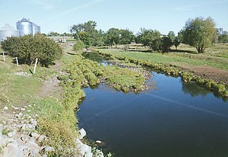
Sherburne County is a county in Central Minnesota. At the 2010 United States Census, the population was 88,499. The county seat is Elk River.

Glendorado Township is a township in Benton County, Minnesota, United States. The population was 762 as of the 2010 census.

St. George Township is a township in Benton County, Minnesota, United States. The population was 1,153 as of the 2010 census.

Becker is a city in Sherburne County, Minnesota, United States, between the Mississippi and Elk Rivers. The population was 4,538 at the 2010 census.

The Elk River is an 84.0-mile-long (135.2 km) river in east-central Minnesota in the United States. It is a tributary of the Mississippi River, draining a watershed of 630 square miles (1,600 km2).

The Saint Francis River is a 79.0-mile-long (127.1 km) tributary of the Elk River in east-central Minnesota in the United States. Via the Elk River, it is part of the watershed of the Mississippi River, draining an area historically characterized by mixed hardwood and coniferous forests on flat to rolling till plains.

Markham is an unincorporated community in Colvin Township, Saint Louis County, Minnesota, United States.

Greaney is an unincorporated community in Saint Louis County, Minnesota, United States. Greaney is located within ZIP code 55771, based in Orr.

Kelsey is an unincorporated community in Kelsey Township, Saint Louis County, Minnesota, United States.

Burnett is an unincorporated community in Industrial Township, Saint Louis County, Minnesota, United States.

Angora is an unincorporated community in Angora Township, Saint Louis County, Minnesota, United States.

Bear River is an unincorporated community in Itasca and Saint Louis counties in the U.S. state of Minnesota.

French River is an unincorporated community in Duluth Township, Saint Louis County, Minnesota, United States; located on the North Shore of Lake Superior.

Buyck is an unincorporated community in Portage Township, Saint Louis County, Minnesota, United States.

Clover Valley is an unincorporated community in Duluth Township, Saint Louis County, Minnesota, United States.

Wahlsten is an unincorporated community in Kugler Township, Saint Louis County, Minnesota, United States.

Gheen is an unincorporated community in Gheen Territory, Saint Louis County, Minnesota, United States, located one mile east of Gheen Corner on Willow River Road.

Orrock is an unincorporated community in Orrock Township, Sherburne County, Minnesota, United States.

Cable is an unincorporated community in Haven Township, Sherburne County, Minnesota, United States. The community is between Clear Lake and St. Cloud along U.S. Highway 10 near Sherburne County Road 65, 42nd Street SE.

Bailey is an unincorporated community in Big Lake Township, Sherburne County, Minnesota, United States. The community is located between Big Lake and Elk River near the junction of Sherburne County Roads 14 and 15, and U.S. Highway 10.


