


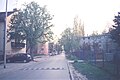
Satelit (Serbian : Сателит) is a small urban neighborhood of the city of Novi Sad, Serbia. In English it translates as “Satellite”. It is part of the larger Bistrica urban area and neighborhood.
Satelit (Serbian : Сателит) is a small urban neighborhood of the city of Novi Sad, Serbia. In English it translates as “Satellite”. It is part of the larger Bistrica urban area and neighborhood.
The southern border of Satelit is Futoški put (Futog Road), the western border is Bulevar Kneza Miloša (Knez Miloš Boulevard),the eastern border is Bulevar Slobodana Jovanovića (Slobodan Jovanović Boulevard) and the northern border is Bulevar Jovana Dučića (Jovan Dučić Boulevard).
The neighbouring settlements of Satelit are: Telep on the south, Novo Naselje on the north and east and Veternik on the west.
Some of the parts of Satelit are: Stari Satelit (Old Satelit) and Mali Satelit (Tozinovac).
The construction of Satelit began in 1957, when the first houses were built in the area now known as Tozinovac. Mass construction between 1976 and 1980 merged Satelit into the New Neighborhood (Novo Naselje), later named Bistrica. Between 2000 and 2020, most of Tozinovac was dismantled to make way for the Bate Brkića Boulevard extension, connecting it with Futoša street. Several new apartment buildings were constructed in the southern parts of Bate Brkića.
Some of the important features of Satelit are: Satelit Market (Satelitska pijaca), "Autokop" (a factory for production of idle parts for cars), and a stadium of "Mladost" football club. There is also an elementary school "Miloš Crnjanski" in the settlement.

Liman is an urban neighborhood of the city of Novi Sad, Serbia. It is located to the south of the city centre, along the Danube river, covering an area of 3.98 km2. It is a relatively new part of the city, built between 1960s and 1990s on what previously were marshes. It is divided into four parts, numbered by Roman numerals: Liman I, II, III and IV, which match the chronology of its development.

Adamovićevo Naselje is an urban neighborhood of the city of Novi Sad, Serbia.

Bistrica, also known as Novo Naselje, is an urban neighborhood of the city of Novi Sad, Serbia. Bistrica is one of the most populated urban areas of the city.

Telep is an urban neighborhood of the city of Novi Sad, Serbia.

Grbavica is an area of the city Novi Sad, Serbia.

Stari grad is an urban neighborhood of the city of Novi Sad, Serbia. It is the main part of Novi Sad, and it is also known as City Centre. In the Serbian language, the name "Stari grad" means "Old Town".

Sajmište is an urban neighborhood of the city of Novi Sad, Serbia.

Detelinara is an urban neighborhood of the city of Novi Sad, Serbia.

Rotkvarija, also known as Žitni Trg, is an urban neighborhood of the city of Novi Sad, Serbia.

Veternička Rampa is an urban neighborhood of the city of Novi Sad, Serbia.

Banatić is an urban neighborhood of the city of Novi Sad, Serbia. Its name means "a little Banat".

Jugovićevo is an urban neighborhood of the city of Novi Sad, Serbia. It is currently a developing neighborhood.

Avijatičarsko Naselje, also known as Avijacija, is an urban neighborhood of the city of Novi Sad, Serbia.

Slana Bara is an urban neighborhood of the city of Novi Sad, Serbia.

Bulevar is an urban neighborhood of the city of Novi Sad, Serbia. Its name simply means "boulevard" in Serbian. Bulevar is not a traditional city neighborhood; it is rather an informal neighborhood that includes parts of several traditional city quarters that are situated around 3 km long Liberation Boulevard, the main street in Novi Sad.
This is article about the infrastructure of Novi Sad.
This is a list of the neighbourhoods and suburbs of Novi Sad.

Klisa is an urban area of the city of Novi Sad, Serbia.

JGSP Novi Sad is a public transit company for the city of Novi Sad and is under the city's jurisdiction. The company conducts intercity lines for areas in Temerin, Žabalj, Sremski Karlovci, Inđija, Beočin, and Irig.

The Novi Sad tram system was a tram system in Novi Sad, Serbia. It was in operation between 30 September 1911 until some time in 1958.


| Neighborhoods |
|  |
|---|---|---|
| Suburbs | ||
| Culture | ||
| Religion | ||
| Museums and galleries |
| |
| Notable sights | ||
| Education | ||
| Health | ||
| Media | ||
| Sports |
| |
| Companies | ||
| Transportation | ||
| Events | ||