


Klisanski breg (Serbian : Klisanski breg), also known as Gornje Sajlovo (Serbian : Горње Сајлово) and Šumice (Serbian : Шумице), is an urban neighborhood of the city of Novi Sad, Serbia.
Klisanski breg (Serbian : Klisanski breg), also known as Gornje Sajlovo (Serbian : Горње Сајлово) and Šumice (Serbian : Шумице), is an urban neighborhood of the city of Novi Sad, Serbia.
In the past, this area was known as Gornje Sajlovo. In 1237, two villages named Sajlovo (Gornje Sajlovo and Donje Sajlovo) were mentioned to exist in this area. The original name of these settlements was Isailovo. The settlements were named after monk Isaija from a nearby monastery that existed in the 12th century, east of Rumenka. The name Sajlovo/Isailovo is of Slavic origin, which indicates that these settlements were initially inhabited by Slavs.
In the 16th century, the village was destroyed and later Ottoman defters mention Gornje Sajlovo as a heath that was inhabited by people, but not in the form of a settlement. In 1554, an Ottoman defter recorded that Sajlovo had three houses that paid taxes, while by 1570, the number of houses that paid taxes had increased to seven. However, since Ottoman defters did not record houses that were liberated from paying taxes, these records do not show the correct number of inhabitants in the area.
The eastern border of Klisanski breg is ulica Profesora Grčića (Profesora Grčića Street), the northern border is E75 international road, the north-western border is a north-western city limit of Novi Sad, while the southern border towards industrial zone is not entirely clear.
The neighbouring city quarters are: Klisa in the east, Rimski Šančevi in the north, and Industrijska Zona Sever (northern industrial zone) in the south.

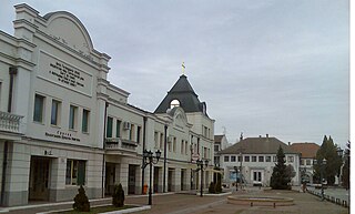
Novi Sad is the second largest city in Serbia after the capital Belgrade and the capital of the autonomous province of Vojvodina. It is located in the southern portion of the Pannonian Plain on the border of the Bačka and Syrmia geographical regions. Lying on the banks of the Danube river, the city faces the northern slopes of Fruška Gora and it is the fifth largest of all cities on the Danube river. It is the largest Danube city that is not the capital of an independent state.

Zrenjanin is a city and the administrative center of the Central Banat District in the autonomous province of Vojvodina, Serbia. The city urban area has a population of 67,129 inhabitants, while the city administrative area has 105,722 inhabitants. The old name for Zrenjanin is Veliki Bečkerek or Nagybecskerek as it was known under Austria-Hungary up until 1918. A thousand Catalans founded on 1735 New Barcelona in a place which is now the suburb of Dolja within Zrenjanin, exiled from the War of the Spanish Succession. After World War I and the liberation of Veliki Bečkerek the new name of the city was Petrovgrad, in honor of His Majesty King Peter I the Great Liberator, the King of Serbia and the King of Serbs, Croats and Slovenes.

Temerin is a town and municipality located in the South Bačka District of the autonomous province of Vojvodina in Serbia. The town has a population of 17,998, while the municipality has a population of 25,780.

Liman is an urban neighborhood of the city of Novi Sad, Serbia. It is located to the south of the city centre, along the Danube river, covering an area of 3.98 km2. It is a relatively new part of the city, built between 1960s and 1990s on what previously were marshes. It is divided into four parts, numbered by Roman numerals: Liman I, II, III and IV, which match the chronology of its development.

Bistrica, also known as Novo Naselje, is an urban neighborhood of the city of Novi Sad, Serbia. Bistrica is one of the most populated urban areas of the city.

Stari Grad is an urban neighborhood and the city center of Novi Sad, Serbia. In the Serbian language, the name "Stari Grad" means "Old Town".

Stari Ledinci also known simply as Ledinci is a suburban settlement of Petrovaradin, Novi Sad, Serbia.
Kać is a suburban settlement of the city of Novi Sad, Serbia. The town had a population of 11,612 in the 2011 census.

Jugovićevo is an urban neighborhood of the city of Novi Sad, Serbia. It is currently a developing neighborhood.

Bangladeš is a small Romani suburban settlement of the city of Novi Sad, Serbia.

Slana Bara is an urban neighborhood of the city of Novi Sad, Serbia.
Sajlovo or Donje Sajlovo is a neighborhood of the city of Novi Sad, Serbia.

This is a list of the neighbourhoods and suburbs of Novi Sad.

Novi Sad is the second largest city of Serbia. It began as a Stone Age settlement in present-day Petrovaradin. The Celts founded the first fortress at this location. During Roman rule, a larger fortress was built in the 1st century AD. It was devastated by the Huns in the 5th century and rebuilt by the Byzantines. The city passed through many other hands until being conquered by the Kingdom of Hungary. The city was first mentioned under the name Peturwarad or Petrovaradin in documents from 1237. It passed through the Ottoman Empire in the 16th century and the Habsburg monarchy in the 17th.

Kljajićevo is a village in Serbia. It is situated in the Sombor municipality, in the West Bačka District, Vojvodina province. The village has a Serb ethnic majority and its population numbered 6,012 people.

Klisa is an urban area of the city of Novi Sad, Serbia.

The City of Novi Sad Serbia has several industrial zones, which are, unlike non-industrial neighborhoods, mostly used for industrial purposes.
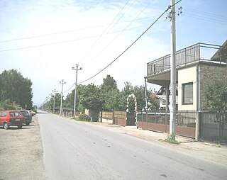
Rimski Šančevi is an urban neighborhood of the city of Novi Sad, Serbia. It is mostly an industrial zone, but it is partially a residential area as well.
This is demographic history of Bačka. This article contains data from various population censuses conducted in the region of Bačka during the history. Censuses from 1715 to 1910 contain data about population of the entire Bačka, while censuses from 1921 to 2002 contain data about population of the Yugoslav/Serbian part of Bačka.

JGSP Novi Sad is a public transit company for the city of Novi Sad and is under the city's jurisdiction. The company conducts intercity lines for areas in Temerin, Žabalj, Sremski Karlovci, Inđija, Beočin, and Irig.
