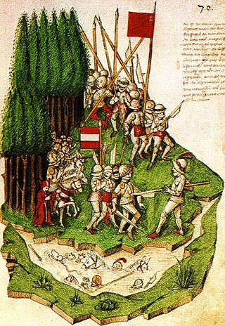
The Confederates prepared a road-block and an ambush at a point between Lake Aegeri and Morgarten pass where the small path led between the steep slope and a swamp. When about 1500 men attacked from above with rocks, logs and halberds, the knights had no room to defend themselves and suffered a crushing defeat, while the foot soldiers in the rear fled back to the city of Zug. A chronicler described the Confederates, unfamiliar with the customs of battles between knights, as brutally butchering everything that moved and everyone unable to flee. This founded the reputation of the Confederates as barbaric, yet fierce and respectable fighters.
Within a month of the battle, in December 1315, the Confederates renewed the oath of alliance made in 1291, initiating the phase of growth of the Old Swiss Confederacy. Within forty years, cities including Lucerne, Zug, Zürich and Bern had joined the confederation.
The victory of the Confederates left them in their virtual autonomy and gave them a breathing-space of some sixty years before the next Habsburg attack resulted in the Battle of Sempach (1386).
The French invasion of Switzerland in 1798 brought about a swift end of the Ancien Régime. The French victories against the larger cities of the swiss plateau led to the creation of the French supported Helvetic Republic on 12 April 1798. Following the declaration of the Republic, the Cantons of Uri, Schwyz and Nidwalden rejected it and raised an army to fight the French. Under Alois von Reding they were able to raise about 10,000 men. This army was deployed along the defensive line from Napf to Rapperswil. General Reding besieged French controlled Lucerne and marched across the Brünig Pass into the Berner Oberland to support the armies of Berne. At the same time, the French General Balthasar Alexis Henri Antoine of Schauenburg marched out of occupied Zürich to attack Zug, Lucerne and the Sattel pass. Even though the Reding's army won victories at Rothenthurm and Morgarten, Schauenburg's victory near Sattel allowed him to threaten the town of Schwyz. On 4 May 1798, the town council of Schwyz surrendered.[3]
Geography
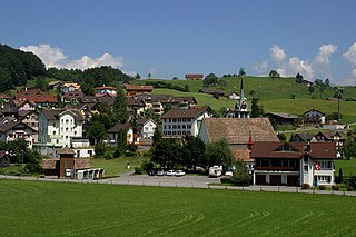
Sattel has an area, as of 2006[update], of 17.3km2 (6.7sqmi). Of this area, 55.7% is used for agricultural purposes, while 37.2% is forested. Of the rest of the land, 6.2% is settled (buildings or roads) and the remainder (0.9%) is non-productive (rivers, glaciers or mountains).[4]
During the last ice age the Reussgletschter completely covered the valley where Sattel currently stands and had two spurs arms up Unterägeri and Äussere Altmatt (Rothenthurm).
Demographics
Sattel has a population (as of 31 December 2020) of 1,925.[5]As of 2007[update], 8.5% of the population was made up of foreign nationals.[6] Over the last 10 years the population has grown at a rate of 18.5%. Most of the population (as of 2000[update]) speaks German (97.3%), with English being second most common ( 0.5%) and Albanian being third ( 0.4%).[4]
As of 2000[update] the gender distribution of the population was 51.4% male and 48.6% female. The age distribution, as of 2008[update], in Sattel is; 409 people or 29.2% of the population is between 0 and 19. 436 people or 31.1% are 20 to 39, and 360 people or 25.7% are 40 to 64. The senior population distribution is 118 people or 8.4% are 65 to 74. There are 62 people or 4.4% who are 70 to 79 and 17 people or 1.21% of the population who are over 80.[6]
As of 2000[update] there are 503 households, of which 134 households (or about 26.6%) contain only a single individual. 51 or about 10.1% are large households, with at least five members.[6]
In the 2007 election the most popular party was the SVP which received 54.7% of the vote. The next three most popular parties were the CVP (23.3%), the FDP (11.6%) and the SPS (7%).[4]
In Sattel about 60.7% of the population (between age 25-64) have completed either non-mandatory upper secondary education or additional higher education (either university or a Fachhochschule).[4]
Sattel has an unemployment rate of 0.69%. As of 2005[update], there were 183 people employed in the primary economic sector and about 60 businesses involved in this sector. 51 people are employed in the secondary sector and there are 12 businesses in this sector. 197 people are employed in the tertiary sector, with 49 businesses in this sector.[4]
From the 2000 census[update], 1,205 or 85.9% are Roman Catholic, while 96 or 6.8% belonged to the Swiss Reformed Church. Of the rest of the population, and there are less than 5 individuals who belong to another Christian church. There are 9 (or about 0.64% of the population) who are Islamic. There are 6 individuals (or about 0.43% of the population) who belong to another church (not listed on the census), 44 (or about 3.14% of the population) belong to no church, are agnostic or atheist, and 41 individuals (or about 2.92% of the population) did not answer the question.[6]
The historical population is given in the following table:[6]
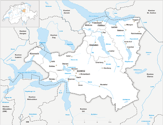
The canton of Schwyz is a canton in central Switzerland between the Alps in the south, Lake Lucerne to the west and Lake Zürich in the north, centred on and named after the town of Schwyz.
The 26 cantons of Switzerland are the member states of the Swiss Confederation. The nucleus of the Swiss Confederacy in the form of the first three confederate allies used to be referred to as the Waldstätte. Two important periods in the development of the Old Swiss Confederacy are summarized by the terms Acht Orte and Dreizehn Orte.
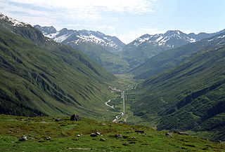
The canton of Uri is one of the 26 cantons of Switzerland and a founding member of the Swiss Confederation. It is located in Central Switzerland. The canton's territory covers the valley of the Reuss between the St. Gotthard Pass and Lake Lucerne.
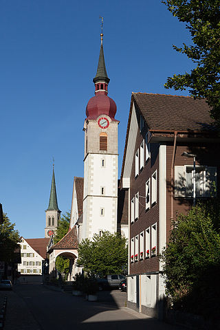
The canton of Zug or Zoug is one of the 26 cantons of Switzerland. It is located in central Switzerland and its capital is Zug. At 239 km2 (92 sq mi) the canton is one of the smallest of the Swiss cantons in terms of area. It is not subdivided into districts, but eleven municipalities.
The Battle of Morgarten took place on 15 November 1315, when troops of Schwyz, supported by their allies of Uri and Unterwalden, ambushed an Austrian army under the command of Leopold I, Duke of Austria on the shores of Lake Ägeri, in the territory of Schwyz.
Obwalden or Obwald is one of the 26 cantons forming the Swiss Confederation. It is composed of seven municipalities and the seat of the government and parliament is in Sarnen. It is traditionally considered a "half-canton", the other half being Nidwalden.
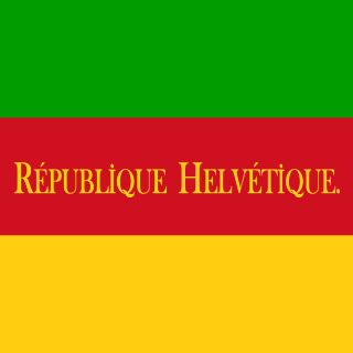
The Helvetic Republic was a sister republic of France that existed between 1798 and 1803, during the French Revolutionary Wars. It was created following the French invasion and the consequent dissolution of the Old Swiss Confederacy, marking the end of the ancien régime in Switzerland. Throughout its existence, the republic incorporated most of the territory of modern Switzerland, excluding the cantons of Geneva and Neuchâtel and the old Prince-Bishopric of Basel.
Cham is a municipality in the canton of Zug in Switzerland.
Dietwil is a municipality in the district of Muri in the canton of Aargau in Switzerland.
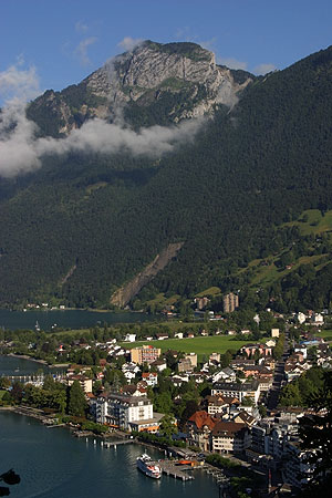
Gersau is a municipality and district in the canton of Schwyz in Switzerland, sitting on the shores of Lake Lucerne. Gersau was for many centuries an independent micro-state in permanent alliance with the Swiss Confederation.
Oberägeri, until 1798 simply known as Ägeri, is a municipality in the canton of Zug in Switzerland.
Unterägeri is a municipality in the canton of Zug in Switzerland.
Weggis is a municipality in the district of Lucerne in the canton of Lucerne in Switzerland.
Adligenswil is a municipality in Lucerne District in Canton of Lucerne in Switzerland. It is east of the city of Lucerne and borders on canton Schwyz.
Ingenbohl is a municipality in Schwyz District in the canton of Schwyz in Switzerland.
Lauerz is a village and municipality in the Schwyz District of the canton of Schwyz in Switzerland. It adjoins Lake Lauerz (Lauerzersee).
Morschach is a municipality in Schwyz District in the canton of Schwyz in Switzerland. It was a world-famous resort from 1869 up to the Great Depression.
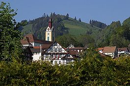
Rothenthurm is a municipality in Schwyz District in the canton of Schwyz in Switzerland.
The French invasion of Switzerland occurred from January to May 1798 as part of the French Revolutionary Wars. The independent Old Swiss Confederacy collapsed from the invasion and simultaneous internal revolts called the "Helvetic Revolution". The Swiss ancien régime institutions were abolished and replaced by the centralised Helvetic Republic, one of the sister republics of the French First Republic.
Uri is a Swiss Talschaft and canton in the upper Reuss valley.
This page is based on this Wikipedia article Text is available under the CC BY-SA 4.0 license; additional terms may apply. Images, videos and audio are available under their respective licenses.