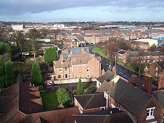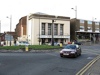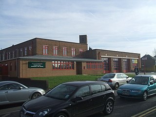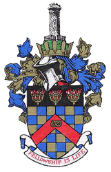
Tipton is an industrial town in the West Midlands in England with a population of around 38,777 at the 2011 UK Census. It is located 16 kilometres (9.9 mi) northwest of Birmingham.

Willenhall is a market town situated in the Metropolitan Borough of Walsall, in the West Midlands, England, with a population taken at the 2011 census of 28,480. It is situated between Wolverhampton and Walsall, historically in the county of Staffordshire. It lies upon the River Tame, and is part of the Black Country.

Sedgley is a town in the north of the Metropolitan Borough of Dudley, in the West Midlands, England.

Darlaston is a town in the Metropolitan Borough of Walsall in the West Midlands of England. It is located near Wednesbury and Willenhall.

Ashmore Park is a large housing estate in Wednesfield, England. It has been part of the city of Wolverhampton, West Midlands since 1966, when the majority of Wednesfield was incorporated into Wolverhampton. It constitutes mostly of the Wednesfield North ward of the Wolverhampton council.
The West Midlands region straddles the historic borders between the counties of Warwickshire, Staffordshire in the north, and Worcestershire in the south.

Coseley is a village in the north of the Dudley Metropolitan Borough, in the English West Midlands. Part of the Black Country, it is situated approximately three miles north of Dudley itself, on the border with Wolverhampton. Though it is a part of Dudley for statistical and administrative purposes, it is divided between the Bilston and Tipton postal districts, and mostly falls within the Wolverhampton South-East parliamentary constituency.

Heath Town is a district of the City of Wolverhampton, West Midlands, England, located east of the city centre. It is also a ward of City of Wolverhampton Council. The ward forms part of the Wolverhampton North East constituency.

Bushbury is a village in Wolverhampton, West Midlands, England. It lies two miles north-east of Wolverhampton city centre, divided between the Bushbury North and Bushbury South and Low Hill wards.

Blakenall Heath is a suburban village of Bloxwich and Walsall, West Midlands, England. It straddles the border of Walsall and Bloxwich.

Ettingshall is an area of Wolverhampton, West Midlands, England, and is a ward of Wolverhampton City Council. The population of this ward taken at the 2011 census was 13,482.

Fallings Park is a suburb of Wolverhampton, West Midlands, and a ward of Wolverhampton City Council. It is situated in the northeast of the city, bordering South Staffordshire and the Wednesfield North, Heath Town, Bushbury South and Low Hill and Bushbury North wards. It forms part of the Wolverhampton North East constituency. Fallings Park ward covers over 5,000 properties in the following areas: Longknowle, Newbolds, Scotlands, Underhill, Willows. The population of the Wolverhampton Ward taken at the 2011 census was 12,410.

Low Hill is in Wolverhampton, West Midlands, England. It is north-east of Wolverhampton city centre, within the Bushbury South and Low Hill ward.
Muirhouse is a residential estate in the north of Edinburgh, the capital of Scotland.

Coseley Urban District was a local government district in Staffordshire which was created in 1894.

Wolverhampton is a city, metropolitan borough, and administrative centre in the West Midlands, England. At the 2011 census, it had a population of 249,470. Natives of the city are called "Wulfrunians".
Woodside is a residential area of Telford, Shropshire, England.
The Scotlands is a residential area of Wolverhampton, West Midlands, England.

Public housing provided the majority of rented accommodation in the United Kingdom until 2011 when the number of households in private rental housing surpassed the number in social housing. Houses and flats built for public or social housing use are built by or for local authorities and known as council houses, though since the 1980s the role of non-profit housing associations became more important and subsequently the term "social housing" became more widely used, as technically council housing only refers to housing owned by a local authority, though the terms are largely used interchangeably. Before 1865, housing for the poor was provided solely by the private sector. Council houses were built on council estates, where other amenities, like schools and shops, were often also provided. From the 1950s, blocks of flats and three-or-four-storey blocks of maisonettes were widely built, alongside large developments of terraced housing, while the 1960s and the 1970s saw construction of many high-rise tower blocks. Flats and houses were also built in mixed estates.

A council house is a form of British public housing built by local authorities. A council estate is a building complex containing a number of council houses and other amenities like schools and shops. Construction took place mainly from 1919 after the Housing Act 1919 to the 1980s, with much less council housing built since then. There were local design variations, but they all adhered to local authority building standards.


