Seelitz | |
---|---|
Location of Seelitz within Mittelsachsen district | |
Coordinates: 51°1′53″N12°49′14″E / 51.03139°N 12.82056°E Coordinates: 51°1′53″N12°49′14″E / 51.03139°N 12.82056°E | |
Country | Germany |
State | Saxony |
District | Mittelsachsen |
Municipal assoc. | Rochlitz |
Subdivisions | 24 |
Government | |
• Mayor (2022–29) | Thomas Oertel [1] |
Area | |
• Total | 31.08 km2 (12.00 sq mi) |
Elevation | 224 m (735 ft) |
Population (2020-12-31) [2] | |
• Total | 1,669 |
• Density | 54/km2 (140/sq mi) |
Time zone | UTC+01:00 (CET) |
• Summer (DST) | UTC+02:00 (CEST) |
Postal codes | 09306 |
Dialling codes | 03737 |
Vehicle registration | FG |
Website | www.gemeinde-seelitz.de/ |
Seelitz is a municipality in the district of Mittelsachsen, in Saxony, Germany. It is part of the administrative partnership Verwaltungsgemeinschaft Rochlitz based in the eponymous town.
The village of Seelitz is situated about 2 km south-east of Rochlitz and 13 km north-east of Mittweida, above the river Zwickauer Mulde. The following communities have been incorporated:
|
|
|
Seelitz and the neighbouring villages are of Slavic origin. Although there is no written evidence, this is proven by archeological finds, mostly pottery shards, by Slavic burgwalls such as those near Fischheim and Köttern, by the names of populated places and landscape features, and by the layout and size of the historic land parcels in the communities.
The place is first mentioned in writing as Seliz in an 1174 deed of donation, according to which margrave Dedo the Fat of Lusatia gave four Hufen of Land in Seelitz to the newly founded Zschillen monastery.
The spelling of the place name has changed little since then: [3]
The name had Old Sorbian origins, but its original meaning is unclear. It may be derived from a person's name Želidrog, shortened to Žel, or from zel, which means 'green' [4]
During the Thirty Years' War and in later conflicts Seelitz suffered from marauding troops and epidemics.
Seelitz belonged administratively to Amt Rochlitz. [3] Since the population of the neighbouring villages had to attend church services in Seelitz, it became an ecclesiastical centre of the region.
Following the incorporation of other communities during the 20th century, Seelitz now has 24 constituent parts.
Former community | Date | Notes |
---|---|---|
Beedeln [5] | 1 July 1965 | incorporated into Kolkau |
Bernsdorf (Seelitz) [6] | 1 May 1936 | incorporated into Beedeln |
Biesern [5] [7] | 1 July 1950 | incorporated into Steudten |
Döhlen (Seelitz) [5] | 1 March 1969 | |
Fischheim [5] [7] | 1 July 1950 | incorporated into Steudten |
Gröblitz [5] [7] | 1 July 1950 | |
Gröbschütz [5] | 1 March 1974 | |
Großstädten [6] | 1 April 1935 | joined Kleinstädten to form Städten |
Kleinstädten [6] | 1. April 1935 | joined Großstädten to form Städten |
Kolkau [8] | 1 April 1993 | |
Kolkau, Gutsbezirk | ca. 1922 | incorporated into Kolkau |
Köttern [5] [7] | 1 July 1950 | incorporated into Spernsdorf |
Neudörfchen (Seelitz) [9] | prior to 1875 | incorporated into Döhlen |
Neutaubenheim, Gutsbezirk | ca. 1922 | incorporated into Döhlen |
Neuwerder [9] | prior to 1875 | incorporated into Döhlen |
Pürsten (Seelitz) [5] [7] | 1 July 1950 | |
Seebitzschen [5] [7] | 1 July 1950 | incorporated into Steudten |
Sörnzig [5] [7] | 1 July 1950 | incorporated into Steudten |
Spernsdorf [8] | 1 April 1993 | |
Städten [5] [7] | 1 July 1950 | incorporated into Zetteritz |
Steudten (Seelitz) [8] | 1 January 1994 | |
Winkeln (Seelitz) [5] [8] | 1 March 1963 1. Januar 1994 | incorporated into Zschoppelshain transferred to Seelitz |
Zetteritz [8] | 1 January 1994 | |
Zetteritz, Gutsbezirk | ca. 1922 | incorporated into Zetteritz |
Zöllnitz (Seelitz) [6] | 1 April 1935 | incorporated into Seebitzschen |
Zschaagwitz (mit Neuzschaagwitz) [5] [7] | 1 July 1950 | incorporated into Spernsdorf |
Zschauitz (Seelitz) [5] [7] | 1 July 1950 | incorporated into Gröbschütz |
According to the Meißnische Chronika ('Misnian Chronicle'), the church of Seelitz dates back into the 8th century. [10] [11]
The parish of Seelit was formed around the year 1000 and became part of the diocese of Meißen, [12] after the country around Rochlitz had been occupied by German settlers who had come from Franconia. By this time, the Sorbian population had formally converted to Christianity. Violent acts in connection with the Christian mission are not reported from this area. [13]
The lapidary inscriptions of the year dates 1516 and 1529 [14] on the village church St Anna indicate that at this time a romanesque church dating from the 11th century had been replaced by the extant hall church in late gothic style. [15]
Around 1430 Seelitz suffered from the invasion of Hussitic troops, during which time the church was destroyed. Seelitz joined the Protestant Reformation comparatively early, the local school which was erected in 1527 was probably already Protestant from the beginning. [12]
From 1769 to 1761, the local church was rebuilt in baroque style under the direction of Wiederau carpenter Michael Mäßig and was fitted with matronea. Altar and pulpit (1770/1771) as well as the baptismal font in rococo style were made by Penig sculptor Johann Gottfried Stecher (1718–1776). [11]
Over time, Seelitz became a regional ecclesiastical centre, and with 23 constituting villages it forms the largest territorial parish in Saxony.
The communal elections in Saxony on 25 May 2014 resulted in the following distribution of seats in the municipal council: [16]
Voter turnout was 57.4%.
The eastern part of the communal area is crossed by Bundesstraße 107, the northern part by Bundesstraße 175 (section between Rochlitz and Geringswalde). The railway lines Glauchau–Großbothen and Waldheim–Rochlitz with stations in Steudten and Döhlen, respectively, have been closed down in 2002 and 1998. The official bicycle route Mulderadweg passes through Seelitz.
Böhlen is a town in Saxony, Germany, south of Leipzig. Its main features are a small airport and a power-plant. It is located in the newly built Neuseenland, the lakes created in the former open-pit mining areas.
Mittweida is a town in Saxony, Germany, in the Mittelsachsen district.
Erlau is a municipality in the district of Mittelsachsen in Saxony in Germany. In 1994 it absorbed the former municipalities Beerwalde, Crossen and Schweikershain, and in 1999 Milkau.
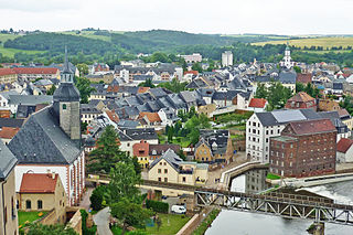
Rochlitz is a major district town in the district of Mittelsachsen, in Saxony, Germany. Rochlitz is the head of the "municipal partnership Rochlitz" with its other members being the municipalities of Königsfeld, Seelitz and Zettlitz.
Geringswalde is a town in the district of Mittelsachsen, in Saxony, Germany. It is situated 12 km northwest of Mittweida, and 27 km north of Chemnitz.
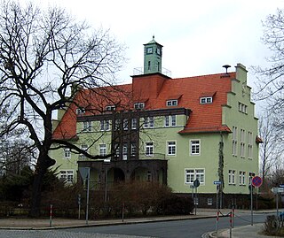
Gröditz is a town in the district Meißen, in Saxony, Germany. The town is located 12 km northeast of Riesa, and 7 km southwest of Elsterwerda.
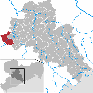
Penig is a town in the district of Mittelsachsen, in the Free State of Saxony, Germany. It is situated on the river Zwickauer Mulde, 19 km northwest of Chemnitz. The old and the new castle were owned by the House of Schönburg from 1378 until 1945. Penig housed a concentration camp during World War II.
Räckelwitz (German) or Worklecy (Sorbian) is a municipality in Bautzen district, in the state of Saxony, Germany. The municipality of Räckelwitz has a population of 1,111 (2020) and is a member of the municipal association "Am Klosterwasser"(Zarjadniski zwjazk „Při Klóšterskej wodźe“).
Großschönau is a municipality in the district Görlitz, in Saxony, Germany located in the cross-border region with the Czech Republic. It used to be a famous Upper Lusatian center of Damask fabric production until the end of the 1980s. Since then it has turned into an area of tourism.
Cornelius Gustav Gurlitt was a German architect and art historian.
The village of Cämmerswalde in the municipality of Neuhausen/Erzgeb. lies in the south of the Saxon district of Mittelsachsen in eastern Germany. The state-recognised spa resort with its 800-year-old history, lies near Seiffen in the eastern part of the Western Ore Mountains not far from the Czech border. The village is a classic Waldhufendorf, with a length of over five kilometres. Cämmerswalde is divided into Oberdorf, Mitteldorf and Niederdorf. Since 1994 Cämmerswalde has belonged to the municipality of Neuhausen/Erzgeb., but used to be an independent parish with the hamlets of Deutschgeorgenthal, Haindorf and, from 1924, Neuwernsdorf and Rauschenbach.
Neuwernsdorf is a village in the municipality of Neuhausen/Erzgeb. in the extreme south of the Saxon district of Mittelsachsen, immediately next to the Czech border by Český Jiřetín and the Rauschenbach Dam.
Scharfenstein Castle lies on an elongated hill spur above the village of Scharfenstein, in the municipality of Drebach in the Ore Mountains of Saxony, Germany. The castle is one of 24 sites run by the state-owned State Palaces, Castles and Gardens of Saxony.
Satzung is a village in the Saxon municipality of Marienberg, which is in the district of Erzgebirgskreis in the German Ore Mountains.
Krakau (German) or Krakow (Sorbian) was a small town in what is now the district of Bautzen in Saxony, Germany. It was located within the Sorbian area, where many inhabitants traditionally speak the West Slavic Sorbian language, and it shared its name with the much larger Polish city. The town was entirely vacated in 1938 when the area became a military training area. After the war, the town was briefly repopulated, before the Soviet occupation troops again evicted the inhabitants to resume use of the area for military purposes. The town was destroyed.
Störmthal is a village, part of Großpösna in the Leipzig district in Saxony, Germany. It is known for its church in Baroque style. The organ, an early work by Zacharias Hildebrandt, was played and inaugurated by Johann Sebastian Bach and is still in mostly the condition of Bach's time.
Pötzschau is a village and a former municipality in Saxony, Germany. Since 2015, it is part of the town Rötha. It consists of the smaller parts Großpötzschau, Kleinpötzschau and Dahlitzsch. Pötzschau is south-east of Leipzig in the valley of the creek Gösel.
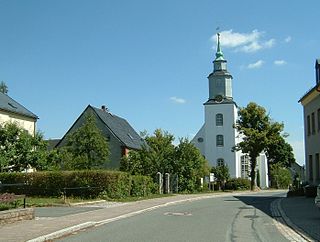
Hundshübel is a village in Erzgebirgskreis district of Saxony, forming a subdivision of the municipality of Stützengrün in the Ore Mountains. It is located north of Eibenstock Dam on federal highway B 169.
Siebenlehn is a district of the town Großschirma in Landkreis Mittelsachsen. Until 2003 it was a separate town. Upon fusion with the neighbouring rural municipality Großschirma on 1 September 2003, the town privileges were transferred to the joint municipality.
Bieberstein Castle is located on the left bank of the river Bobritzsch in Bieberstein, part of Reinsberg municipality, in Landkreis Mittelsachsen, Saxony.