This page is based on this
Wikipedia article Text is available under the
CC BY-SA 4.0 license; additional terms may apply.
Images, videos and audio are available under their respective licenses.

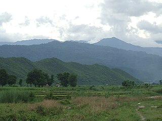
The Irrawaddy or, officially, Ayeyarwady River is a river that flows from north to south through Myanmar. It is the country's largest river and most important commercial waterway. Originating from the confluence of the N'mai and Mali rivers, it flows relatively straight North-South before emptying through the Irrawaddy Delta into the Andaman Sea. Its drainage basin of about 404,200 square kilometres (156,100 sq mi) covers a large part of Burma. After Rudyard Kipling's poem, it is sometimes referred to as 'The Road to Mandalay'.

The Sittaung River, is a river in south central Myanmar in Bago Division. The Pegu Range separates its basin from that of the Irrawaddy. The river originates at the edge of the Shan Hills southeast of Mandalay, and flows southward to the Gulf of Martaban. Its length is 420 km and its mean annual discharge is around 50 cubic kilometers per year.

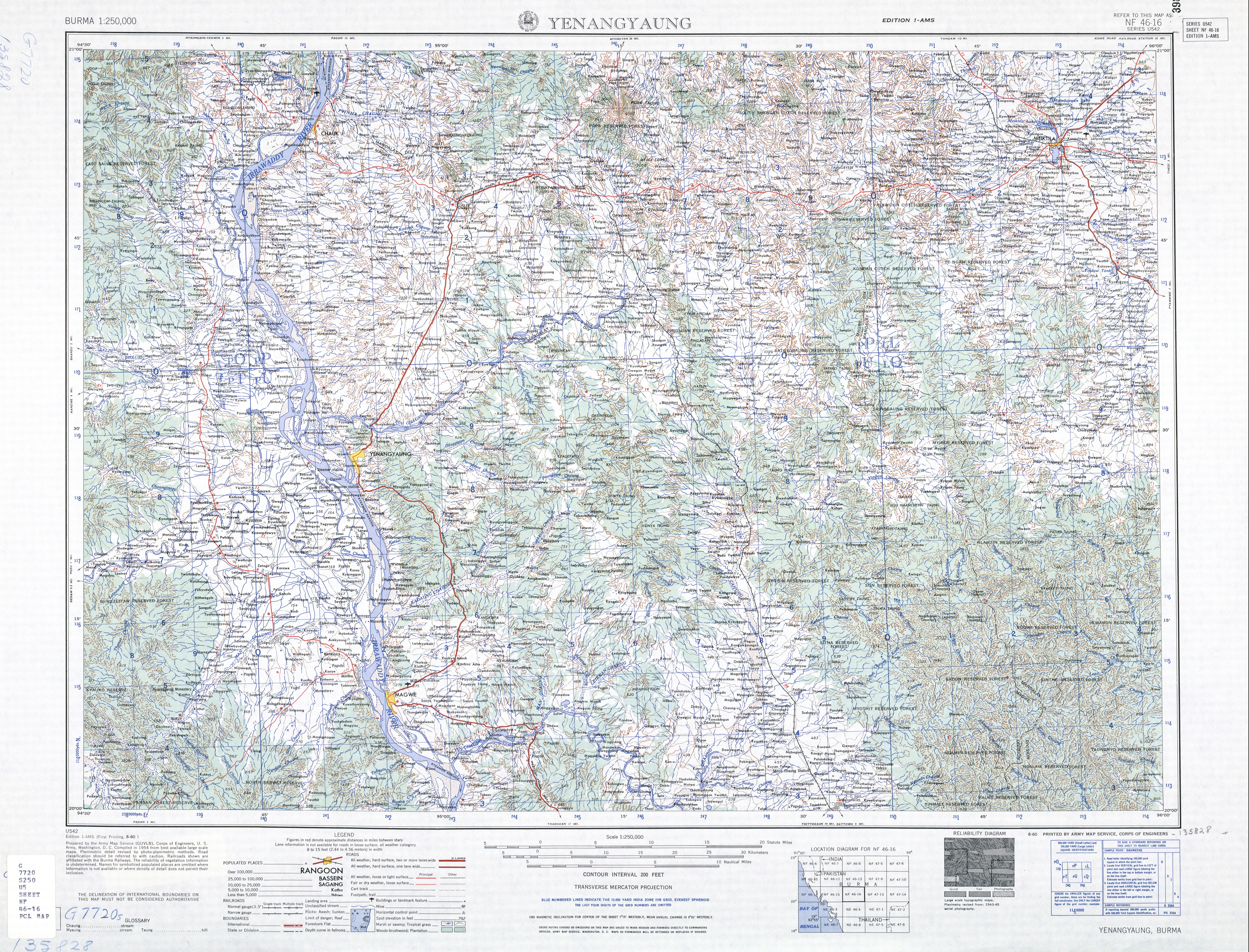
Chauk is a town and river port in Magway Region, north-central Myanmar (Burma), on the Irrawaddy River. It is located across the river from Seikphyu (ဆိပ်ဖြူ) and is connected by a bridge.

Pyin Oo Lwin District is a district of the Mandalay Region in central Burma. It lies northeast of Mandalay, with the Myitnge River as its southern boundary. To the east it is bordered by Shan State and in part by the Chaung Magyi. It goes north as far as the town of Dakaung where it adjoins Htigyaing Township, Katha District in Sagaing Region. Its western boundary, is for the most part the Irrawaddy, but a very small portion of Thabeikkyin Township is west of the Irrawaddy, near the town of Baw in Sagaing Region. To the southwest it borders Mandalay District.
Thabeikkyin Township is a township of Pyin Oo Lwin District in the Mandalay Region of Burma. It is the northern-most township in Pyin Oo Lwin District and, although it primarily lies on the east bank of the Irrawaddy, it has a small enclave on the western bank extending as far as the village of Gagalaw, near the town of Baw in Katha District, Sagaing Region. On the south it borders Singu Township, on the east, Mogote Township and further north Shan State, while it abuts Tigyaing Township of Sagaing Region to the north.
Pathein Township is a township of Pathein District in the Ayeyawady Division of Burma (Myanmar). The administrative seat is the town of Pathein.
Labutta Township or Latputta Township is one of the two township in Labutta District in the Ayeyarwady Region of Myanmar. It is located in the delta of the Irrawaddy.
Kyainseikgyi Township is a township of Kawkareik District in the Kayin State of Myanmar. It is the fourth-biggest township in Kayin State. The two main sub-towns are Kyeikdon and Payathonsu. It is drained by the Zami, Winyaw and the Haungtharaw rivers.
Singu is a town in the Mandalay Region of central Myanmar. It is the capital of Singu Township.
Htantabin Township is a township located on the western border of central Yangon Region, Burma (Myanmar). Its administrative seat is Htantabin which is located in the southeastern part of the township on the western bank of the Hlaing River just south of its confluence with the Kokkowa River.
Htigyaing Township or Tigyaing Township is a township of Katha District in eastern Sagaing Division, in northern Burma (Myanmar). It lies on the border with the Shan State of Burma. The administrative seat is at Htigyaing.

Wetlet Township is a township of Shwebo District in the Sagaing Division of Burma (Myanmar).
It is located on the plains between the Mu River and the Irrawaddy. Its administrative seat is the town of Wetlet.
Yaw River or Ywa River is a river of Burma, a tributary of the Irrawaddy. It flows into the Irrawaddy on the right (west) just above the town of Seikpyu, at 20°54′13″N 94°48′39″E.
Pauk Township is a township of Pakokku District in Magway Division of Burma (Myanmar). The principal town and administrative seat is Pauk.
Kale Township is a township in Kale District in the Sagaing Division of Burma (Myanmar). The principal town is Kalay.
Thayet Township is a township of Thayet District in the Magway Region of Burma (Myanmar). It lies on the west side of the Irrawaddy. The major town and administrative center is Thayet. Notable peaks are Mount Myinba and Mount Myinmagyi.
Pakokku Township is a township of Pakokku District in Magway Division of Burma (Myanmar). The principal town and administrative seat is Pakokku. The township has its eastern and southeastern border along the Irrawaddy where its principal town, Pakokku, is a port. The Yaw River forms the township’s southwest border. There is a commercial airport at Lanywa (Lan).
Lanywa or Lan is a town in the Magway Division in Myanmar on the right (western) bank of the Irrawaddy, just above Seikphyu and Chauk. The town hosts a commercial airport, south-east of town.
Yesagyo Township is a township of Magway District in the Magway Region of central Burma (Myanmar). The principal town and administrative seat is Yesagyo.


