
Issaquena County is a county located in the U.S. state of Mississippi. As of the 2020 Census, its population was 1,338, making it the least populous county in the United States east of the Mississippi River. Its county seat is Mayersville. With a per-capita income of $18,598, Issaquena County is, by that measure, one of the poorest counties in the United States.

Grand Tower is a city in Jackson County, Illinois, United States. The population was 605 at the 2010 census. The town gets its name from Tower Rock, a landmark island in the Mississippi River.
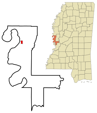
Mayersville is a town on the east bank of the Mississippi River, and the county seat for Issaquena County, Mississippi, United States. It is located in the Mississippi Delta region, known for cotton cultivation in the antebellum era. Once the trading center for the county, the town was superseded when railroads were built into the area. The population of the majority-black town was 547 at the 2010 census, down from 795 at the 2000 census.

Rolling Fork is a city and county seat of Sharkey County, Mississippi, United States. As of the 2020 census, the population of the town was 1,883.

The National Oceanic and Atmospheric Administration Commissioned Officer Corps is one of eight federal uniformed services of the United States, and operates under the National Oceanic and Atmospheric Administration (NOAA), a scientific agency overseen by the Department of Commerce. The NOAA Corps is made up of scientifically and technically trained officers. The NOAA Corps and the United States Public Health Service Commissioned Corps are the only U.S. uniformed services that consist only of commissioned officers, with no enlisted or warrant officer ranks. The NOAA Corps' primary mission is to monitor oceanic conditions, support major waterways, and monitor atmospheric conditions.

Tornado, also called Upper Falls, is a census-designated place (CDP) in Kanawha County, West Virginia, United States.
Eliza Winston was an enslaved American from Mississippi who was freed from her owners while with them on vacation in Minnesota, a free state. She received a hearing in court via a Freedom suit, where she said she and her late husband had purchased her freedom from a previous owner, but it was not honored. She was freed from her Mississippi owners and possibly aided in getting to Canada, but no definitive account exists for her life afterwards.

Jean de Suarez d'Aulan was a French aristocrat, aviator, auto racer, bobsledder, businessman and soldier.

Valley Park is a census-designated place and unincorporated community in Issaquena County, Mississippi, United States. Its elevation is 95 feet. Although unincorporated, it has a post office, with the ZIP code of 39177.
Fitler is an unincorporated community in Issaquena County, Mississippi, United States. Fitler is located on Mississippi Highway 1, approximately six miles west of Onward. Fitler had a post office from about 1901 to 1976.
Grace is a census-designated place and unincorporated community in Issaquena County, Mississippi, United States. It is located several miles northeast of Mayersville.
Baleshed is a ghost town in Issaquena County, Mississippi, United States. Baleshed was located on the Mississippi River.
Arcadia is a ghost town in Issaquena County, Mississippi, United States.

Ben Lomond is a ghost town in Issaquena County, Mississippi, United States.
Chotard is an unincorporated community in Issaquena County, Mississippi, United States.
Eutaw is a ghost town in Bolivar County, Mississippi, United States. The settlement had a port on the Mississippi River called "Eutaw Landing."
Duncansby is a ghost town in Issaquena County, Mississippi, United States.
Magna Vista is a ghost town in Issaquena County, Mississippi.
Riverton is a ghost town in Bolivar County, Mississippi, United States.

Skipwith's Landing was a 19th-century boat landing and human settlement on the east bank of the Mississippi River, located in the county of Issaquena in the U.S. state of Mississippi. Skipwith's Landing was situated about 55 mi (89 km) to 100 mi (160 km) north of Vicksburg, Mississippi, depending on mode of travel. Circa 1866, a witness at a U.S. Congressional hearing described Skipwith's Landing as being among the most sparsely populated sections of the state with no village or town in proximity. Circa 1867, there were no roads leading to or from Skipwith's Landing; the only access was by the river. For a time there was a cut made by the river that was known as Skipwith's Chute. Another related placename was Skipwith Crevasse. There was a U.S. post office at Skipwith's in 1870.


