
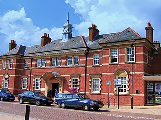
St James' by the Park (sometimes known as Shirley Parish Church) is an Anglican parish church which meets in Shirley, Southampton. Following the closure of St John's Church, the parish has one church building, the grade II listed St James'. [1]
St James' by the Park (sometimes known as Shirley Parish Church) is an Anglican parish church which meets in Shirley, Southampton. Following the closure of St John's Church, the parish has one church building, the grade II listed St James'. [1]

The Domesday Book records a church being present at Shirley in 1085, but on 1 May 1574 the parish of Shirley was amalgamated with that of Millbrook as the small Shirley congregation could not afford the upkeep of the Shirley church building. [2] The Shirley church was demolished in 1609, with stones from the old building used to enlarge St Nicholas' Church building in Millbrook. [2]
By 1836, the population of the combined parish had reached 2,375 inhabitants, and the old Millbrook parish church was too small. [2] Land was donated for a new church building in Shirley by Nathaniel Newman Jefferys, [3] and Church Building Society combined with private funding to pay for the structure itself. [2] The new church, dedicated to St. James, was designed by local architect William Hinves [3] and consecrated on 20 August 1836 by the Bishop of Winchester with a large crowd present despite "unfavourable weather", according to the Hampshire Advertiser newspaper. [2] The newspaper went on to give this description of the new building:
It contains six hundred sittings. At the back of the altar is a gothic screen, divided into three components, the outer entablatures contain the Commandments, the Lord's Prayer and the Belief, the centre entablature the crucifixion by Shayer, a first rate painting, the head of life itself and the expression of subdued anguish is beautifully conceived and awakes the feeling of an intense degree of interest. It is one of the happiest of his late products. [2]
The building was also described in 1848 as "a handsome structure in the later English style, with a square embattled tower". [2]
The first vicar of Shirley was the Reverend William Orger, who looked after the parish for 25 years. [2] During this time, the church grew quickly, to such an extent that the building was added to within a few years of its consecration. Balconies added in 1840 raised the capacity to 1080. [2] [4] In 1848, only 432 of these pews were free, implying a regular congregation of around 600. [4] A church clock was provided in 1875, [2] and further new pews and a new chancel were added in 1881. [2]

In 1912, the parish register for St John's was started, [5] the church being originally based in a temporary tin building. [6] Plans to rebuild St John's church were submitted in 1957, [7] with amended plans submitted and approved in 1959. [8] The foundation stone of the new building was laid by the Bishop of Winchester, Dr Alwyn Williams. [9] The building was subsequently adapted into a community centre named St John's Centre. [10]
The interior of the St James' building was renovated in 1994; the pews were removed and the floor levelled and carpeted. On 1 March 2016, they further updated their seating with the addition of new chairs that now blue and are more cushioned than the previous ones.
In 2020 it was reported that St John's Centre could be demolished and replaced with housing [11] and plans were submitted later that year to replace the building with five houses. [12] Permission for those plans was refused [12] and new plans were submitted in 2021 to replace the St John's building with four houses; this planning application was withdrawn in October 2022. [13] The St John's building was sold to the Church of Pentecost and handed over at a joint celebration in early 2023. [6]

Winchester is a cathedral city in Hampshire, England. The city lies at the heart of the wider City of Winchester, a local government district, at the western end of the South Downs National Park, on the River Itchen. It is 60 miles (97 km) south-west of London and 14 miles (23 km) from Southampton, its nearest city. At the 2021 census, the built-up area of Winchester had a population of 48,478. The wider City of Winchester district includes towns such as Alresford and Bishop's Waltham and had a population of 127,439 in 2021. Winchester is the county town of Hampshire and contains the head offices of Hampshire County Council.

Thornhill is a suburb of Southampton, United Kingdom, situated on the eastern border of the city and bounded by three major roads. According to the 2001 census the population was 11,460. The under 16s represent 23.4% of the population, 5% more than the city figure of 18.2%; the over 65s represent 17.4%, again, higher than the city average of 14.5%.
Eastleigh is a town in Hampshire, England, between Southampton and Winchester. It is the largest town and the administrative seat of the Borough of Eastleigh, with a population of 24,011 at the 2011 census.

The A33 is a major road in the counties of Berkshire and Hampshire in southern England. The road currently runs in three disjoint sections.

Totton and Eling is a civil parish in Hampshire, England, with a population of about 28,100 people. It contains the town of Totton and is situated between the eastern edge of the New Forest and the River Test, close to the city of Southampton but outside the city boundary; the town is within the New Forest non-metropolitan district. Surrounding towns and villages include Ashurst, Marchwood, Cadnam and Ower.
Whiteley is a planned community of 6,500 homes in the county of Hampshire, England, United Kingdom near Fareham. The development straddles the boundary between two council districts: the Borough of Fareham to the south and west, and the City of Winchester to the north and east.

Shirley is a town in the Metropolitan Borough of Solihull, in the West Midlands, England. Historically a rural settlement within the county of Warwickshire, it is now contiguous with nearby Solihull and Birmingham.
Hedge End is a town and civil parish in Hampshire, England. Situated to the east of the City of Southampton, it adjoins the districts of West End and Botley. Hedge End lies within the Borough of Eastleigh and is part of the Southampton Urban Area. The original hamlet developed on Botley Common after 1250 when it was granted to the men of Botley as common pasture. In 1267, royal charters allowed Botley to hold an annual fair and a weekly market on the common which eventually became a market town.
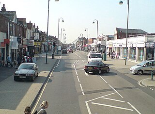
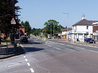
Shirley is a broad district and a former village on the western side of Southampton, in the ceremonial county of Hampshire, England. Shirley's main roles are retailing and residential. It is the most important suburban shopping area in the west of the city. Housing is a mixture of council houses in the centre of the district surrounded by private housing, with larger suburban houses concentrated in Upper Shirley. Shirley is separated from Highfield by Southampton Common, a large green public space.

Freemantle is a suburb and electoral ward in Southampton, England.

Millbrook is a suburb and former civil parish of Southampton, in the ceremonial county of Hampshire, England. As the area developed, several settlements grew within the parish, some of them becoming parishes in their own right, thus reducing the extent of the Millbrook parish. As well as the Millbrook of today, the original Millbrook parish included Freemantle, Regents Park, and Redbridge. Some of these areas are still referred to as being part of Millbrook. The brook that Millbrook was named after is now known as Tanner's Brook.
The Didcot, Newbury and Southampton Railway (DN&SR) was a cross-country railway running north–south between Didcot, Newbury and Winchester. Its promoters intended an independent route to Southampton and envisaged heavy traffic from the Midlands and North of England to the port, but they ran out of funds to complete the line to Southampton. The intended heavy through traffic never materialised, and the line was dependent on larger railways—the Great Western Railway and the London and South Western Railway—for support, which was not freely given. The line opened in two stages, in 1882 and 1885.

Highfield Church is a parish church in the Highfield district of Southampton, England. It is an Anglican Church in the Diocese of Winchester.
Southampton is a city in Hampshire, England. The area has been settled since the Stone Age. Its history has been affected by its geographical location, on a major estuary on the English Channel coast with an unusual double high tide, and by its proximity to Winchester and London; the ancient and modern capitals of England. Having been an important regional centre for centuries, Southampton was awarded city status by Queen Elizabeth II in 1964.

North Stoneham is a settlement between Eastleigh and Southampton in south Hampshire, England. Formerly an ancient estate, manor, and civil parish, it is currently part of the Borough of Eastleigh. Until the nineteenth century, it was a rural community comprising a number of scattered hamlets, including Middle Stoneham, North End, and Bassett Green, and characterised by large areas of woodland.

St Andrew's Church is an Anglican parish church in the centre of Farnham, Surrey. It is a Grade I listed building and surviving parts of the structure date back to the Middle Ages. It is in the Archdeaconry of Surrey, in the Diocese of Guildford. The churchyard contains the grave of the political activist William Cobbett, and there is a memorial to the hymn-writer Augustus Toplady.

Southampton Corporation Transport motor bus services started in 1919 as a successor to Southampton Corporation Tramways. After Southampton achieved city status in 1964 it was renamed Southampton City Transport. In 1986, as a result of deregulation it became Southampton Citybus, an arms-length company that was sold to the staff in 1993. It continued trading as Southampton Citybus until it was bought by First Bus in 1997.
The following is a timeline of the history of the city of Southampton, Hampshire, England.
50°55′36″N1°25′42″W / 50.92669°N 1.42825°W