Shivalaya Upazila

Last updated • 1 min readFrom Wikipedia, The Free Encyclopedia
Shivalaya
শিবালয়
Teota Zamindar Palace.jpg
Teota Zamindar Bari
Shivalaya in Dhaka division (Bangladesh).svg
Coordinates: 23°50′N89°47.5′E / 23.833°N 89.7917°E / 23.833; 89.7917
Country Flag of Bangladesh.svg  Bangladesh
Division Dhaka
District Manikganj
Area
  Total199.07 km2 (76.86 sq mi)
Population
 (2022) [1]
  Total187,462
  Density940/km2 (2,400/sq mi)
Time zone UTC+6 (BST)
Postal code
1850 [2]
Area code 0651 [3]
Website Official Map of Shivalaya

Shivalaya (Bengali : শিবালয়, Shibaloy, meaning "Home of Shiva") is an upazila of Manikganj District [4] in the Division of Dhaka, Bangladesh.

Contents

Geography

Shivalaya is located at 23°50′00″N89°47′30″E / 23.8333°N 89.7917°E / 23.8333; 89.7917 . Shivalaya's total area is 199.07 km2.

Demographics

Religions in Shivalaya Upazila (2022) [5]
ReligionPercent
Islam
87.69%
Hinduism
12.14%
Other or not stated
0.17%

According to the 2011 Census of Bangladesh, Shivalaya Upazila had 40,795 households and a population of 171,873. 35,698 (20.77%) were under 10 years of age. Shivalaya had a literacy rate (age 7 and over) of 53.28%, compared to the national average of 51.8%, and a sex ratio of 1017 females per 1000 males. 5,202 (3.03%) lived in urban areas. [6] [7]

As of the 1991 Bangladesh census, Shivalaya has a population of 143842. Males constitute 52.42% of the population, and females 47.58%. This Upazila's eighteen up population is 75930. Shivalaya has an average literacy rate of 29.1% (7+ years), and the national average of 32.4% literate. [8]

Administration

Shivalaya Upazila is divided into seven union parishads: Aruoa, Mohadebpur, Shibaloy, Simulia, Teota, Ulayel, and Uthali. The union parishads are subdivided into 202 mauzas and 255 villages. [9]

Education

College:

High School:

Primary School:-

See also

Related Research Articles

<span class="mw-page-title-main">Assasuni Upazila</span> Upazila in Khulna, Bangladesh

Assasuni is an upazila of Satkhira District in Khulna Division, Bangladesh.

<span class="mw-page-title-main">Homna Upazila</span> Upazila in Chittagong, Bangladesh

Homna Upazila is an upazila of Comilla District in the Division of Chittagong, Bangladesh. Homna thana was established in 1918.

<span class="mw-page-title-main">Charbhadrasan Upazila</span> Upazila in Dhaka, Bangladesh

Charbhadrasan or Char Bhadrasan is an upazila of Faridpur District in the Division of Dhaka, Bangladesh.

<span class="mw-page-title-main">Nagarkanda Upazila</span> Upazila in Dhaka, Bangladesh

Nagarkanda is an upazila of Faridpur District in the Division of Dhaka, Bangladesh.

<span class="mw-page-title-main">Sarishabari Upazila</span> Upazila in Mymensingh Division, Bangladesh

Sarishabari is an upazila of Jamalpur District in the Division of Mymensingh, Bangladesh.

<span class="mw-page-title-main">Kuliarchar Upazila</span> Upazila in Dhaka, Bangladesh

Kuliarchar - কুলিয়ারচর is an upazila of Kishoreganj District under the Division of Dhaka, Bangladesh. It is about 97.6 km (61 mi) northwest of the capital city of Dhaka. It is also a center of business, especially the fish, jute trade and processing plants, and the shoes sector of the country.

<span class="mw-page-title-main">Daulatpur Upazila, Manikganj</span> Upazila in Dhaka, Bangladesh

Daulatpur is an upazila of Manikganj District in the Division of Dhaka, Bangladesh.

<span class="mw-page-title-main">Harirampur Upazila</span> Administrative region in Dhaka Division, Bangladesh

Harirampur is an upazila of Manikganj District in the Division of Dhaka, Bangladesh.

<span class="mw-page-title-main">Manikganj Sadar Upazila</span> Upazila in Dhaka, Bangladesh

Manikgonj Sadar is an upazila of Manikgonj District in the division of Dhaka, Bangladesh.

<span class="mw-page-title-main">Saturia Upazila</span> Upazila in Dhaka, Bangladesh

Saturia is an upazila of Manikganj District in the Division of Dhaka, Bangladesh. The administrative center is located in Saturia.

<span class="mw-page-title-main">Singair Upazila</span> Upazila in Dhaka, Bangladesh

Singair is an upazila of Manikganj District in the Division of Dhaka, Bangladesh.

<span class="mw-page-title-main">Pangsha Upazila</span> Upazila in Dhaka, Bangladesh

Pangsha is an upazila of Rajbari District in the Division of Dhaka, Bangladesh.

<span class="mw-page-title-main">Rajbari Sadar Upazila</span> Upazila in Dhaka, Bangladesh

Rajbari Sadar is an upazila of Rajbari District in the Division of Dhaka, Bangladesh. It has its headquarters in the town of Rajbari.
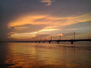
<span class="mw-page-title-main">Bhuapur Upazila</span> Upazila in Dhaka, Bangladesh

Bhuyanpur is an upazila of Tangail District in the Division of Dhaka, Bangladesh.
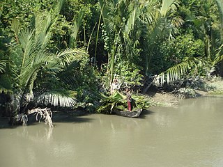
<span class="mw-page-title-main">Sarankhola Upazila</span> Upazila in Khulna, Bangladesh

Sarankhola is an upazila of Bagerhat District in the Division of Khulna, Bangladesh. Sarankhola was formed as a Thana in 1907. A major part of the upazila belongs to the Sundarbans.

<span class="mw-page-title-main">Jibannagar Upazila</span> Upazila in Khulna, Bangladesh

Jibannagar is an upazila of Chuadanga District in the Division of Khulna, Bangladesh.

<span class="mw-page-title-main">Batiaghata Upazila</span> Upazila in Khulna, Bangladesh

Batiaghata is an upazila of Khulna District in the Division of Khulna, Bangladesh.

<span class="mw-page-title-main">Rupsa Upazila</span> Upazila in Khulna, Bangladesh

Rupsa is an upazila of Khulna District in the Division of Khulna, Bangladesh.
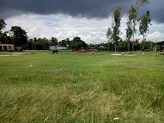
<span class="mw-page-title-main">Kalai Upazila</span> Upazila in Rajshahi, Bangladesh

Kalai is an upazila of Joypurhat District in the Division of Rajshahi, Bangladesh.
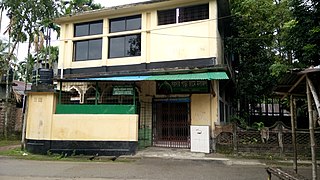
<span class="mw-page-title-main">Kurigram Sadar Upazila</span> Upazila in Rangpur, Bangladesh

Kurigram Sadar is an upazila of Kurigram District in the Division of Rangpur, Bangladesh.

References

  1. National Report (PDF). Population and Housing Census 2022. Vol. 1. Dhaka: Bangladesh Bureau of Statistics. November 2023. p. 398. ISBN   978-9844752016.
  2. "Bangladesh Postal Code". Dhaka: Bangladesh Postal Department under the Department of Posts and Telecommunications of the Ministry of Posts, Telecommunications and Information Technology of the People's Republic of Bangladesh. 20 October 2024.
  3. "Bangladesh Area Code". China: Chahaoba.com. 18 October 2024.
  4. MA Ramzan (2012), "Shivalaya Upazila", in Sirajul Islam and Ahmed A. Jamal (ed.), Banglapedia: National Encyclopedia of Bangladesh (Second ed.), Asiatic Society of Bangladesh
  5. Population and Housing Census 2022 - District Report: Manikganj (PDF). District Series. Dhaka: Bangladesh Bureau of Statistics. June 2024. ISBN   978-984-475-255-9.
  6. "Bangladesh Population and Housing Census 2011 Zila Report – Manikganj" (PDF). bbs.gov.bd. Bangladesh Bureau of Statistics.
  7. "Community Tables: Manikganj district" (PDF). bbs.gov.bd. 2011.
  8. "Population Census Wing, BBS". Archived from the original on 2005-03-27. Retrieved November 10, 2006.
  9. "District Statistics 2011: Manikganj" (PDF). Bangladesh Bureau of Statistics. Archived from the original (PDF) on 13 November 2014. Retrieved 14 July 2014.