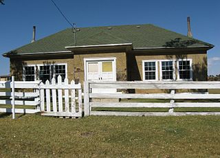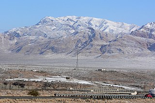
Washington County is a county in the southwestern corner of Utah, United States. As of the 2020 United States Census, the population was 180,279, making it the fifth-most populous county in Utah. Its county seat and largest city is St. George. The county was created in 1852 and organized in 1856. It was named after the first President of the United States, George Washington. A portion of the Paiute Indian Reservation is in western Washington County. Washington County comprises the St. George, UT Metropolitan Statistical Area.
Keetley is a ghost town located in northeastern Wasatch County, Utah, United States.

Hanksville is a small town in Wayne County, Utah, United States, at the junction of State Routes 24 and 95. The population was 219 at the 2010 census.

The Powell Geographic Expedition of 1869, led by American naturalist John Wesley Powell, was the first thorough cartographic and scientific investigation of long segments of the Green and Colorado rivers in the southwestern United States, including the first recorded passage of white men through the entirety of the Grand Canyon. The expedition, which lasted approximately three months during the summer of 1869, embarked from Green River Station, Wyoming Territory and traveled downstream through parts of the present-day states of Colorado and Utah before reaching the confluence of the Colorado and Virgin rivers in present-day Arizona and Nevada. Despite a series of hardships, including losses of boats and supplies, near-drownings, and the eventual departures of several crew members, the voyage produced the first detailed descriptions of much of the previously unexplored canyon country of the Colorado Plateau.

U.S. Route 50 (US 50) is a transcontinental highway in the United States, stretching from West Sacramento, California, in the west to Ocean City, Maryland, on the east coast. The Nevada portion crosses the center of the state and was named "The Loneliest Road in America" by Life magazine in July 1986. The name was intended as a pejorative, but Nevada officials seized it as a marketing slogan. The name originates from large desolate areas traversed by the route, with few or no signs of civilization. The highway crosses several large desert valleys separated by numerous mountain ranges towering over the valley floors, in what is known as the Basin and Range province of the Great Basin.
Chester is an unincorporated community in central Sanpete County, Utah, United States.
Birdseye is an unincorporated community in southeastern Utah County, Utah, United States.
Ticaboo is an unincorporated community in far southeastern Garfield County, Utah, United States.

Vivian Park is an unincorporated community in northeastern Utah County, Utah, United States.

The Shivwits Band of Paiutes is a sovereign, federally recognized tribe located in southwestern Utah. The Shivwits Band is one of five Bands comprising the inter-Tribal government of the Paiute Indian Tribe of Utah.
Rosette is an unincorporated ranching community in northwestern Box Elder County, Utah, United States.
Trout Creek is an unincorporated community, in far western Juab County, Utah, United States.

Grover is an unincorporated community in southwestern Wayne County, Utah, United States. Originally known as Carcass Creek, Grover is a small ranching community off the county's main recreational corridor.
The Santa Clara River is a 52-mile-long (84 km) river whose three forks join above Pine Valley in the Pine Valley Mountains in Washington County, Utah, United States. It flows west, then south, then briefly southeast before joining the Virgin River just south of downtown St. George. It is southern Utah's largest tributary to the Virgin River.

The Beaver Dam Mountains are a 23 miles (37 km) long mountain range located mostly in extreme southwest Washington County, Utah, west of St. George, with the south of the range extending into the Arizona Strip.

The Juab Valley is a 40-mile (64 km) long valley located on the eastern edge of Juab County, Utah, United States.
Buckskin Mountain is a 16-mile (26 km) mountain ridge that spans from Coconino County, Arizona to Kane County, Utah in the United States, that is divided almost equally between the two counties.

The Red Mountains of Washington County, Utah, United States, is a mostly circular 7 miles (11 km) long mountain range.
Knolls is an unincorporated community in north-central Tooele County, Utah, United States.
Lost Creek State Park is a state park in northeastern Morgan County, Utah, United States, about 13 miles (21 km) northeast of city of Henefer and about 10 miles (16 km) northeast of the unincorporated community of Croydon, Utah.


