Shock, West Virginia

Last updated
Shock, West Virginia
Unincorporated community
USA West Virginia location map.svg
Red pog.svg
Shock
Usa edcp location map.svg
Red pog.svg
Shock
Coordinates: 38°46′42″N80°57′59″W / 38.77833°N 80.96639°W / 38.77833; -80.96639 Coordinates: 38°46′42″N80°57′59″W / 38.77833°N 80.96639°W / 38.77833; -80.96639
Country United States
State West Virginia
County Gilmer
Elevation 741 ft (226 m)
Time zone Eastern (EST) (UTC-5)
  Summer (DST) EDT (UTC-4)
ZIP code 26638
Area code(s) 304 & 681
GNIS feature ID 1549928 [1]

Shock is an unincorporated community in Gilmer County, West Virginia, United States. Shock is 13 miles (21 km) southwest of Glenville, along the Right Fork Steer Creek. [2] Shock has a post office with ZIP code 26638. [3]

Unincorporated area Region of land not governed by own local government

In law, an unincorporated area is a region of land that is not governed by a local municipal corporation; similarly an unincorporated community is a settlement that is not governed by its own local municipal corporation, but rather is administered as part of larger administrative divisions, such as a township, parish, borough, county, city, canton, state, province or country. Occasionally, municipalities dissolve or disincorporate, which may happen if they become fiscally insolvent, and services become the responsibility of a higher administration. Widespread unincorporated communities and areas are a distinguishing feature of the United States and Canada. In most other countries of the world, there are either no unincorporated areas at all, or these are very rare; typically remote, outlying, sparsely populated or uninhabited areas.

Gilmer County, West Virginia county in West Virginia, United States

Gilmer County is a county in the U.S. state of West Virginia. As of the 2010 census, the population was 8,693. Its county seat is Glenville. The county was formed in 1845 from parts of Lewis and Kanawha Counties, and named for Thomas Walker Gilmer, Governor of Virginia from 1840 to 1841. Gilmer was later a representative in the United States Congress and Secretary of the Navy in President John Tyler's cabinet.

West Virginia State of the United States of America

West Virginia is a state located in the Appalachian region in the Southern United States and is also considered to be a part of the Middle Atlantic States. It is bordered by Pennsylvania to the north, Maryland to the east and northeast, Virginia to the southeast, Kentucky to the southwest, and Ohio to the northwest. West Virginia is the 41st largest state by area, and is ranked 38th in population. The capital and largest city is Charleston.

The community was named after the Shock family, original owners of the town site. [4]

Climate

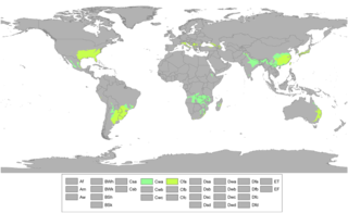
The climate in this area is characterized by hot, humid summers and generally mild to cool winters. According to the Köppen Climate Classification system, Shock has a humid subtropical climate, abbreviated "Cfa" on climate maps. [5]

Humid subtropical climate category in the Köppen climate classification system

A humid subtropical climate is a zone of climate characterized by hot and humid summers, and mild winters. These climates normally lie on the southeast side of all continents, generally between latitudes 25° and 40° and are located poleward from adjacent tropical climates. While many subtropical climates tend to be located at or near coastal locations, in some cases they extend inland, most notably in China and the United States, where they exhibit more pronounced seasonal variations and sharper contrasts between summer and winter, as part of a gradient between the more tropical climates of the southern coasts of these countries and the more continental climates of China and the United States’ northern and central regions.

Related Research Articles

Branchland, West Virginia Unincorporated community in West Virginia, United States

Branchland is an unincorporated community in western Lincoln County, West Virginia, United States. It lies along West Virginia Route 10 southwest of the town of Hamlin, the county seat of Lincoln County. Its elevation is 597 feet (182 m). Although it is unincorporated, it has a post office, with the ZIP code of 25506. Raccoon Creek Road is one of the more popular ways of transportation through the area.

Creston, West Virginia Unincorporated community in West Virginia, United States

Creston is an unincorporated community in southeastern Wirt County, West Virginia, United States. It lies at the confluence of the Little Kanawha River and the West Fork Little Kanawha River on West Virginia Route 5, southeast of the town of Elizabeth, the county seat of Wirt County. Its elevation is 653 feet (199 m). Creston had a post office, which closed on June 25, 2011. The community was named for a drainage divide near the town site.

Millwood, West Virginia Unincorporated community in West Virginia, United States

Millwood is an unincorporated community in northwestern Jackson County, West Virginia, United States, along the Ohio River at the mouth of Mill Creek. It lies along West Virginia Routes 2 and 62 northwest of the city of Ripley, the county seat of Jackson County. Its elevation is 577 feet (176 m). Although Millwood is unincorporated, it has a post office, with the ZIP code of 25262.

Paynesville, West Virginia Unincorporated community in West Virginia, United States

Paynesville is an unincorporated community in McDowell County, West Virginia, United States. Paynesville is located along West Virginia Route 83 at the Virginia border. Paynesville has a post office with ZIP code 24873.

Dellslow, West Virginia Unincorporated community in West Virginia, United States

Dellslow is an unincorporated community in Monongalia County, West Virginia, United States. Dellslow was established in 1798 and is located along West Virginia Route 7 near the southern border of Brookhaven. Dellslow has a post office with ZIP code 26531.

Dailey, West Virginia Census-designated place (CDP) in West Virginia, United States

Dailey is a census-designated place (CDP) in Randolph County, West Virginia, United States. Dailey is located on U.S. Route 219 and U.S. Route 250 3 miles (4.8 km) south-southwest of Beverly. Dailey has a post office with ZIP code 26259. As of the 2010 census, its population was 114.

Lorentz, West Virginia Unincorporated community in West Virginia, United States

Lorentz is an unincorporated community in Upshur County, West Virginia, United States. Lorentz is located on U.S. Route 33 and U.S. Route 119 4 miles (6.4 km) west-northwest of Buckhannon. Lorentz has a post office with ZIP code 26229.

Hico, West Virginia Census-designated place in West Virginia, United States

Hico is a census-designated place (CDP) in Fayette County, West Virginia, United States. Hico is located at the junction of U.S. Route 19 and U.S. Route 60 7 miles (11 km) northeast of Fayetteville. Hico has a post office with ZIP code 25854. As of the 2010 census, its population was 272.

Borderland, West Virginia Unincorporated community in West Virginia, United States

Borderland is an unincorporated community in Mingo County, West Virginia, United States. Borderland is located along the Tug Fork and U.S. Routes 52 and 119 3 miles (4.8 km) northwest of Williamson. Borderland had a post office, which opened on March 6, 1905, and closed on June 20, 2009.

Sprague, West Virginia Unincorporated community in West Virginia, United States

Sprague is an unincorporated community and coal town in Raleigh County, West Virginia, United States. Sprague is located on West Virginia Route 16 1 mile (1.6 km) north of downtown Beckley. Sprague has a post office with ZIP code 25926.

Redstar, West Virginia Unincorporated community in West Virginia, United States

Redstar is an unincorporated community in Fayette County, West Virginia, United States. Redstar is 2.5 miles (4.0 km) south of Oak Hill. Redstar had a post office with ZIP code 25914, which closed on January 20, 2007.

Haywood, West Virginia Unincorporated community in West Virginia, United States

Haywood is an unincorporated community in Harrison County, West Virginia, United States. Haywood is located on West Virginia Route 20 0.5 miles (0.80 km) northeast of Lumberport. Haywood has a post office with ZIP code 26366.

Procious, West Virginia Unincorporated community in West Virginia, United States

Procious is an unincorporated community in Clay County, West Virginia, United States. Procious is located on the Elk River and West Virginia Route 4, 7 miles (11 km) west-northwest of Clay. Procious has a post office with ZIP code 25164.

Cora, West Virginia Unincorporated community in West Virginia, United States

Cora is an unincorporated community in Logan County, West Virginia, United States. Cora is 2 miles (3.2 km) southwest of Logan, along the Copperas Mine Fork. Cora has a post office with ZIP code 25614.

Trevilians, Virginia Unincorporated community in Virginia, United States

Trevilians is an unincorporated community in Louisa County, Virginia, United States. Trevilians is located at the junction of U.S. Route 33 and Virginia State Route 22 4 miles (6.4 km) west-northwest of Louisa. Trevilians has a post office with ZIP code 23170.

Elrod, Alabama Unincorporated community in Alabama, United States

Elrod is an unincorporated community in Tuscaloosa County, Alabama, United States. Elrod is located on County Route 15, 13.3 miles (21.4 km) west-northwest of Tuscaloosa. Elrod has a post office with ZIP code 35458. Elrod was renamed from Sipsey Turnpike in 1898 after the Mobile and Ohio Railroad reached the community. It was named in honor of William W. Elrod, a local physician.

Crozier, Virginia Unincorporated community in Virginia, United States

Crozier is an unincorporated community in Goochland County, Virginia, United States. Crozier is located on Virginia State Route 6, about 5.8 miles (9.3 km) east-southeast of Goochland. Crozier has a post office with ZIP code 23039.

Pilot, Virginia Unincorporated community in Virginia, United States

Pilot is an unincorporated community in Montgomery County, Virginia, United States. Pilot is 5.9 miles (9.5 km) south-southeast of Christiansburg. Pilot has a post office with ZIP code 24138.

Elkwood, Virginia Unincorporated community in Virginia, United States

Elkwood is an unincorporated community in Culpeper County, Virginia, United States. Elkwood is located on U.S. Route 15 8.1 miles (13.0 km) east-northeast of Culpeper. Elkwood has a post office with ZIP code 22718.

Huddleston, Virginia Unincorporated community in Virginia, United States

Huddleston is an unincorporated community in Bedford County, Virginia, United States, 12.5 miles (20.1 km) south-southeast of Bedford. Huddleston has a post office with ZIP code 24104, which opened on August 28, 1909. Huddleston Elementary School is located in the community.

References

  1. "US Board on Geographic Names". United States Geological Survey. 2007-10-25. Retrieved 2008-01-31.
  2. West Virginia Atlas & Gazetteer. Yarmouth, Me.: DeLorme. 1997. p. 44. ISBN   0-89933-246-3.
  3. ZIP Code Lookup
  4. Kenny, Hamill (1945). West Virginia Place Names: Their Origin and Meaning, Including the Nomenclature of the Streams and Mountains. Piedmont, WV: The Place Name Press. p. 575.
  5. Climate Summary for Shock, West Virginia