Sierra del Toro

Last updated
Sierra del Toro

Penaescabia ElToro.jpg

Peñaescabia or Penya d'Escàbia (1 326 m)
Highest point
Elevation 1,616 m (5,302 ft)
Listing List of mountains in the Valencian Community
Coordinates 39°56′41″N0°47′47″W / 39.94472°N 0.79639°W / 39.94472; -0.79639 Coordinates: 39°56′41″N0°47′47″W / 39.94472°N 0.79639°W / 39.94472; -0.79639
Geography
Relief Map of Spain.png
Red triangle with thick white border.svg
Sierra del Toro
Spain
Location

Alt Palància, Valencian Community

Gúdar-Javalambre, Aragon
Parent range Iberian System, Eastern zone
Geology
Mountain type Karstic (Jurassic)
Climbing
Easiest route From the towns of El Toro, Manzanera, Abejuela, Barraques, Toràs, or Begís

Sierra del Toro [1] (Valencian : Serra del Toro) is a 21 km (13 mi) long mountain range in the Alt Palància comarca, Valencian Community, close to the limit with Teruel Province, Aragon, Spain. It is named after the nearby town of El Toro.

Valencian Community Autonomous community of Spain

The Valencian Community is an autonomous community of Spain. It is the fourth most populous autonomous community after Andalusia, Catalonia and Madrid with more than 4.9 million inhabitants. Its homonymous capital Valencia is the third largest city and metropolitan area in Spain. It is located along the Mediterranean coast on the east side of the Iberian peninsula. It borders with Catalonia to the north, Aragon and Castilla–La Mancha to the west, and Murcia to the south. The Valencian Community consists of three provinces which are Castellón, Valencia and Alicante.

Aragon Autonomous community of Spain

Aragon is an autonomous community in Spain, coextensive with the medieval Kingdom of Aragon. Located in northeastern Spain, the Aragonese autonomous community comprises three provinces : Huesca, Zaragoza, and Teruel. Its capital is Zaragoza. The current Statute of Autonomy declares Aragon a historic nationality of Spain.

Spain Kingdom in Southwest Europe

Spain, officially the Kingdom of Spain, is a country mostly located on the Iberian Peninsula in Europe. Its territory also includes two archipelagoes: the Canary Islands off the coast of Africa, and the Balearic Islands in the Mediterranean Sea. The African enclaves of Ceuta and Melilla make Spain the only European country to have a physical border with an African country (Morocco). Several small islands in the Alboran Sea are also part of Spanish territory. The country's mainland is bordered to the south and east by the Mediterranean Sea except for a small land boundary with Gibraltar; to the north and northeast by France, Andorra, and the Bay of Biscay; and to the west and northwest by Portugal and the Atlantic Ocean.

Contents

Location

This mountain range is located at the eastern end of the Iberian System and is a southern prolongation of the Sierra de Javalambre. Its highest point is Puntal del Agrillar (1,616 m). Other important peaks are Puntal de Magaña (1,614 metres), Alto del Tomatero (1,607 metres), Puntal de Peiró (1,605 metres) and Salada (1,581 metres), where there is a military communications compound. Its summits are usually covered in snow in the winter and are among the highest peaks of the Land of Valencia. Therefore there are also numerous ancient ice houses.

Sistema Ibérico mountain range

The Iberian System, is one of the major systems of mountain ranges in Spain. It consists of a vast and complex area of mostly relatively high and rugged mountain chains and massifs located in the central region of the Iberian Peninsula, but reaching almost the Mediterranean coast in the Valencian Country in the east.

Sierra de Javalambre mountain in Spain

Sierra de Javalambre is a 29 km (18 mi) long mountain range in the Gúdar-Javalambre comarca of Aragon and the Rincón de Ademuz and Serrans comarcas of the Valencian Community, Spain.

Snow precipitation in the form of flakes of crystalline water ice

Snow refers to forms of ice crystals that precipitate from the atmosphere and undergo changes on the Earth's surface. It pertains to frozen crystalline water throughout its life cycle, starting when, under suitable conditions, the ice crystals form in the atmosphere, increase to millimeter size, precipitate and accumulate on surfaces, then metamorphose in place, and ultimately melt, slide or sublimate away. Snowstorms organize and develop by feeding on sources of atmospheric moisture and cold air. Snowflakes nucleate around particles in the atmosphere by attracting supercooled water droplets, which freeze in hexagonal-shaped crystals. Snowflakes take on a variety of shapes, basic among these are platelets, needles, columns and rime. As snow accumulates into a snowpack, it may blow into drifts. Over time, accumulated snow metamorphoses, by sintering, sublimation and freeze-thaw. Where the climate is cold enough for year-to-year accumulation, a glacier may form. Otherwise, snow typically melts seasonally, causing runoff into streams and rivers and recharging groundwater.

These mountains have been often devastated by forest fires in hot and dry summers and extensive planting of trees has been undertaken. [2]

This mountain range was the scenario of violent battles during the Spanish Civil War (1936–1939) when the fascist troops tried to split the Spanish Republican government territory in two and reach the Mediterranean coast and there are many remains of trenches. [3]

Spanish Civil War War between the Republicans and the Nationalists in Spain from 1936 to 1939

The Spanish Civil War took place from 1936 to 1939. Republicans loyal to the left-leaning Second Spanish Republic, in alliance with the Anarchists and Communists, fought against the Nationalists, a Falangist, Carlist, Catholic, and largely aristocratic group led by General Francisco Franco. The war was known as a struggle between democracy and fascism, particularly due to the international political climate. The Nationalists won the war in early 1939 and ruled Spain until Franco's death in November 1975.

Second Spanish Republic the regime that existed in Spain, 1931 to 1939

The Spanish Republic, commonly known as the Second Spanish Republic, was the democratic government that existed in Spain from 1931 to 1939. The Republic was proclaimed on 14 April 1931, after the deposition of Alfonso XIII, and it lost the Spanish Civil War on 1 April 1939 to the rebel faction, that would establish a military dictatorship under the rule of Francisco Franco.

See also

Related Research Articles

Sierra de Gredos mountain range

The Sierra de Gredos is a mountain range in central Spain that spans the provinces of Ávila, Salamanca, Cáceres, Madrid, and Toledo. It is part of the much larger Sistema Central of mountain ranges. Its highest point is Pico Almanzor, at 2,592 metres and it has been declared a natural park by the Autonomous Community of Castile and León. The Sierra de Gredos is one of the most extensive mountain ranges of the Central System; it comprises five river valleys: the Alto Tormes, the Alto Alberche, the Tiétar Oriental, the Tiétar Occidental y la Vera, and the Valle del Ambroz. The first known inhabitants were the Vettones, a pre-Roman Celtic people. The central part of the range encomprises the Sierra de Gredos Regional Park.

Abejuela Place in Aragon, Spain

Abejuela is a municipality located in the province of Teruel, Aragon, Spain. According to the 2004 census (INE), the municipality has a population of 68 inhabitants. It is the southernmost town in Aragon.

Aitana mountain in Valencian Country

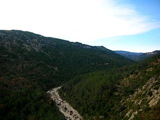
Aitana is a mountain massif that is part of Prebaetic System in the eastern end of the Iberian Peninsula. Administratively, the mountainous area is located in the Marina Baixa, Alcoià and Comtat comarcas in the northern part of Alicante province, Valencian Community, Spain. Its peak at 1,558 metres above sea level is the highest point of the province.

Serra Mariola Natural Park Nature park in Spain, a mountain range in the Valencian Community, Spain.

The Serra Mariola Natural Park is a mountain range in the Valencian Community, Spain, one of the most peripheral offsprings of the Baetic System. Most if its territory is included in a natural park founded in 2002, covering an area of 17,257 ha.

Maestrazgo, Aragon Comarca in Aragon, Spain

Maestrazgo is a comarca in southeastern Aragon, Spain. Its names derives from the Maestrat/Maestrazgo mountain massif that extends to the east to the Comarques of the Valencian Community Alt Maestrat and Baix Maestrat. The most important town is Cantavieja. It is bordered by the Aragonese comarcas of Andorra-Sierra de Arcos, Cuencas Mineras, Comunidad de Teruel and Bajo Aragón, in the north and in the west and Gúdar-Javalambre in the south, as well as with the Castellón Province in the east. Some municipal terms of this comarca are part of the historical region of Lower Aragon.

Serra dIrta mountain in the Land of Valencia

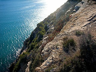
Serra d'Irta is an 18.8 km long mountain range in the Baix Maestrat comarca, Valencian Community, Spain. Its highest point is Pic Campanilles.

Penyagolosa mountain in Spain

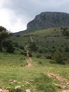
Penyagolosa is a mountain in the Alcalatén area, Valencian Community, Spain. Geologically it is part of the Iberian System, located at the eastern end of Iberian Peninsula. Its peak is at 1,813 meters above sea level and is often crowned with snow in the winter.

Serra de Sant Pere

Serra de Sant Pere or Serra del Solà is a 5.8 km (4 mi) long mountain range in the Baix Maestrat comarca, Valencian Community, Spain. Its highest point is Tossal de Sant Pere. The slopes are covered in low Mediterranean vegetation

Sierra de Orihuela mountain in the Land of Valencia

Sierra de Orihuela is a 9.4 km (6 mi) long mountain range in the Vega Baja del Segura comarca, Valencian Community, Spain. Its highest point is Peña de Orihuela. This range is named after the town of Orihuela, located at the feet of the mountains. The western end of the range is within the limits of the Santomera municipal term, in the Region of Murcia.

Sierra del Mugrón mountain in Spain

Sierra del Mugrón is a 16.6 km (10 mi) long mountain range located between the Valle de Cofrentes comarca, Valencian Community, and Almansa, Castile-La Mancha, Spain. It is an isolated range between the Iberian System and the Cordillera Prebética. Its highest point is 1,209 m. The northern section of this range is within the Ayora municipal term, while the southern belongs to Almansa.

Serra dEspadà mountain in the Land of Valencia

Serra d'Espadà is a 51 km (32 mi) long mountain range in the Alt Palància, Alt Millars and Plana Baixa comarcas, in the Province of Castellón, Valencian Community, Spain. Its highest point is La Ràpita.

Sierra de Utiel

Sierra de Utiel is a 16.45 km (10 mi) long mountain range in the Alt Palància, Alt Millars and Plana Baixa comarcas, Valencian Community, Spain. Its highest point is the 1,306 m high El Remedio. There is often snow in the winter.

Serra Calderona mountain in Spain

Serra Calderona, often referred to as La Calderona is a 49 km (30 mi) long mountain range in the Camp de Túria, Horta Nord and Alt Palància comarcas of the Valencian Community, between the provinces of Castelló and Valencia Spain.

Serra de Vallivana

Serra de Vallivana or Muntanyes de Vallivana is an over 14 km (9 mi) long mountain range straddling the Alt Maestrat and Baix Maestrat comarcas, Valencian Community, Spain.

Sierra de Gúdar mountain in Spain

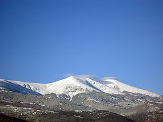
Sierra de Gúdar is a mountain range in the Gúdar-Javalambre and Maestrazgo comarcas of Aragon and the Alto Mijares comarca of the Valencian Community, Spain. The highest point in the range is Peñarroya (2,019 m).

Serra dEsparreguera

Serra de d'Esparreguera or Serra Esparreguera is an over 17 km (11 mi) long mountain range in the Alt Maestrat comarca, Valencian Community, Spain.

Serra de la Vall dàngel mountain in the Land of Valencia

Serra de la Valldàngel or Serra de la Vall d'Àngel,, is a mountain range in the Baix Maestrat comarca, Castellón Province, Valencian Community, Spain.

Serra del Turmell mountain in Valencian Country

Serra del Turmell, also known as Serra del Mont Turmell, is an over 12 km (7 mi) long mountain range in the Baix Maestrat comarca, Valencian Community, Spain.

References

  1. Vicenç M. Rosselló i Verger, Toponímia, geografia i cartografia
  2. Les llavors dels futurs boscs - Tree planting Archived 2011-07-21 at the Wayback Machine .
  3. Abril del 38 (III part) (in Spanish)