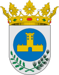
Abejuela

Last updated
Abejuela
Abejuela 03.JPG
Bandera de Abejuela.svg
Escudo de Abejuela.svg
Relief Map of Spain.png
Red pog.svg
Coordinates: 39°55′N0°54′W / 39.917°N 0.900°W / 39.917; -0.900
Country Spain
Autonomous community Aragon
Province Teruel
Municipality Abejuela
Area
  Total86.67 km2 (33.46 sq mi)
Elevation
1,169 m (3,835 ft)
Population
 (2018) [1]
  Total49
  Density0.57/km2 (1.5/sq mi)
Time zone UTC+1 (CET)
  Summer (DST) UTC+2 (CEST)

Abejuela is a municipality located in the province of Teruel, Aragon, Spain. According to the 2018 census (INE), the municipality has a population of 49 inhabitants. It is the southernmost town in Aragon.

Contents

Sierra de Javalambre rises north of the town and Sierra del Toro to the east.

Economy

The economy of Abejuela is focused primarily on agriculture and livestock raring. Some crops include wheat, barley, and outstanding quality truffle plantations, one of the best there is in Spain. Livestock raring is also high quality because all livestock are fed almost completely 100% natural.

History

There is little documentation on Abejuela, because almost all its files were destroyed in the Civil War.

It is known from oral tradition, that the first settlers were people exiled to its highest and coldest point called Almansa, where the hermitage of Santa Margarita is located. It is believed that around the fifteenth century the first buildings on what is now Abejuela were built, these are the Church and the military tower in the square.

Abejuela, is still one of the few towns that retains almost all of its architecture intact, with renovations remaining faithful to its surroundings and despite the years they have been kept in perfect condition.

Location

The distance of Abejuela from Teruel is 79 km (49 mi), 78 km (48 mi) from Valencia. It is within the Gúdar Javalambre region. Abejuela, has 8,000 hectares (20,000 acres) of forest and farmland between altitudes of 800 and 1,610 m (2,620 and 5,280 ft). The population is located at 1,167 m (3,829 ft) high.

For more than 50 years Abejuela maintained communication with its province (Teruel) since at this time it was only accessible from Aragon by a municipal road or a detour of 35 kilometers (22 mi) through the province of Valencia.

The municipal district of Abejuela is bounded by Manzanera on the north, south and west by the Yesa, Chelva and Higueruelas and on the east by Andilla and el Toro, all these in the Valencia province except El Toro (Castellon).

La Cervera

Within the municipality is the hamlet of La Cervera. Unfortunately it is undergoing total abandonment, due to the lack of electricity and water. La Cervera is located about 8 km (5.0 mi) from the town and in its time was critical to the survival of Abejuela, because the weather there was softer and its lands were used for grazing and other necessities which in times of snow were useful within the district.

Feasts

The following feasts are celebrated on the following dates:

Monuments

Related Research Articles

<span class="mw-page-title-main">Teruel</span> City in Aragon, Spain

Teruel is a city in Aragon, located in eastern Spain, and is also the capital of Teruel Province. It had a population of 35,900 as of 2022, making it the least populated provincial capital in Spain. It is noted for its harsh climate, with a wide daily variation on temperatures and its renowned jamón serrano, its pottery, its surrounding archaeological sites, rock outcrops containing some of the oldest dinosaur remains of the Iberian Peninsula, and its famous events: La Vaquilla del Ángel during the weekend closest to 10 July and "Bodas de Isabel de Segura" around the third weekend of February.

<span class="mw-page-title-main">Benabarre</span> Municipality in Aragon, Spain

Benabarre, in Ribagorçan and Aragonese: Benavarri is a town and municipality in the Aragonese comarca of Ribagorza, in the province of Huesca, Spain.

<span class="mw-page-title-main">Province of Teruel</span> Province of Spain

Teruel is a province of Aragon, in the northeast of Spain. The capital is Teruel.

<span class="mw-page-title-main">Manzanera</span> Place in Aragon, Spain

Manzanera is a small town and municipality in the province of Teruel, part of the autonomous community of Aragón, Spain. It is in the Gúdar-Javalambre comarca and it has 540 people. It is close to the ski area called Javalambre.

<span class="mw-page-title-main">Tordesillas</span> Municipality in Castile and León, Spain

Tordesillas is a town and municipality in the province of Valladolid, Castile and León, central Spain. It is located 25 kilometres (16 mi) southwest of the provincial capital, Valladolid at an elevation of 704 metres (2,310 ft). The population was c. 8,760 as of 2021.

<span class="mw-page-title-main">Pancrudo</span> Place in Aragon, Spain

Pancrudo is a municipality in the Teruel Community comarca, Teruel province, Aragon, Spain. According to the 2010 census the municipality had a population of 136 inhabitants. Its postal code is 44720. Its distance from the provincial capital, Teruel is 56 kilometres.

<span class="mw-page-title-main">Aras de los Olmos</span> Municipality in Valencian Community, Spain

Aras de los Olmos is a municipality of Valencia, Spain. Belonging to the province of Valencia, in the region of Los Serranos.

<span class="mw-page-title-main">Salvacañete</span> Place in Castile-La Mancha, Spain

Salvacañete is a Spanish municipality located in the province of Cuenca, within the autonomous community of Castilla-La Mancha. According to the 2023 census (INE), the municipality has a population of 300 inhabitants. On January 12, 2021, a minimum temperature of −16.2 °C (2.8 °F) was registered.

<span class="mw-page-title-main">Formiche Alto</span> Municipality in Aragon, Spain

Formiche Alto is a municipality located in the province of Teruel, Aragon, Spain. According to the 2004 census (INE), the municipality had a population of 191 inhabitants. According to the 2010 census, the municipality has a population of 190 inhabitants. Its postal code is 44440

<span class="mw-page-title-main">Mora de Rubielos</span> Municipality in Aragon, Spain

Mora de Rubielos is a municipality located in the mountainous area of the Iberian System, province of Teruel, Aragon, Spain.

<span class="mw-page-title-main">Oliete</span> Municipality in Aragon, Spain

Oliete is a municipality located in the province of Teruel, Aragon, Spain. According to the 2017 census (INE), the municipality has a population of 357 inhabitants.

Torrijo del Campo is a municipality located in the province of Teruel, Aragon, Spain. According to the 2018 census (INE), the municipality has a population of 447 inhabitants.

<span class="mw-page-title-main">Valdelinares</span> Municipality in Aragon, Spain

Valdelinares is a municipality and ski resort located in the Sierra de Gúdar range of the Sistema Ibérico, in the province of Teruel, Aragon, Spain. According to the 2004 census (INE), the municipality had a population of 141 inhabitants.

<span class="mw-page-title-main">Villarroya de los Pinares</span> Municipality in Aragon, Spain

Villarroya de los Pinares is a municipality located in the Maestrazgo region, province of Teruel, Aragon, Spain. According to the 2004 census (INE), the municipality had a population of 190 inhabitants.

Villadoz is a municipality located in the province of Zaragoza, Aragon, Spain. According to the 2020 census, the municipality has a population of 95 inhabitants.

<span class="mw-page-title-main">Seno, Aragon</span> Place in Aragon, Spain

Seno is a municipality located in the Bajo Aragon area, close to Maestrazgo in province of Teruel, Aragon, Spain, at an altitude of 792 m. According to the 2018 census the municipality has a population of 39 inhabitants.

<span class="mw-page-title-main">Sistema Ibérico</span> Major system of mountain ranges in Spain

The Iberian System is one of the major systems of mountain ranges in Spain. It consists of a vast and complex area of mostly relatively high and rugged mountain chains and massifs located in the central region of the Iberian Peninsula, but reaching almost the Mediterranean coast in the Valencian Community in the east.

<span class="mw-page-title-main">Azara, Huesca</span> Municipality in Somontano de Barbastro, ESP

Azara is a municipality in the province of Huesca, Spain. In 2018, it had a population of 174 inhabitants. It is located in the middle of a valley named after Alferche, to the right of the La Clamor Canyon, surrounded by sandstone the highest among which is Peña de Santa Margarita, 40 km away from Huesca.

<span class="mw-page-title-main">Sierra del Toro</span>

Sierra del Toro is a 21 km (13 mi) long mountain range in the Alt Palància comarca, Valencian Community, close to the limit with Teruel Province, Aragon, Spain. It is named after the nearby town of El Toro.

<span class="mw-page-title-main">Vía Verde de Ojos Negros</span> Greenway in Spain

The Ojos Negros Greenway, is a 160-kilometre greenway in Spain running between the village of Santa Eulalia del Campo in the province of Teruel in Aragón and the village of Algimia d'Alfara, in the province of Valencia in the Valencian Community.

References

  1. Municipal Register of Spain 2018. National Statistics Institute.