Teruel is a province of Aragon, in the northeast of Spain. The capital is Teruel.

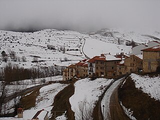
Manzanera is a small town and municipality in the province of Teruel, part of the autonomous community of Aragón, Spain. It is in the Gúdar-Javalambre comarca and it has 540 people. It is close to the ski area called Javalambre.
Ababuj is a municipality located in the Comunidad de Teruel comarca, province of Teruel, Aragon, Spain. According to the 2010 census the municipality had a population of 77 inhabitants. Its postal code is 44155.

Abejuela is a municipality located in the province of Teruel, Aragon, Spain. According to the 2018 census (INE), the municipality has a population of 49 inhabitants. It is the southernmost town in Aragon.

Bádenas is a municipality located in the province of Teruel, Aragon, Spain. According to the 2004 census (INE), the municipality has a population of 19 inhabitants.
Bordón is a municipality located in the province of Teruel, Aragon, Spain. According to the 2010 census the municipality has a population of 141 inhabitants.
Camarena de la Sierra is a municipality located in the province of Teruel, Aragon, Spain. According to the 2004 census (INE), the municipality had a population of 166 inhabitants.

Gúdar is a municipality located in the province of Teruel, Aragon, Spain. According to the 2004 census (INE), the municipality had a population of 80 inhabitants.

Mora de Rubielos is a municipality located in the mountainous area of the Iberian System, province of Teruel, Aragon, Spain.

Torrijas is a municipality located in the province of Teruel, Aragon, Spain. According to the 2004 census (INE), the municipality has a population of 87 inhabitants.
Valacloche is a municipality located in the province of Teruel, Aragon, Spain. According to the 2004 census (INE), the municipality has a population of 23 inhabitants.
Valdelinares is a municipality and ski resort located in the Sierra de Gúdar range of the Sistema Ibérico, in the province of Teruel, Aragon, Spain. According to the 2004 census (INE), the municipality had a population of 141 inhabitants.

Villarluengo is a municipality at the heart of the mountainous Maestrazgo comarca, province of Teruel, Aragon, Spain. According to the 2010 census the municipality has a population of 188 inhabitants.

Villarroya de los Pinares is a municipality located in the Maestrazgo region, province of Teruel, Aragon, Spain. According to the 2004 census (INE), the municipality had a population of 190 inhabitants.
Terzaga is a municipality located in the province of Guadalajara, Castile-La Mancha, Spain. According to the 2022 census (INE), the municipality has a population of 20 inhabitants. It belongs to the Alto Tajo Natural Park and the Geopark of the Comarca Molina-Alto Tajo. It has an area of 33.81 km2. From Guadalajara capital it is separated by a distance of 159 km. It is one of the localities through which the route of the Three Taifas of the Camino del Cid takes place.

Pina de Montalgrao, or simply Pina, is a municipality in the comarca of Alto Palancia, Castellón, Valencia, Spain. According to the 2010 census the municipality has a population of 148 inhabitants.
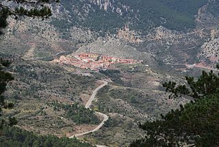
Maestrazgo is a comarca in southeastern Aragon, Spain. Its names derives from the Maestrat/Maestrazgo mountain massif that extends to the east to the Comarques of the Valencian Community Alt Maestrat and Baix Maestrat. The most important town is Cantavieja. It is bordered by the Aragonese comarcas of Andorra-Sierra de Arcos, Cuencas Mineras, Comunidad de Teruel and Bajo Aragón, in the north and in the west and Gúdar-Javalambre in the south, as well as with the Castellón Province in the east. Some municipal terms of this comarca are part of the historical region of Lower Aragon.

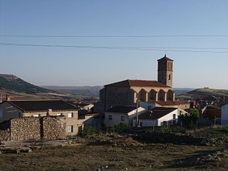
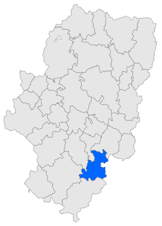
Gúdar-Javalambre is a comarca in Aragon, Spain. The most important town is Mora de Rubielos.
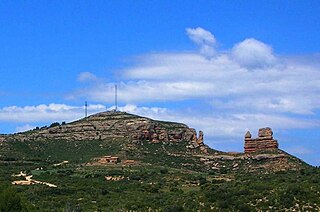
Sierra de Javalambre ) is a 29 km (18 mi) long mountain range in the Gúdar-Javalambre comarca of Aragon and the Rincón de Ademuz and Serrans comarcas of the Valencian Community, Spain.

Sierra de Gúdar is a mountain range in the Gúdar-Javalambre and Maestrazgo comarcas of Aragon and the Alto Mijares comarca of the Valencian Community, Spain. The highest point in the range is Peñarroya (2,019 m).


