This article needs additional citations for verification .(January 2021) |
![]() | You can help expand this article with text translated from the corresponding article in Spanish. (September 2012)Click [show] for important translation instructions.
|
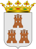
Santa Eulalia del Campo | |
---|---|
| |
Coordinates: 40°34′N1°19′W / 40.567°N 1.317°W | |
Country | ![]() |
Autonomous community | ![]() |
Province | Teruel |
Municipality | Santa Eulalia del Campo |
Government | |
• Mayor | Héctor Palatsi Martínez |
Area | |
• Total | 80.9 km2 (31.2 sq mi) |
Elevation | 984 m (3,228 ft) |
Population (2018) [1] | |
• Total | 1,037 |
Time zone | UTC+1 (CET) |
• Summer (DST) | UTC+2 (CEST) |
Santa Eulalia del Campo is a municipality located in the province of Teruel, Aragon, Spain. According to the 2005 census (INE), the municipality has a population of 1,171 inhabitants.
This town is located near Sierra Palomera, a mountain range of the Sistema Ibérico. On January 12, 2021, a minimum temperature of −23.0 °C (−9.4 °F) was registered. [2]
The surroundings of the Chapel of the Mill; Sierra Palomera with a view of the former premises of the Sugar Factory; Jiloca; the Media Caseta Mount or Mount Cirogrillos; Railway Station Via Minero Peirón of the Virgen del Pilar - on the road to the Tremedal Orihuela - are some of the tourist attractions.
Teruel is a city in Aragon, located in eastern Spain, and is also the capital of Teruel Province. It had a population of 35,900 as of 2022, making it the least populated provincial capital in Spain. It is noted for its harsh climate, with a wide daily variation on temperatures and its renowned jamón serrano, its pottery, its surrounding archaeological sites, rock outcrops containing some of the oldest dinosaur remains of the Iberian Peninsula, and its famous events: La Vaquilla del Ángel during the weekend closest to 10 July and "Bodas de Isabel de Segura" around the third weekend of February.
The province of Málaga is located in Andalusia, Spain. It is bordered by the Mediterranean Sea to the south and by the provinces of Cádiz to the west, Seville to the northwest, Córdoba to the north, and Granada to the east.
Teruel is a province of Aragon, in the northeast of Spain. The capital is Teruel.
Querétaro, officially the Free and Sovereign State of Querétaro, is one of the 32 federal entities of Mexico. It is divided into 18 municipalities. Its capital city is Santiago de Querétaro. It is located in north-central Mexico, in a region known as Bajío. It is bordered by the states of San Luis Potosí to the north, Guanajuato to the west, Hidalgo to the east, México to the southeast and Michoacán to the southwest.
San Lorenzo de El Escorial, also known as El Escorial de Arriba, is a town and municipality in the Community of Madrid, Spain, located to the northwest of the region in the southeastern side of the Sierra de Guadarrama, at the foot of Mount Abantos and Las Machotas, 47 kilometres (29 mi) from Madrid. It is head of the eponymous judicial party. The settlement is popularly called El Escorial de Arriba, to differentiate it from the neighbouring village of El Escorial, also known as El Escorial de Abajo.
El Yunque or El Yunque Peak is a mountain located fully within the boundaries of the El Yunque National Forest, part of the U.S. Forest Service, which is the only tropical rainforest under the U.S. Forest Service jurisdiction. It is located in the municipality of Río Grande.
Soto del Real, whose former name was Chozas de la Sierra, is a town and municipality in the northern area of the autonomous Community of Madrid which had 9,188 inhabitants in 2022.
La Yesca is a municipality and the municipal seat of the same in the Mexican state of Nayarit. The population of the municipality was 12,025 (2005). The population of the town and municipal seat was 356 inhabitants in 2005. The population density was 7 inhabitants per square kilometer, one of the lowest in the state.
Las Casas del Conde is a tiny village and municipality in the province of Salamanca, western Spain, part of the autonomous community of Castile-Leon. It is located 78 kilometres (48 mi) from the provincial capital city of Salamanca and has a population of only 55 people.
El Arenal is a village and municipality of Spain located in the province of Ávila, within the autonomous community of Castile and León. According to the 2023 census (INE), the municipality had a population of 964 inhabitants. The municipality has a total area of 27.08 km2. It is part of the Sierra de Gredos Regional Park.
Zahara de los Atunes is a village on the Costa de la Luz of Spain in the province of Cádiz and the autonomous region of Andalusia. It is noted for its excellent beaches, an outdoor cinema, and la Iglesia Del Carmen church where, curiously, tuna were butchered and salted. Also in the town are excellent facilities including a variety of restaurants, cafes and hotels.
Utiel is a municipality in the comarca of Plana de Utiel in the Valencian Community, Spain.
Calamocha is a town and municipality of Teruel province in the autonomous community of Aragon, Spain. In 2015 the municipality had a population of 4,417 inhabitants.
El Frasno is a municipality in the province of Zaragoza, Aragon, Spain. According to the 2004 census (INE), the municipality had a population of 476 inhabitants.
Tabuenca is a municipality located in the province of Zaragoza, Aragon, Spain. According to the 2010 census the municipality has a population of 412 inhabitants. Its postal code is 50547.
Selas is a municipality located in the province of Guadalajara, Castile-La Mancha, Spain. According to the 2004 census (INE), the municipality has a population of 63 inhabitants.
Bello is a municipality located in the province of Teruel, Aragon, Spain. According to the 2003 census (INE), the municipality has a population of 369 inhabitants.
The Iberian System is one of the major systems of mountain ranges in Spain. It consists of a vast and complex area of mostly relatively high and rugged mountain chains and massifs located in the central region of the Iberian Peninsula, but reaching almost the Mediterranean coast in the Valencian Community in the east.
Sierra de Quila, officially the Sierra de Quila Flora and Fauna Protection Area, is a Mexican Flora and Fauna Protection Area in the state of Jalisco, Mexico. It has an area of 15,193 hectares, and is located within six municipalities: San Martín de Hidalgo, Tecolotlán, Cocula, Atengo, Tenamaxtlán, and Ameca.
Honduras de la Sierra is a municipality in the Mexican state of Chiapas, located approximately 150 kilometres (93 mi) southeast of the state capital of Tuxtla Gutiérrez. Gazetted in 2019, it is the newest municipality in Chiapas.